• About

doubtfulsea

~ adventure fantasy

Tag Archives: Roman Roads

Over the River…

06 Wednesday Mar 2019

Posted by Ollamh in J.R.R. Tolkien, Literary History, Maps, Narrative Methods

≈ 2 Comments

Tags

atlas, Maps, Middle-earth, Roman Roads, Ted Nasmith, The Hobbit, The Lord of the Rings, Tolkien

As ever, dear readers, welcome.

Two postings ago, we had been discussing how time is marked in The Hobbit.  After a one-post interlude—a book review—we were intending to extend our discussion (as our original plan was) to The Lord of the Rings, but something caught our attention and, in this posting, we’re still interluding—although it is about The Hobbit.

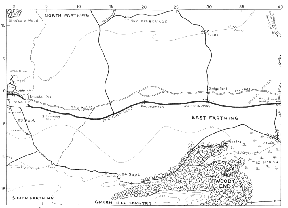
We had just set off from Bag End with Bilbo and the dwarves and noticed this:

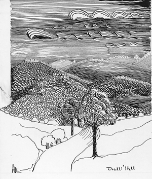
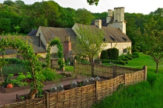
“At first they had passed through hobbit-lands, a wide respectable country inhabited by decent folk, with good roads, an inn or two, and now and then a dwarf or a farmer ambling by on business.  Then they came to lands where people spoke strangely, and sang songs Bilbo had never heard before.  Now they had gone on far into the Lone-lands, where there were no people left, no inns, and the roads grew steadily worse.  Not far ahead were dreary hills, rising higher and higher, dark with trees.  On some of them were old castles with an evil look, as if they had been built by wicked people.” (The Hobbit, Chapter 2, “Roast Mutton”)

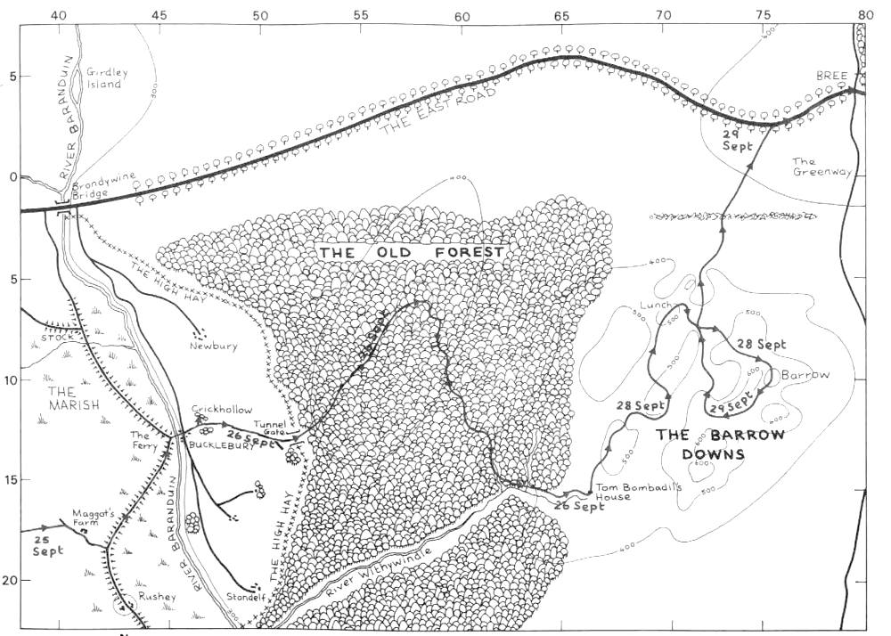
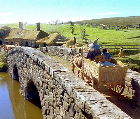
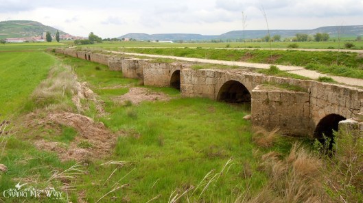
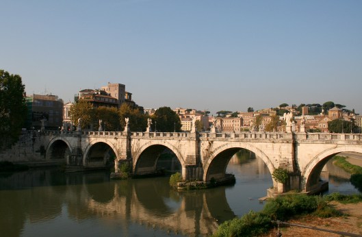
The company passes over an ancient bridge:

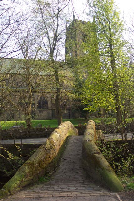
“Somewhere behind the grey clouds the sun must have gone down, for it began to get dark as they went down into a deep valley with a river at the bottom.  Wind got up, and willows along its banks bent and sighed.  Fortunately the road went over an ancient stone bridge, for the river, swollen with the rains, came rushing down from the hills and mountains in the north.”

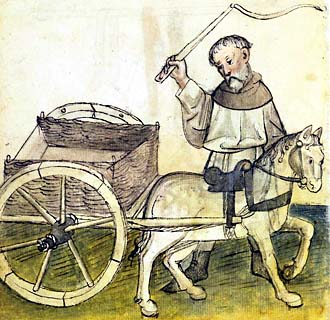
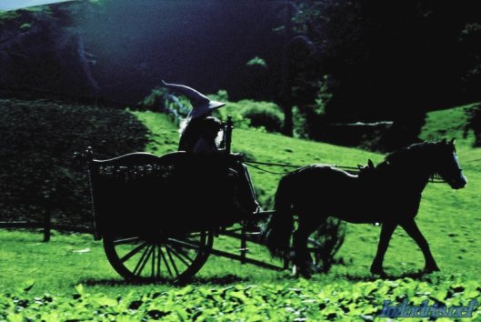
They go on till Bilbo and the dwarves reach the trolls.
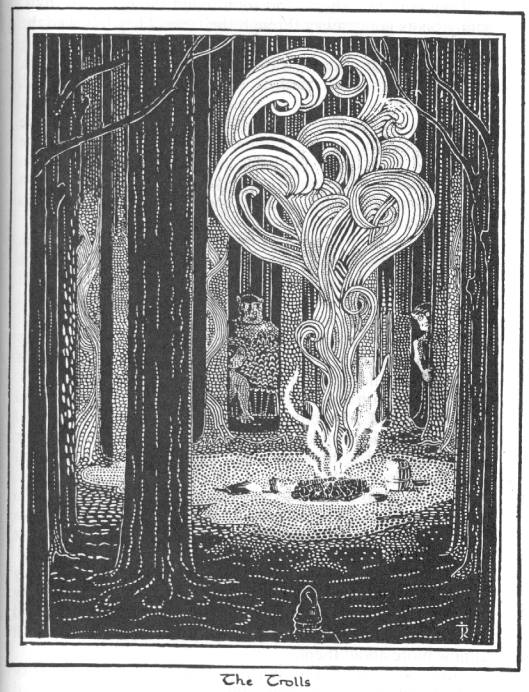
image1trollhill.gif

image2trolls.png

(drawings by JRRT)

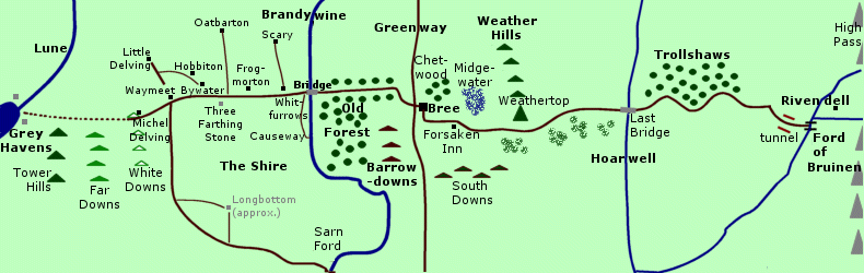
Here, though, we want to pause for a moment and look back, and, like any careful—and curious—traveler, consult a map.

image3map.jpg

First—and this is something we noted in that previous post—there is really no hard evidence for just how long this leg of the trip took.  All we are given are  “At first”, “now and then”, “Then”, and “Now”, and the sense of distance comes to us as much through landscape changes as from those vague words:  from “hobbit-lands” to “lands where people spoke strangely…” then “Now they had gone far into the Lone-lands”.

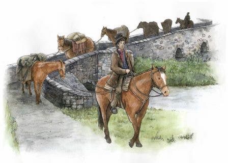
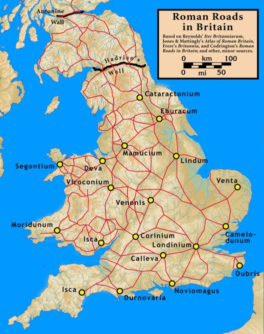
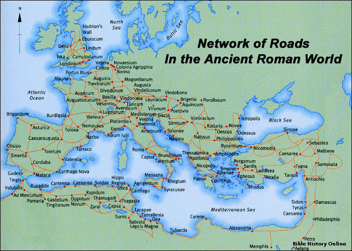
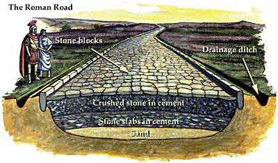
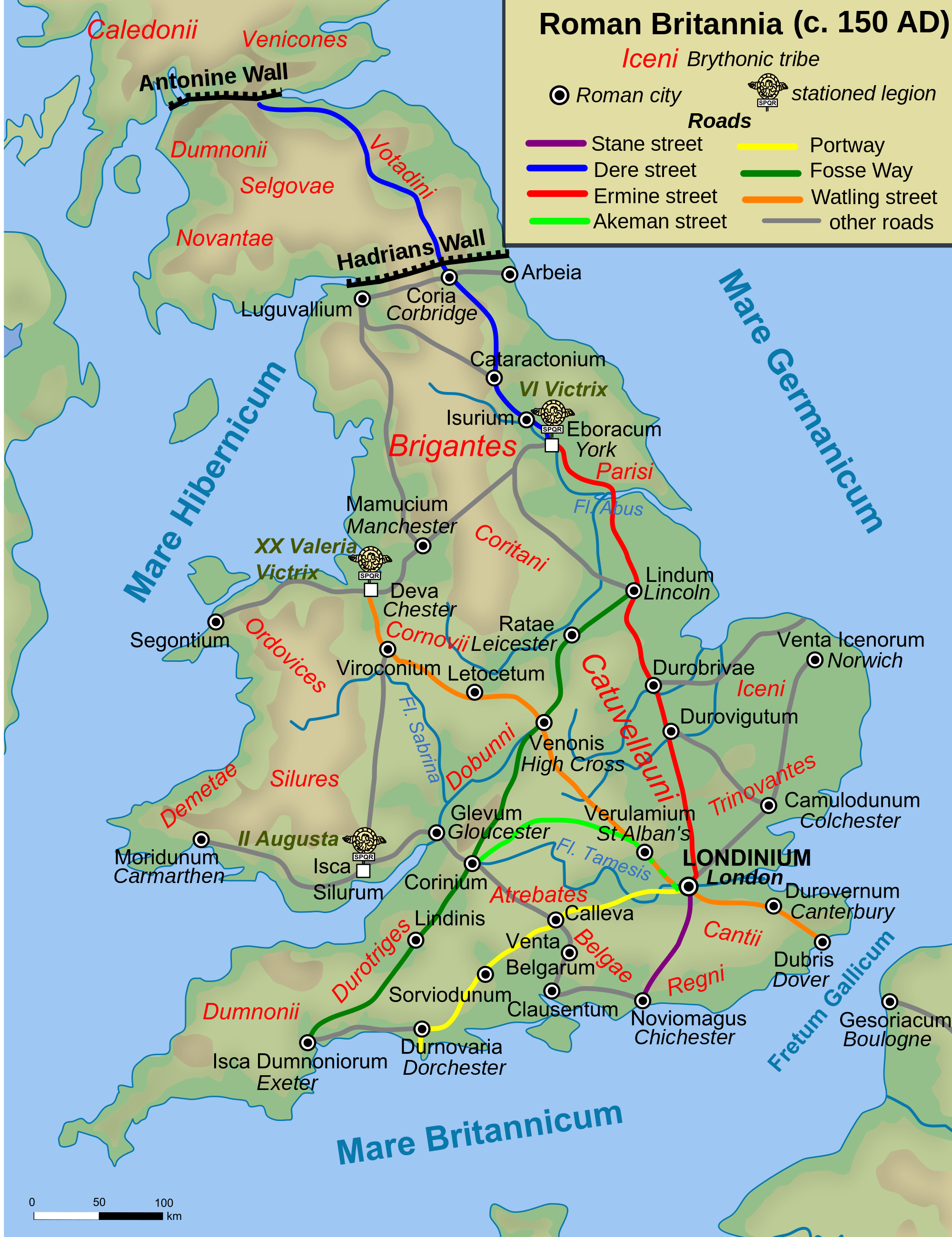
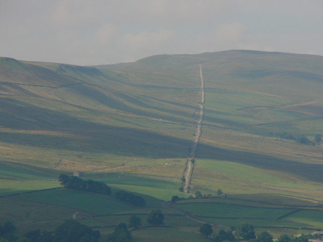
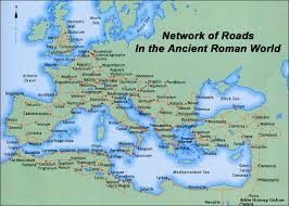
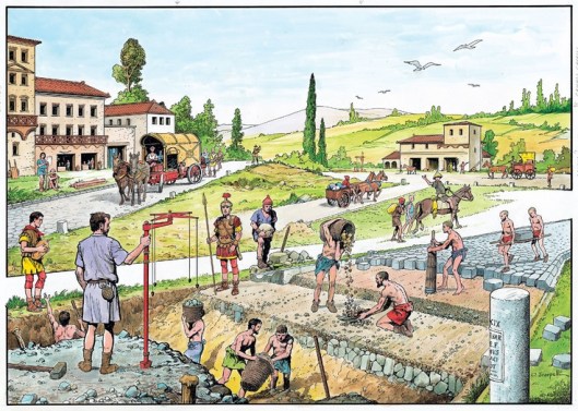
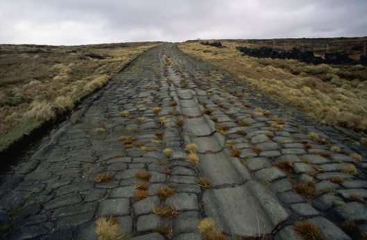
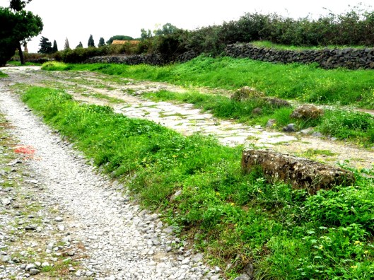
Second, looking at that map, there are certain puzzling words in that description of travel.  The description twice says “roads”, at first “good roads”, then, as the journey goes eastwards, “the roads grew steadily worse”.  Our map, however, shows only one road, the East or East/West Road, the history of which goes far into the history of Middle-earth and which we have always imagined that JRRT modeled on the remains of Roman roads one could still walk in England in his time—and even today.

image4romanroad.jpg

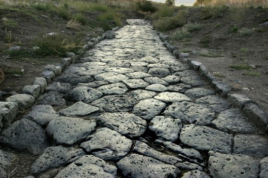
(Here’s a LINK to a very good basic article on constructing roads in Roman Britain.)

And then there is this:

“Not far ahead were dreary hills, rising higher and higher, dark with trees.  On some of them were old castles with an evil look, as if they had been built by wicked people.”

As far as we know, there are no “castles” in Middle-earth—the East Road does skirt Weathertop.  As Aragorn says:

“The Old Road, which we have left far away on our right, runs to the south of it and passes not far from its foot.”  (The Fellowship of the Ring, Book One, Chapter 11, “A Knife in the Dark”)

And perhaps his description might—very roughly—fit a (ruined) castle:

“…in the first days of the North Kingdom, they built a great watch-tower on Weathertop, Amon Sul they called it.  It was burned and broken, and nothing remains of it now but a tumbled ring, like a rough crown on the old hill’s head.”

As it was destroyed in the conflict against the Witch King of Angmar, we would certainly agree that “wicked people” had once been involved in its history.

Our puzzlement is not just about what appears in the text, however.  There is also what’s missing (most of it shown on the map):

  1. the bridge over the Brandywine which appears in the first paragraph of “The Scouring of the Shire”
  2. any mention of the Greenway, which crosses the East Road at Bree
  3. and then there is Bree itself

Of course, this is back-reading.  We are looking at a map which is descended from one which JRRT gradually built up over time in the years after The Hobbit, when Middle-earth continued to grow and grow in his imagination and hence in his fiction.  (For an extensive view of his work as a world-creator, see this intelligent and extremely useful volume by Karen Wynn Fonstad,

image5fonstad.jpg

which deals with the whole history of Middle-earth in chronological order.  For The Lord of the Rings, we would recommend this, by Barbara Strachey,

image6strachey.jpg

which has been our guide on a number of trips along Frodo’s route.)

As well, it’s good to remember that, for the most part, the company in The Hobbit is traveling at its own speed, a speed determined primarily by the countryside they cross and their trip seems—if occasionally miserable—almost leisurely, especially in comparison with The Lord of the Rings, in which so much of the first volume in particular lays out a route along which several of the main protagonists are driven by evil pursuers.  The journey itself, in the latter, becomes, day by day, the focus of the narrative as they attempt to escape the Nazgul and that day-by-day quality is intensified after the wounding of Frodo on Weathertop, as he begins to fade and his friends are desperate to reach Rivendell.

image7rivendell.jpg

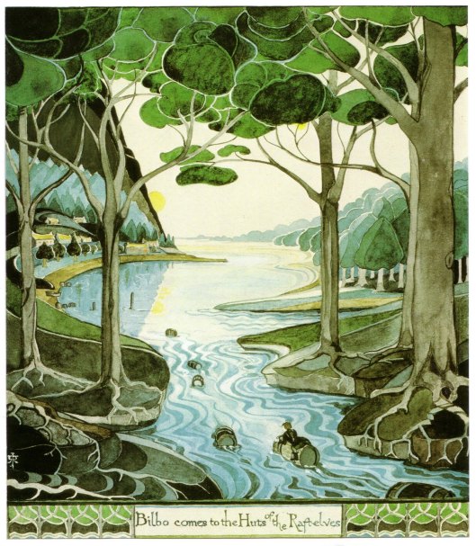
The contrast between the two stories is especially striking here, as Bilbo and company are mocked and sung to by invisible elves in The Hobbit (Chapter 3, “A Short Rest”) as they ride down into the valley, whereas, in The Lord of the Rings (The Fellowship of the Ring, Book One, Chapter 12, “Flight to the Ford”), we see this (by the excellent Ted Nasmith)—

image8ford.jpg

This change in the narrative emphasis, from discrete events along a route in The Hobbit, to an emphasis upon the journey itself, will bring us back to our original discussion on the marking of time—moving now from the earlier book to The Lord of the Rings in our next posting.

Thanks, as always, for reading and

MTCIDC

CD


PS

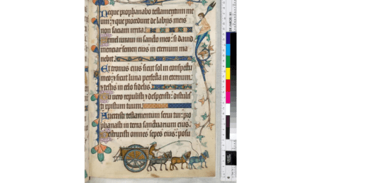
We would guess, by the way, that that “ancient stone bridge” mentioned above is the so-called “Last Bridge”, which Glorifindel  calls “the Bridge of Mitheithel” (The Fellowship of the Ring, Book One, Chapter 12, “Flight to the Ford”) and which crosses the River Hoarwell (“Mitheithel” to the elves) on the East Road.

PPS

If you grew up, as we did, hearing the song we hinted at in our title, you might want to learn more at this LINK…

Wains and Carts and… (Part I)

07 Wednesday Feb 2018

Posted by Ollamh in J.R.R. Tolkien, Literary History, Military History

≈ Leave a comment

Tags

Bronze Age, Byzantines, Carts, chariots, delivery carts, Flintbek, Gandalf, Great War, Greece, Iliad, Late-Victorian, Medieval, military, Mycenaean, Neolithic, Roman Roads, Romans, Schleswig-Holstein, The Lord of the Rings, Tolkien, Trundholm Sun Chariot, Wagons, wattle and daub

Welcome, dear readers, once more to our blog.
We’ve just been watching the extended version opening of The Fellowship of the Ring, in which Gandalf appears, driving a cart.
image1gandalfcart.jpg
(Sorry—we couldn’t resist! We love Legos and the older Playmobil—Vikings, pirates, Roman warship, too. Not to forget the Egyptian pyramid! )
Unlike ordinary medieval carts,
image2amedcart.jpg
it is quite elaborate.
image2gandalfcart.jpg
image3gandalfcart.jpg
You can see from our second illustration that both the medieval example and Gandalf’s have wattled sides—that is, the upright spindles below the railing top have pliable sticks (perhaps willow or hazel?) woven between them to make the sides of the cart.
This is also a common method for producing traditional house walls: you just add daub, which is clay plus fibre, as a kind of plaster to fill in around the sticks.
image4wattleanddaub.jpg
Many buildings, from the Neolithic on, were constructed using the technique,
image5technique.jpg
image6house.jpg
as well as, without the daub, miles and miles of useful fencing.
image7fence.jpg
What caught our attention, however, was the general look of the cart and the detailing of the wooden railing,
image8agscart.jpg
image8bgscart.jpg
image8cgscart.jpg
which very much reminded us of this—
image8chariot.jpg
a Celtic chariot of the sort one sees both in chariot burials
image9chariotburial.JPG
and in stirring reconstructions.
image10britchariots.jpg
But that’s not the direction we wanted to take in this post. Rather, we were, as so often, thinking about the medieval world and Middle-earth and, in this case, wheeled vehicles.
The earliest evidence in Europe currently known for such vehicles is not the remains of a vehicle itself, but rather its tracks, found under a burial mound at Flintbek, in Schleswig-Holstein, in northwest Germany.
image11flintbek.jpg
These have been dated to about 3600BC, during the late Neolithic Era. A bit later, we see this odd thing, the so-called “Trundholm Sun Chariot”, from about 1400BC
image12trundholm.jpg
which actually appears to be some sort of wagon, or at least its frame.

Perhaps 50 years later, there are Bronze Age Mycenaean chariots
image13mycen.jpg
but, at least as far as illustrations go, European domestic vehicle depictions are scarce, especially in contrast to those of military—or sport—vehicles. Here’s a 5th-century BC depiction of a wagon being used for a wedding,
image14grkwagon.jpg
but we could then show you heaps of illustrations of chariots, used in very early Greece for warfare. You see them all over the Iliad, for example,
image15achilles.jpg
but chariots in the later Greek world were abandoned for warfare, although retained for racing, which was true for the Romans and for their successors, the Byzantines.
image16byzchar.jpg
We have lots more depictions of domestic vehicles from the Roman world, both carts
image17romancart.jpg
and wagons.
image18romwag.jpg
This shouldn’t be surprising, we suppose, given that the Romans built more than 50,000 miles of roads.
image19romrd
Judging by these depictions, it appears that the medieval world simply continued using Roman vehicle patterns, just as, where available, they continued to use Roman roads.
image19romcrt.jpg
image20medwag.png
For us, then Gandalf’s cart—which is not really described:
“At the end of the second week in September a cart came in through Bywater from the direction of Brandywine Bridge in broad daylight. An old man was driving it all alone…It had a cargo of fireworks…”
(The Fellowship of the Ring, Book One, Chapter 1, “A Long-expected Party”)
would follow what we see in manuscript illustrations.
Tolkien might have been thinking of such illustrations, of course, but there is another possibility. In the late-Victorian world into which JRRT was born, horses still powered vehicles and delivery carts like this one
image21deliverycart.jpg
would have been a common site—even after the Great War. Perhaps he was thinking of something he might still have seen outside his window when he was young?
We’ll stop here for now, but will continue in Part II, where we’ll consider Farmer Maggot’s wagon and wains…

Thanks, as ever, for reading.
MTCIDC
CD

Shire Portrait (3a)

15 Wednesday Feb 2017

Posted by Ollamh in Economics in Middle-earth, Imaginary History, J.R.R. Tolkien, Literary History, Maps, Narrative Methods

≈ Leave a comment

Tags

Argeleb, Baraduin, Beleriand, Blanco, Bridge of Stonebows, Bronze Age Horse, cable ferry, coins, Dartmoor, Doriath, Dwarves, English South Downs, Fallowhide, Far Downs, Farthings, Fornost Erain, Frodo, Gloucestershire, Government, Great East Road, Green Hill Country, Greenway, Jeremy Brett, Little Delving, Longbottom Leaf, Maps, Marcho, Michel Delving, Middle-earth, Minas Tirith, Misty Mountains, Old Dee Bridge, Oxfordshire, River Baranduin, Roads, Roman Roads, Sherlock Holmes, Sidney Paget, Sir Arthur Conan Doyle, Steven Spielberg, Tharbad, The Hobbit, The Hound of the Baskervilles, The Lord of the Rings, The Shire, Three Farthing Stone, Tobacco, Tolkien, Warwickshire, White Downs, Worcestershire

Welcome, dear readers, to the third installment of our rough portrait of the Shire. We call it a “rough portrait” because, so far, we’ve relied upon only three sources: The Hobbit, The Lord of the Rings, and The Letters of J.R.R. Tolkien. We’ll continue to do so in this installment, but we will add two works of geography, K. W. Fonstad’s The Atlas of Middle-earth and Barbara Strachey’s Journeys of Frodo (although we may take a hint of two from other works).

So far, we’ve discussed the government of the Shire (Shire Portrait 1) and the economy (Shire Portrait 2). In this, we want to move on to the geography of the Shire. We begin with Fonstad’s map.

1mapoftheshire.jpg

Except for Buckland, all of the Shire lies west of the River Baranduin (the “Brandywine”). This river can be broad enough to require a cable ferry

2ferryoncable.jpg

and it is navigable, at least by small boats—after all, it was in such a boat that Frodo’s parents were drowned.

As well, there is the Bridge of Stonebows on the Great East Road. Since it’s wide enough for gates and is reported to have had houses on the far side of it, we might imagine it to look like the Old Dee Bridge, at Chester, in England.

3olddeebridgechester

This bridge dates from Norman times (although there was a bridge there from the days of the Roman occupation—“Chester”, after all, is only a corruption of castra, Latin for “military camp”—founded as Deva Victrix in 79AD), with the present version being more-or-less 14th-century. In the Prologue to The Lord of the Rings, the Bridge of Stonebows is said to have been “built in the days of the power of the North Kingdom”, making us wonder whether the Dwarves, who had cut the Great East Road long before, had only had a ford at that place.

To the west of the river stretches the Shire, most of it to the north and south of the Great East Road, which acts as a kind of spine, there being subsidiary roads leading off it towards the various villages. Originally built by the Dwarves in the First Age, it led from Doriath in Beleriand eastward beyond the Baraduin towards the Misty Mountains. After the destruction of Beleriand, the remaining section ran only from the Grey Havens eastward. When Marcho and Blanco, the Fallowhide brothers, gained permission to colonize the area in TA1601 from Argeleb II, the only payment required was “that they should keep the Great Bridge in repair, and all other bridges and roads, speed the king’s messengers, and acknowledge his lordship”, which would have included the Great East Road.

In a previous posting, we talked about the North-South Road (later, the “Greenway”, which once ran from Fornost Erain, in the north, to Minas Tirith, in the south. Because of its ancient importance and places like the causeway and bridge at Tharbad, we imagined it to be like a Roman road—carefully laid out by engineers and paved but, no longer maintained, gone to seed.

4buildingromanroad.jpg

5romanroad.jpg

6overgrownromanroad.JPG

Because of its great age and one-time importance, we’ve always pictured the Great East Road to be similar, especially when it is clear that the kings of Arnor considered its maintenance to be the equivalent of tribute or taxes from the new Shire. Subsidiary roads which split off from the East Road, however, we might see as the usual rutted country roads.

7ruttedroad.jpg

The Shire, besides being bisected by the Great East Road, is also divided into four parts—hence the name “Farthings”—like the pre-decimal English coin, which was a fourth part of a penny (when a penny obviously was worth a lot more!).

8farthingcoin.jpg

We wonder what these divisions were intended to be used for—perhaps for the election of the Mayor? In our previous posting on the government of the Shire, we quoted JRRT as saying in the Prologue to The Lord of the Rings, “The Shire at this time had hardly any ‘government’”, so, for the moment, that’s our best guess.

(We should note here the “Three Farthing Stone”, which marks more or less where the North, East, and South Farthings meet. It has been suggested that it has been based upon the actual English “Four Shires Stone”—

9fourfarthingstone.jpg

which sits at the place where, pre-1931, four shires—Worcestershire, Warwickshire, Oxfordshire, and Gloucestershire — touched. Not only is there a similarity in the names and what the stone may function as, but the Three Farthing Stone is just to the west of Frogmorton, whereas the Four Shire Stone is just east of Moreton-in-Marsh. And is JRRT having a quiet joke in that, after a boundary adjustment in 1931, the Four Shire Stone should really be called the Three Shire Stone?)

Just south of the Great East Road is the Green Hill Country, which appears to be heavily forested.

11gribskov

This is mirrored by a smaller wood north of the road, Bindbole.

Other than these (and, of course, the Old Forest in Buckland), the land seems to be open. To the north are the North Moors. These are windy uplands, mostly grass, with little in the way of trees.

13adartmore

Dartmoor (which is the image above), in southwest England, seems so bare (although it has the fallen remains of earlier cultures on it), that it can seem a little spooky—the perfect setting for Sir Arthur Conan Doyle’s Sherlock Holmes novel The Hound of the Baskervilles (first published in book form in 1902).

13bbaskervilles.jpg

(We love the original Sidney Paget illustrations in The Strand Magazine, but our favorite film version is the one starring Jeremy Brett as Holmes. For pure fun, by the way, we recommend Steven Spielberg’s Young Sherlock Holmes—not for the purist, we hasten to add.)

13cpaget.jpg

13dartmore.jpg

13dbrett.jpg

13eyoungsherlock.jpg

To the west are two lines of downs, the White and the Far (or Fox) Downs. When we think of downs, we think of the chalky rolling hills southeast of the Thames in England. Here’s what the English South Downs look like

14southdowns.jpg

and it’s easy to imagine that the Shire version would look very similar and the chalk would easily be cut into to make Michel Delving (“Big Dig”) and Little Delving (“Little Dig”). The chalk just below the surface is exposed on the south English coast

15chalkcliffs.jpg

making that name “the White Downs” clear. And we can’t resist adding another chalk artifact. In Oxfordshire (but once Berkshire), on the edge of the Berkshire Downs, is a Late Bronze Age horse, cut into the chalk. We wonder why there isn’t one in Rohan…

16uffingtonhorse.jpg

Last of all, there’s the South Farthing, stretching south of The Green Hill Country. As it is a tobacco-growing area, but in a temperate climate (at least, we understand that the Shire is in a temperate zone—they appear to have—or to have had—snowy winters), we visualize it as looking like the Connecticut Valley, which runs south down from Vermont, through western Massachusetts and through central Connecticut, in the US.

17connecticutrvalley.jpg

In the central part of the valley are tobacco plantations.

18tobaccofields.jpg

These always include drying barns for the tobacco—which would become the Longbottom Leaf Merry and Pippin discover two casks of in Saruman’s pantry.

19tobaccobarn.jpg

The one farthing we haven’t studied directly is the East Farthing, but, as it contains a continuation of the Green Hill Country, abuts the Brandywine, and has the already-mentioned bridge of Stone Bows, and thus has no main features we haven’t mentioned, we’ll conclude here for the moment. In our next, we want to examine Shire architecture, from hobbit holes to mills.

Thanks, as ever, for reading.

MTCIDC

CD

One More River (1)

21 Wednesday Dec 2016

Posted by Ollamh in Artists and Illustrators, Imaginary History, J.R.R. Tolkien, Maps, Narrative Methods

≈ Leave a comment

Tags

Alan Lee, Beorn, Bilbo, bog people, Bombur, Boromir, bridges, causeways, drowsiness, Dwarves, Esgaroth, Great East Road, Greyflood, Gwathlo, Hobbiton-across-the-water, Lethe, Middle-earth, Mirkwood, Rammas Echor, Rivendell, river-crossing puzzle, Roman Roads, Tharbad, The Atlas of Middle-Earth, The Hobbit, The Lord of the Rings, Tolkien, Tollund Man

Welcome, dear readers. Here we are again in Middle-earth, as so often we’ve been over the last couple of years, but, as we said in our last post, one reason why we revere JRRT and his work is that it’s so rich—it seems like one can open it to any page and there is something new to explore. In this post, we began with an odd little detail, just something said almost in passing by Boromir:

“A long and wearisome journey. Four hundred leagues I reckoned it, and it took me many months, for I lost my horse at Tharbad, at the fording of the Greyflood.” (The Fellowship of the Ring, Book 2, Chapter VIII, “Farewell to Lorien”)

Tharbad, we knew from the Companion, was once a river port on the Gwathlo, Boromir’s “Greyflood”. Here’s a description from the extremely helpful introductory section of the Companion called “The Maps of The Lord of the Rings”:

“…with long labour a port capable of receiving seagoing vessels had been made at Tharbad, and a fort raised there on great earthworks on both sides of the river, to guard the once famed Bridge of Tharbad” (lxv)

This “once-famed” bridge was clearly long-gone by the time, at the end of the Third Age, when Boromir reached the river it had once offered passage over, for all of the work done once upon a time, including long causeways—raised approach roads above boggy ground—here’s a Roman example from northern Spain with causeway and bridge—

1bridgewithcauseway.jpg

“But in the days of The Lord of the Rings the region had become ruinous and lapsed into its primitive state: a slow wide river running through a network of swamps, pools and eyots [little islands]: the haunt of hosts of swans and other water-birds.” (from a letter of 30 June, 1969, to Paul Bibire, quoted in Companion, 650)

JRRT appears to have left no description of the bridge itself, but we imagine it as looking rather like a Roman one (as JRRT could have seen pictures of surviving ones like this in Portugal

2ponte.jpg

or this in Rome.

3ponteadriano.JPG

Unlike much of the rest of the Roman world, no Roman bridge survives in Britain—only the remains of piers, ramps, and approaches–so we’re assuming that, if he were at all influenced by Roman architecture—and that’s an absolute assumption on our part, we admit, but certainly things like Hadrian’s Wall seem to have been an inspiration—see our earlier posting on the Rammas Echor—it was through photographs.)

This mention, however, sparked us to think about the crossing of bodies of water, both in The Hobbit and in The Lord of the Rings, just how many there were, and the kinds of events which happened at them.

Bilbo’s Bag End, of course, is just down the road from The Water and its mill, as depicted by Tolkien himself.

4imghillandmill.jpg

When he sets off with the dwarves, however, there is little incident involved in running water at first. The party has to cross a river, “swollen with the rains, [which] came rushing down from the hills and mountains in the north.” (The Hobbit, Chapter 2, “Roast Mutton”) They cross this by “an ancient stone bridge” (perhaps like this one at Carrbridge, in Scotland?)

5imagecarbridge.jpeg

but, somehow, they can’t escape the river, as, during the night, “…one of the ponies took fright at nothing and bolted. He got into the river before they could catch him; and before they could get him out again, Fili and Kili were nearly drowned, and all the baggage that he carried was washed away off him.” (The Hobbit, Chapter 2, “Roast Mutton”). So far, when it comes to running water, for all that there was a bridge, it seems difficult for the dwarves to stay out of it.

Their second adventure with water is more successful, when they cross the bridge at Rivendell, which we have discussed in a posting on Rivendell architecture, so, for this one, we’ll simply add Tolkien’s illustration of Rivendell, plus a real favorite, Alan Lee’s of the bridge.

6imagerivendelljrrt.jpg

7imagerivendellbridgealanlee.jpg

Beyond Rivendell, it’s into the mountains (literally, when they are pulled into the world of the goblins by a secret door) and, when they come out, their next water barrier is surmounted for them when they’re rescued by eagles and flown to the other side of the northern Anduin.

8eaglerescue.jpg

If they had simply taken the Great East Road (as we presume Bilbo and Gandalf did on the way back), they would have found a ford where the road runs eastward into the Old Forest Road. (see Karen Wynn Fonstad, The Atlas of Middle-earth, 80-81, for a larger view).

9mistymtnsmap.gif

The real problem with a crossing comes at the next water course. They had plunged into Mirkwood

9ajrrtmirkwood.png

and come up across a stream (in fact, the Enchanted River, although they didn’t know it). During their leave-taking at Beorn’s, he had warned them about it:

“There is one stream there, I know, black and strong which crosses the path. That you should neither drink of, nor bathe in; for I have heard that it carries enchantment and a great drowsiness and forgetfulness.” (The Hobbit, Chapter 7, “Queer Lodgings”)

As people with a background in Greek and Roman mythology, we immediately thought of Lethe, the name of which comes from a Greek verb which means “to escape notice/be hidden—therefore, to forget”.

It was one of the rivers of the Underworld and, if you drank from it, you lost all memory of your past. In that part of classical religion which believed in reincarnation, it was one step on the way to returning to earth.

10imagelethe.jpg

Here in Mirkwood, however, the point is to avoid drinking, or even touching, it. The difficulty, of course, is that, if you can’t touch it, how do you get across it, especially when:

“There had been a bridge of wood across, but it had rotted and fallen leaving only the broken posts near the bank.” (The Hobbit, Chapter 8, “Flies and Spiders”)

Providentially, there is a boat drawn up on the opposite shore and we’ve always been reminded here of what is called a “river-crossing puzzle”. There are many variations, but the earliest currently known dates from the 9th century AD, and is found in Propositiones ad Acuendos Juvenes (maybe something like “Puzzles for Sharpening [the Minds of] Young Folk”—which makes it sound rather Victorian). We provide links here for: River crossing puzzle, Fox, goose and bag of beans puzzle, and Propositiones ad Acuendos Juvenes, for anyone interested to learn more.

11imagefoxgoose.jpg

In the case of the dwarves, the math goes awry when the largest of them, Bombur, accidentally falls into the water and becomes comatose.

12imageleebombur.jpg

(And this Alan Lee drawing oddly reminds us of “bog people”—that is, the bodies of people, the earliest being from 8000BC, a majority being Iron Age, found in peat bogs throughout northern Europe. Because of the conditions in bogs, some have been amazingly preserved, such as “Tollund Man”—here

13imagetollund.jpg

14imagetollund.jpg)

He eventually awakes, long before the party’s next river, which acts as a moat to the caves of the Elf king of Mirkwood.

15imagethranduilsgate.jpg

This has a bridge, across which, at various times, Thorin, the dwarves, and Bilbo (wearing the Ring) go.

It is the next bit of water, however, which bears the greater interest. This is the underground stream which comes up in the cave where the elves store empty wine barrels to return to the men of Esgaroth. And this, the dwarves and Bilbo don’t cross, but ride down, packed in (or perched on) those empty barrels.

16imagebarrelriding.jpg

This leads us to the last body of water: the Long Lake, on which Esgaroth stands. From here, the people of Lake Town convey them back north to a landing place from which they will start out for the Lonely Mountain and the climax of their quest.17imageesgaroth.jpg

18lonelymountain.jpg

And here we’ll end our quest for water-crossings for this posting, to be continued with one on The Lord of the Rings in our next—along with all of those extras which we can’t help adding, from medieval puzzles to peat bog people.

Thanks, as always, for reading!

MTCIDC

CD

ps

If you celebrate this time of year for any reason, may your celebration be a happy one! We mostly dream of toys…

19imagetoytownsoldiers.JPG

The Road (No Longer) Taken

21 Wednesday Sep 2016

Posted by Ollamh in J.R.R. Tolkien, Literary History, Maps, Military History, Narrative Methods

≈ Leave a comment

Tags

Adventure, Fornost, History, Isengard, Medieval, Middle-earth, Numenorean road, pack horses, Ridgeway, Roman bridges, Roman occupation of England, Roman Roads, Stonewain Valley, the Greenway, The Lord of the Rings, the North Road, The Salt Road, Tiber River, Tolkien, Via Salaria

Dear Readers, welcome, as always. In this posting, we’ve been thinking about the subject of roads in Middle-earth and, in particular, the North Road, also called the Greenway.

middle-earth-map.jpg

This was the North-South Road, which ran, once upon a time, from Isengard to Fornost, described by Christopher Tolkien as “the great Numenorean road linking the Two Kingdoms, crossing the Isen at the Fords of Isen and the Greyflood at Tharbad and then on northwards to Fornost”. (Unfinished Tales, 314, n.32)

Mostly, the roads of Middle-earth seem to be what you’d expect in a text which is based upon the actual medieval world: dirt tracks.

medievalroad.jpg

In the real English medieval world, most of these were not really for carts or carriages,

medievalcart.jpg

canvas.png

but rather for pack horses and their loads, which only required the narrowest of paths.

packhorsetrain1

The_Marsden_pack_horse_road,_Marsden_-_geograph.org.uk_-_826758

Bridge in Marsden, West Yorkshire

Bridge in Marsden, West Yorkshire

There had been simple pathways in Britain since earliest times, like the Ridgeway.

Ivinghoe Beacon seen looking north from The Ridgeway.

Ivinghoe Beacon seen looking north from The Ridgeway.

And yet there were still the remains of a different sort of road in Britain, those built under the Roman occupation of England, from 43 to 410AD.

Roman.Britain.roads

The Romans had begun their rise to power in Italy by controlling a road, the Via Salaria, which ran inland from the Mediterranean. A major purpose of this road (you can see it in its name, “The Salt Road”) was to further the salt trade.

The salt came from salt pans on the Mediterranean coast.

saltblocks

saltpans

The early Romans had been lucky (or wise) in founding their city at a major ford of the Tiber River, where the Via Salaria crossed it.

archaicrome

And out from Rome spread a network of roads.

roman-roads-italy-map

In time, the main roads were not simply dirt tracks, but very-carefully-constructed, well-laid-out stone-paved roadways.

Eli dis 2

These included sturdy bridges, as well, some of them still in place.

alcantara-bridge

Over these roads marched Roman armies

romantroopsonroad

and Roman commerce, as well.

plaustrum2

Eventually, there were over 50,000 miles (80,500 km) of paved roads, as well as many miles more yet of unpaved.roman_empire_117_ad

As far as our current research goes, we have no actual proof that the Greenway was paved like Roman roads. One road for which there is a hint of evidence is that which runs through the Stonewain Valley:

“Through the gap the forgotten wain-road long ago had run down, back into the main horse-way from the City through Anorien; but now for many lives of men trees had had their way with it, and it had vanished, broken and buried under the leaves of uncounted years.” (The Return of the King, Book 5,   Chapter 5, “The Ride of the Rohirrim”)

A comparable illustration—with grass instead of trees and leaves—is this of a Roman road in Lancashire, in northeastern England.

Roman Road walk Lancashire

The idea of a road nearly abandoned and covered with grass—therefore “the Greenway”—seems to fit both this modern photo and JRRT’s idea, though, doesn’t it?

One of the spooky, but wonderful things about the ancient Roman world is that, for all that it’s been gone for 1500 years or more, there is so much of it still there for us, above ground and below—as it was for Tolkien. Thus, when we think about what was once one of the major thoroughfares of Middle-earth, we imagine that he, like us, saw a Roman road, decaying, but still useful.

Thanks, as always, for reading.

MTCIDC

CD

It Will Have To Be Paid For!

12 Wednesday Aug 2015

Posted by Ollamh in Economics in Middle-earth, J.R.R. Tolkien, Maps

≈ Leave a comment

Tags

Asia Minor, Bilbo, Bronze, Chinese, Coinage, Currency, Deagol, Egyptians, Germanic, Gondor, Greeks, Isengard, Italy, Middle-earth, Moria, Pennies, Rohan, Roman Coins, Roman Roads, Romans, Saruman, Shire, Silver, Smeagol, Sumerians, Theodric, Tolkien, Trade, Treasure

Dear Readers,

Welcome, as always!

We recently wrote about Saruman and his pipeweed trade along the North-South and Great East Roads, and concluded that those roads reminded us of Roman Roads.  Looking at road networks from both Rome and Middle-earth, we see both as just that, networks, lines of communication which travel to and from central points.

roman-empire-roads-map9

middle-earth-map-roads

The roads of Middle-earth don’t appear to be so elaborately constructed and paved, of course, but then, at least for many centuries before The Lord of the Rings, there had been no central authority to maintain the system.

Roman Road

Although the idea of a Roman road—especially one that is incomplete or ruinous–

roman-road-bainbridge-geograph-e1400883247896

gives us a similar image.

But there’s still something missing—Saruman has roads and connections, but how would he have paid for the pipeweed? He could have used a barter system, although that would mean understanding what it would be that he might use—raw material from the mountains? Some sort of manufactured goods made at Isengard? This could certainly be so, if we’re thinking of Middle-earth as a place set in pre-currency times, such as the Sumerians and the Egyptians, who managed their extensive trade just fine without a single coin.

Grain-Goddess-small MonetaryEgyptian

And we could just leave it at that, but then there’s a clue in the first chapter of The Fellowship of the Ring which suggests that the actual commercial system is based upon currency.

“When the old man, helped by Bilbo and some dwarves, had finished unloading, Bilbo gave a few pennies away…” LOTR 25

Bilbo is rumored to have treasure hidden away in his hobbit-hole, with much speculation from all,

“’There’s a tidy bit of money tucked away up there, I hear tell,’ said a stranger… ‘All the top of your hill is full of tunnels packed with chests of gold and silver…’” LOTR 23

And the Shire isn’t the only place where pennies are used—when Sam wants to purchase Bill the pony in Bree,

“Bill Ferny’s price was twelve silver pennies; and that was indeed at least three times the pony’s value in those parts.” LOTR 175

This indicates a standard value based upon that currency, which one assumes was universal (with a tone in the text which implies that everyone might share that opinion), and old enough that it was the accepted modus for buying and selling. As Tolkien himself once wrote:

“I am not incapable or unaware of economic thought; and I think as far as the ‘mortals’ go, Men, Hobbits, and Dwarfs, that the situations are so devised that economic likelihood is there and can be worked out…” LT, L.154 P.196.

Thus, although he was clearly aware of such economic transactions, he didn’t need them for a plot and Merry and Pippin’s food and drink–and smoke–are simply there–with the implication that Saruman’s reach is longer than anyone has assumed.

In fact, there are very few scenes where money is needed at all—the Prancing Pony is the only inn they come across on the road, and the Fellowship otherwise camps out until they are taken in at Lorien, Edoras, and Gondor, and a guest/host relationship becomes a major part of the story. We’ve actually even seen this sort of thing near the very beginning of the story, when Frodo becomes Elf-friend to Gildor, and is awarded provisions (and a hearty breakfast) for their journey. 

We have only a little knowledge of the commercial world of Middle Earth, as you can see, and no description of “pennies”, except that some are silver.  What might they have looked like?  In our earlier essays, we’ve used parallels from the history of our earth, just as JRRT might used road systems which could easily have been influenced by the Roman roads which once connected so much of Britain, to build the roads in Middle-earth. Some of those Roman roads, even in his time, were still visible–some even still used (although usually paved over).

2000px-Roman_Roads_in_Britannia.svgRomanRoadBritain2

Using our parallel method, we turn to Roman coinage.

RomanSilverPenny

We’re dealing with silver coinage in northwest Middle-earth, where Saruman’s imports come from, and if we’re thinking about Rome, we’d be looking at a time where coinage had already existed. We have no idea when coins were first issued in Middle Earth–considering how complexly organized the North and South Kingdoms had been for many centuries, we would imagine that a thousand years before the events of The Lord of the Rings  probably wouldn’t be too soon.  We have a small piece of evidence from some five hundred years before, when Deagol says to Smeagol:

“’I don’t care,’ said Déagol, ‘I have given you a present already, more than I could afford.’” LOTR, 52

In Rome, silver coinage was introduced in 269 BC, courtesy of the Greeks, after the Romans had been using bronze.

RomanBronzeCoin

Coins originated in Asia Minor in the 6th c. BC and quickly caught on, being a convenient and highly portable way of transporting wealth—it was much easier to carry and design to designate between currencies, and the Chinese even began to manufacture coins which could be strung together.

ChineseCoin

In Middle-earth, this would make it easier to trade beyond the borders of a local market, or even the Shire–and would certainly have been accepted at The Prancing Pony.

All of this leads, however, to Questions for Further Study, as textbooks often say.  Currency needs backing—the Roman republic and then the empire backed Roman coins.  What backed those pennies in the Shire and beyond?Imagine that, in Middle-earth, the major legitimate government was Gondor—would these pennies have been originally Gondor-issued? If so, perhaps just what happened to Roman currency in late imperial times might have happened in Middle-earth—as Rome began to fall apart, semi-independent governments began to issue coins on their own, such as Theodric, the Germanic ruler of Northeastern Italy:

Theodorictriplesolidus_zps7dc7f768

Visually, they remind us–and they were certainly intended to–of imperial coins, with their images of Roman emperors.  Theodoric, even with his unusual hairstyle, meant to be seen as a new ruler for an old Rome.  Can we imagine dwarf coins, perhaps issued from the Moria mint?  And, when we remember that Mordor has tried to acquire horses from Rohan, what would Mordorian currency have looked like? And, returning to Saruman for a final time—if he paid for pipeweed in coins, did they bear a white hand?

Thanks, as ever, for reading,

MTCIDC,

CD

Trading with the Enemy

15 Wednesday Jul 2015

Posted by Ollamh in Economics in Middle-earth, J.R.R. Tolkien, Maps

≈ 2 Comments

Tags

Bree, Cross-Roads, Gandalf, Gimli, Great East Road, Greenway, Isengard, Laketown, Legolas, Marxist Critics, Merry and Pippin, Middle-earth, Mirkwood, North-South Road, Peter Jackson, Pipeweed, Roads, Roman Roads, Rome, Saruman, Sauron, South Farthing, Swanfleet, The Lord of the Rings, The Shire, Theoden, Tolkien, Trade, Transport

Dear Readers,

In a recent posting, we opened with the image of Merry and Pippin happily feasting among the ruins of Isengard as Gandalf, Theoden, and company ride up to meet them.

“…suddenly they were aware of two small figures lying…at their ease…there were bottles and bowls and platters laid beside them, as if they had just eaten well, and now rested from their labour. One seemed asleep; the other, with crossed legs and arms behind his head, and little rings of thin blue smoke.” L543

MandPIsengard

We, as the readers, may be just as taken aback as the company; we’re joining the Hobbits again for the first time since Isengard’s demise, and it’s natural to ask: where, in the midst of all of this ruin, did they find this stuff? Gimli doesn’t hesitate to ask for us.

“’Where did you come by the weed, you villains?’” L544

Of course, he’s talking about pipeweed, something common, yet treasured, in the Shire. It is not native to a place like Isengard, so far south, but here we have the Hobbits smoking it and even enjoying a surplus. Legolas is just as impressed,

“’You speak for me, Gimli,’ laughed Legolas, ‘though I would sooner learn how they came by the wine.’” L544

Pippin only teases, answering that

“’Here you find us sitting on a field of victory…and you wonder how we came by a few well earned comforts.” L544

And so we’re left with this mystery of supplies, but we can be sure that, in Tolkien’s mind, there was an answer. He was, after all, diligent about even minute details concerning Middle-earth, and was also the same man who once said that

“I am not incapable or unaware of economic thought; and I think as far as the ‘mortals’ go, Men, Hobbits, and Dwarfs, that the situations are so devised that economic likelihood is there and can be worked out…” LT, L.154 P.196.

In this quotation, Tolkien can almost be echoing, in an ironic way, the argument of Marxist critics that economic systems, even those appearing in literature, hide their true nature. Tolkien seems to be telling us that he was well aware of trade systems, and, we would suggest, this would include a basic foundation: transport. And, using what we are given in the texts, we can see that there were two main methods. One is by water–as in the flourishing wine trade between Mirkwood and Laketown.

hobbit-raft-elves

This pair of places is naturally connected by river and lake. Such is not the case with the South Farthing and Isengard, of course. Instead, water bodies like the Swanfleet lie between them. And yet there is that pipeweed. The Hobbits are smoking it and, in the extended edition of the film version, Peter Jackson even shows us two large barrels of pipeweed labeled “South Farthing”.

This brings us to our second method of transport, by road.

ShireRoads

Like all educated men of his time, Tolkien had been raised on the world of the Greeks and Romans and, among the longest-lasting monuments of the Roman world was the extensive system of roads, some of which are still in existence in our own time and are even (asphalted over) the basis of certain modern English roads. In Middle-earth, there appear to be a number of such ancient roads, such as the Cross-Roads:

CrossRoads

The Great East road:

greateastrd-map

The North-South road:

north-south-road

Other possibilities would include once-active, but now abandoned routes, like the Greenway, running north from Bree and the Stone Road which the Woodwoses know and point out to Theoden.

As you can see, we can easily imagine Tolkien thinking out the economics of Middle Earth through a road network similar to that of the Roman Empire, with its own intricate road systems

RomanRoadNetwork


Along these roads came much of Rome’s wealth and the case would have been the same for Middle-earth, so here’s a clue to Saruman’s pipeweed trade with the Shire. Looking at a map, we see that The Great East Road, which, traveling east from the Shire, would lead to Bree, and to the Cross-Roads, reaching The North-South Road.

fonstad01 fonstad02

Such trade would seem natural, not only to the Romans, but to us. In the wreckage of Isengard, however, for all that Merry and Pippin are so casual about it, there is another implication: Saruman, who wants to be another Sauron, must know much more about the Shire than anyone, even Gandalf has understood, and, thinking of the “Scouring of the Shire”, that could easily bode ill for the future of that place which the Hobbits think so safe and removed…

Thanks, as ever, for reading.

MTCIDC,

CD

The Doubtful Sea Series Facebook Page

The Doubtful Sea Series Facebook Page

  • Ollamh

Categories

  • Artists and Illustrators
  • Economics in Middle-earth
  • Fairy Tales and Myths
  • Films and Music
  • Games
  • Heroes
  • Imaginary History
  • J.R.R. Tolkien
  • Language
  • Literary History
  • Maps
  • Medieval Russia
  • Military History
  • Military History of Middle-earth
  • Narnia
  • Narrative Methods
  • Poetry
  • Research
  • Star Wars
  • Terra Australis
  • The Rohirrim
  • Theatre and Performance
  • Tolkien
  • Uncategorized
  • Villains
  • Writing as Collaborators
Follow doubtfulsea on WordPress.com

Across the Doubtful Sea

Recent Postings

  • Horning In (2) February 1, 2023
  • Horning In (1) January 25, 2023
  •  Things You/They Know That Ain’t January 18, 2023
  • Sympathy for a Devil? January 11, 2023
  • Trumpeting January 4, 2023
  • Seating December 28, 2022
  • Yule? December 21, 2022
  • Sequels and Prequel December 14, 2022
  • Rascals December 7, 2022

Blog Statistics

  • 69,219 Views

Posting Archive

  • February 2023 (1)
  • January 2023 (4)
  • December 2022 (4)
  • November 2022 (5)
  • October 2022 (4)
  • September 2022 (4)
  • August 2022 (5)
  • July 2022 (4)
  • June 2022 (5)
  • May 2022 (4)
  • April 2022 (4)
  • March 2022 (5)
  • February 2022 (4)
  • January 2022 (4)
  • December 2021 (5)
  • November 2021 (4)
  • October 2021 (4)
  • September 2021 (5)
  • August 2021 (4)
  • July 2021 (4)
  • June 2021 (5)
  • May 2021 (4)
  • April 2021 (4)
  • March 2021 (5)
  • February 2021 (4)
  • January 2021 (4)
  • December 2020 (5)
  • November 2020 (4)
  • October 2020 (4)
  • September 2020 (5)
  • August 2020 (4)
  • July 2020 (5)
  • June 2020 (4)
  • May 2020 (4)
  • April 2020 (5)
  • March 2020 (4)
  • February 2020 (4)
  • January 2020 (6)
  • December 2019 (4)
  • November 2019 (4)
  • October 2019 (5)
  • September 2019 (4)
  • August 2019 (4)
  • July 2019 (5)
  • June 2019 (4)
  • May 2019 (5)
  • April 2019 (4)
  • March 2019 (4)
  • February 2019 (4)
  • January 2019 (5)
  • December 2018 (4)
  • November 2018 (4)
  • October 2018 (5)
  • September 2018 (4)
  • August 2018 (5)
  • July 2018 (4)
  • June 2018 (4)
  • May 2018 (5)
  • April 2018 (4)
  • March 2018 (4)
  • February 2018 (4)
  • January 2018 (5)
  • December 2017 (4)
  • November 2017 (4)
  • October 2017 (4)
  • September 2017 (4)
  • August 2017 (5)
  • July 2017 (4)
  • June 2017 (4)
  • May 2017 (5)
  • April 2017 (4)
  • March 2017 (5)
  • February 2017 (4)
  • January 2017 (4)
  • December 2016 (4)
  • November 2016 (5)
  • October 2016 (6)
  • September 2016 (5)
  • August 2016 (5)
  • July 2016 (5)
  • June 2016 (5)
  • May 2016 (4)
  • April 2016 (4)
  • March 2016 (5)
  • February 2016 (4)
  • January 2016 (4)
  • December 2015 (5)
  • November 2015 (5)
  • October 2015 (4)
  • September 2015 (5)
  • August 2015 (4)
  • July 2015 (5)
  • June 2015 (5)
  • May 2015 (4)
  • April 2015 (3)
  • March 2015 (4)
  • February 2015 (4)
  • January 2015 (4)
  • December 2014 (5)
  • November 2014 (4)
  • October 2014 (6)
  • September 2014 (1)

Blog at WordPress.com.

  • Follow Following
    • doubtfulsea
    • Join 68 other followers
    • Already have a WordPress.com account? Log in now.
    • doubtfulsea
    • Customize
    • Follow Following
    • Sign up
    • Log in
    • Report this content
    • View site in Reader
    • Manage subscriptions
    • Collapse this bar
 

Loading Comments...