• About

doubtfulsea

~ adventure fantasy

Monthly Archives: February 2017

Shire Portrait (3b)

22 Wednesday Feb 2017

Posted by Ollamh in Economics in Middle-earth, Imaginary History, J.R.R. Tolkien, Literary History, Military History, Military History of Middle-earth, Narrative Methods

≈ Leave a comment

Tags

24Hr Trench, Andrew Robertshaw, architecture, Birmingham, Brandywine, crop rotation, Diamond Jubilee, dugouts, Dunedain, feudal system, German lawn chairs, Hornblotton, Inns, Laura Ingalls Wilder, Lavenham, manor, Marish, Medieval, Queen Elizabeth II, Queen Victoria, Sarehole, Sarehole's mill, Somerset, Suffolk, The Hobbit, The Lord of the Rings, The Shire, Tolkien, village, Western Front, WWI Trenches

Welcome, dear readers, as always.

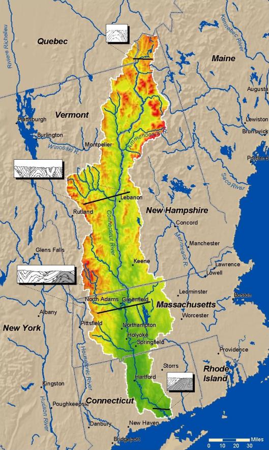
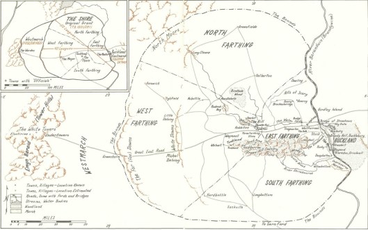
In this post, we’re continuing our series on the Shire. So far, we’ve looked at its government and organization (1), its economy (2), and its geography (3a). Now we want to look at Shire architecture.

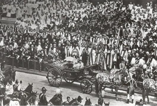
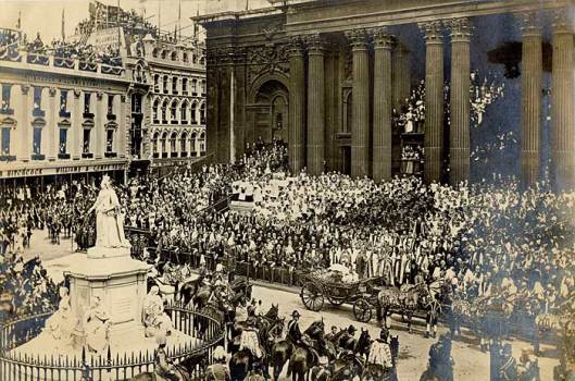
Our initial inspiration for this was from a line in a letter from JRRT to Allen & Unwin, 12/12/55. Speaking of the Shire, he says: “It is in fact more or less a Warwickshire village about the period of the Diamond Jubilee… (Letters, 230)

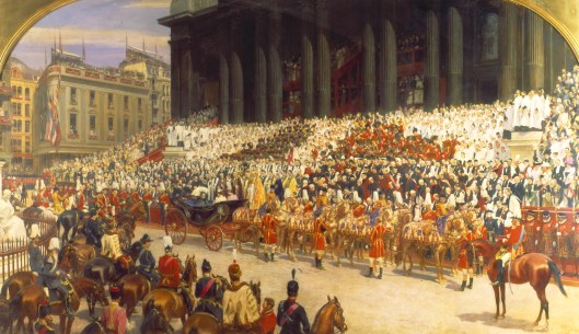
The “Diamond Jubilee” was the 60th anniversary of the reign of Queen Victoria (she came to the throne in 1837–Queen Elizabeth II celebrated her Diamond Jubilee just five years ago).

1vic.jpg

The Jubilee was a huge celebration, bringing in people from all over Britain’s empire, who converged on London in the summer of 1897.

2adiam2bdiam2cdiam

JRRT was born in 1892 and had been brought to England in 1895, for a visit which became permanent when his father died back in South Africa. He and his brother

3atolkandbro.jpg

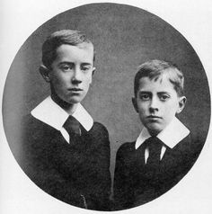
lived with their mother for a time in the village of Sarehole, just south of the huge industrial city of Birmingham. Sarehole’s mill

3sareholemill.jpg

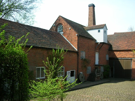
still stands. It has been said that this mill is the model for the one by The Water in The Hobbit, as drawn by JRRT.

4hob.jpg

Thus, when we think about Shire architecture, we can have a double picture:

  1. bits of description in JRRT’s works
  2. actual late Victorian rural villages of the sort in which Tolkien spent part of his childhood

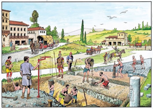
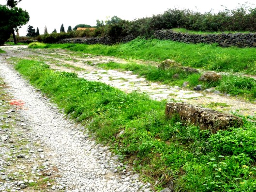
If we begin with historical villages, there isn’t anything to see in the actual Sarehole, except for the mill, which, though built upon the site of a mill which can be dated to 1542, is a building from 1771, just before the industrial revolution, an event with which Tolkien certainly had problems. If we look at other such villages, however, we can get a general picture. Basing our image upon a schematic medieval village plan, we find a double line of houses strung out along a single road.

5medvil.JPG

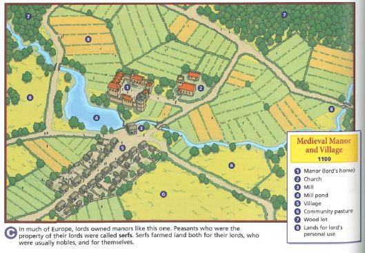
Spreading back from the houses are the fields, as villages in this world were self-sustaining. You can see these in JRRT’s illustration of the mill and the Hill. You’ll notice that these are in strips. In the feudal world, they illustrated both the use of crop rotation (different plants in different fields, with some fields allowed to rest), plus fields of the lord of the manor, which the tenants were obliged to tend. In Tolkien’s Shire, as there is no feudal system, we presume the stripping is for rotation.

4hob

Missing, however, from Hobbiton, would be two features you can see in the medieval illustration: a manor house and a church.

In the feudalism mentioned above, this ideal village is part of the social/governmental system in which it is attached to the smallest unit of that system, the manor.

8feudal.jpg

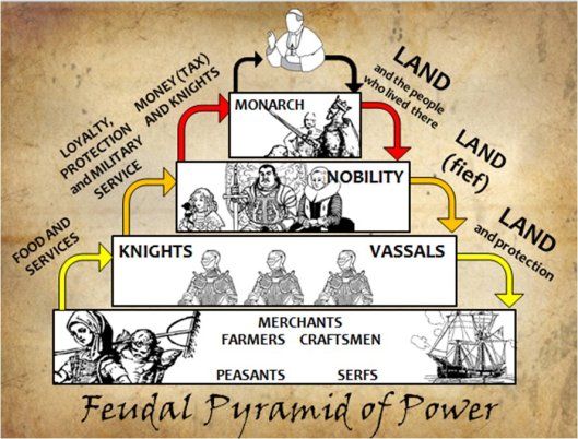
As the chart explains, in the early medieval world, land was power and kings used their claim to control their lands (supposedly given to them by God) as a way to control the state in general.   They deeded certain sections of land to their nobles, in return for taxes and military service. Those nobles, in turn, deeded out land to lesser nobles, all the way down to individual knights, who might hold no more than one parcel, or manor, with its house, church, and village of freemen (literally, free men, who could own land but paid taxes to the lord for it), peasants (who were also free, but held no land), and serfs (who were landless as well as being the property of the local lord).

Although Tolkien once described the Shire as “granted as a fief” (Letters, 158) and “half republic half aristocracy” (Letters, 241), it is not a feudal property and therefore lacks those marks of that system, those manor houses.

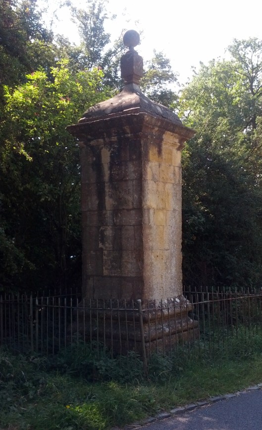
As well, it is also missing churches, or, for that matter, any form of religious shrine. A real English medieval village, depending on its size and wealth, could have had a very modest building, such as this at Hornblotton, in Somerset.

9hornblotton.jpg

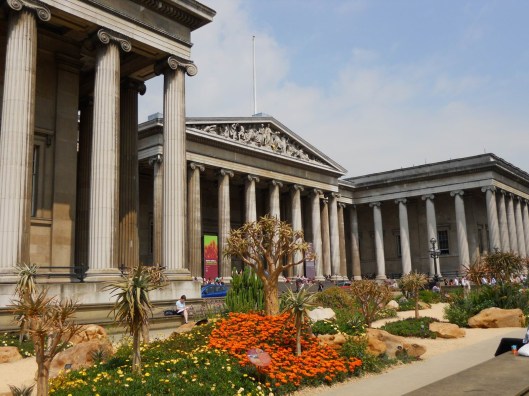
Or, if your village had become a prosperous town, like Lavenham, in Suffolk, you could even have a mini-cathedral. (Lavenham’s money had come from the international trade in woolen cloth.)

110lavenham.jpg

Although Tolkien insisted that there was a monotheistic underlay to Middle-earth in the Third Age, he also says of the folk of the Shire: “I do not think Hobbits practiced any form of worship or prayer (unless through exceptional contact with Elves).” (Letters, 193)

Without manors and churches, the Shire consists of private dwellings and inns. Inns seem to be like their parallels in our medieval world.

11medinn.jpg

And, of course, there are the inns of the Shire and the Prancing Pony in Bree.

12prancingpony.jpg

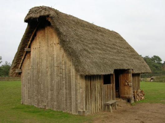
Private houses, including farms, however, fall into two categories: traditional hobbit (that is, built into hillsides) and what we might call outside-influence houses. As Tolkien says in the Prologue to The Lord of the Rings:

“All Hobbits had originally lived in holes in the ground, or so they believed…Actually in the Shire of Bilbo’s days it was, as a rule, only the richest and the poorest Hobbits that maintained the old custom. The poorest went on living in burrows of the most primitive kind…while the well-to-do still constructed more luxurious versions of the simple diggings of old…in the hilly regions and the older villages, such as Hobbiton and Tuckborough, or in the chief township of the Shire, Michel Delving on the White Downs, there were now many houses of wood, brick, or stone…Hobbits had long accustomed to build sheds and workshops…

The habit of building farmhouses and barns was said to have begun among the inhabitants of the Marish down by the Brandywine.

It is probable that the craft of building, as many other crafts beside, was derived from the Dunedain. But the Hobbits may have learned it direct from the Elves… “

Our Tolkien illustration of The Hill

12hob.jpg

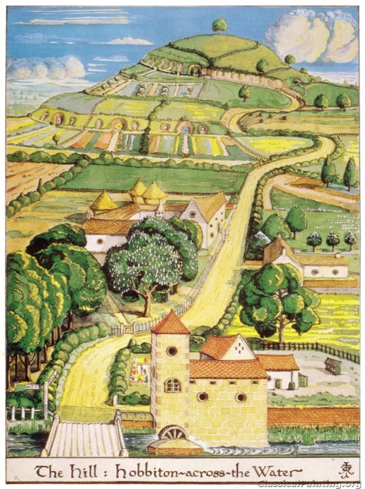
shows us both styles. In the background, burrows; in the foreground, outside-influence houses. The traditional style reminds us of something from US western history: the use of “dugouts” as (at least temporary) dwellings as settlers moved west across the plains.

13sodhouse.jpg

As fans of the Laura Ingalls Wilder books will remember, her family lived in one of these along the banks of Plum Creek in the 1870s.

14sod.jpg

15littlehouse.jpg

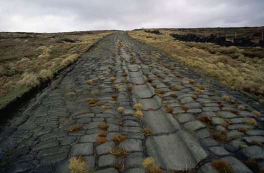
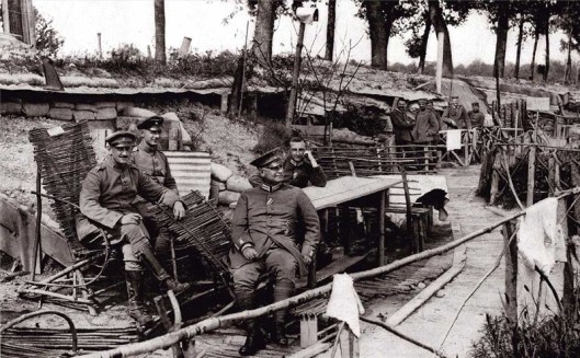
On a more sinister note, we’ve always wondered whether JRRT’s inspiration for hobbit holes may have come from his time on the Western Front, where, from late 1914, soldiers had burrowed into the earth to protect themselves from enemy attack and from the increasingly inclement weather. The shelters could be simply cutouts in the earth

15dugout.jpg

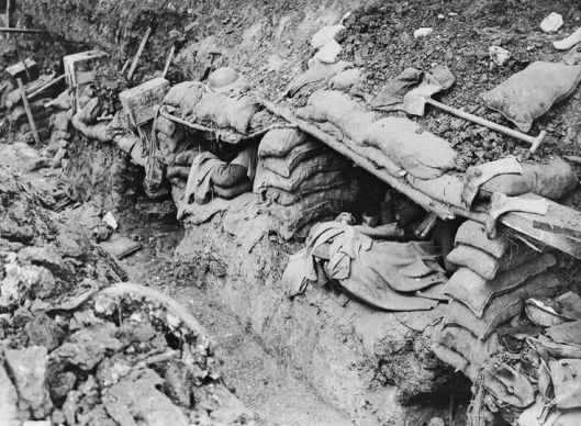
or very elaborate cottages. The Germans were especially admired for their creativity in building the more elaborate ones.

16gmandugout.jpg

We can’t mention the Great War and trenches without also mentioning the brilliant Andrew Robertshaw, the English military historian, who actually reconstructed sixty feet of a trench line in his backyard.

17androb.jpg

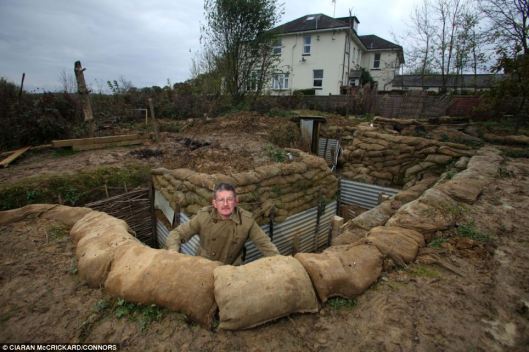
He shares his experience in doing this in his book, 24Hr Trench.

511PnAeovzL._SX342_BO1,204,203,200_.jpg

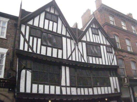
Continuing our medieval parallel, we imagine the outside-influence houses to look something like these:

medhouse1medhouse2

19medhousea.jpg

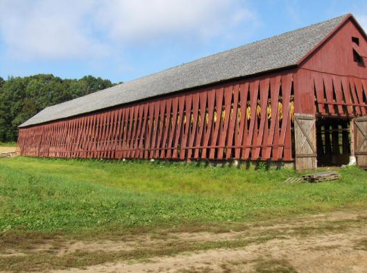
And, for outbuildings, there are a few surviving medieval barns, like this one:

19medbarn.jpg

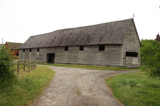
whose roofs are often held up by the most beautiful woodwork, always reminding us of cathedrals, on the one hand, and sailing ships on the other.

20medbarn.JPG

Imagine that this is what Farmer Cotton’s farm might have looked like.

And, with this image, we conclude this posting. In our next, we’re going to move to the edge of the Shire, to discuss marches—geographical ones, that is.

Thanks, as ever, for reading!

MTCIDC

CD

Shire Portrait (3a)

15 Wednesday Feb 2017

Posted by Ollamh in Economics in Middle-earth, Imaginary History, J.R.R. Tolkien, Literary History, Maps, Narrative Methods

≈ Leave a comment

Tags

Argeleb, Baraduin, Beleriand, Blanco, Bridge of Stonebows, Bronze Age Horse, cable ferry, coins, Dartmoor, Doriath, Dwarves, English South Downs, Fallowhide, Far Downs, Farthings, Fornost Erain, Frodo, Gloucestershire, Government, Great East Road, Green Hill Country, Greenway, Jeremy Brett, Little Delving, Longbottom Leaf, Maps, Marcho, Michel Delving, Middle-earth, Minas Tirith, Misty Mountains, Old Dee Bridge, Oxfordshire, River Baranduin, Roads, Roman Roads, Sherlock Holmes, Sidney Paget, Sir Arthur Conan Doyle, Steven Spielberg, Tharbad, The Hobbit, The Hound of the Baskervilles, The Lord of the Rings, The Shire, Three Farthing Stone, Tobacco, Tolkien, Warwickshire, White Downs, Worcestershire

Welcome, dear readers, to the third installment of our rough portrait of the Shire. We call it a “rough portrait” because, so far, we’ve relied upon only three sources: The Hobbit, The Lord of the Rings, and The Letters of J.R.R. Tolkien. We’ll continue to do so in this installment, but we will add two works of geography, K. W. Fonstad’s The Atlas of Middle-earth and Barbara Strachey’s Journeys of Frodo (although we may take a hint of two from other works).

So far, we’ve discussed the government of the Shire (Shire Portrait 1) and the economy (Shire Portrait 2). In this, we want to move on to the geography of the Shire. We begin with Fonstad’s map.

1mapoftheshire.jpg

Except for Buckland, all of the Shire lies west of the River Baranduin (the “Brandywine”). This river can be broad enough to require a cable ferry

2ferryoncable.jpg

and it is navigable, at least by small boats—after all, it was in such a boat that Frodo’s parents were drowned.

As well, there is the Bridge of Stonebows on the Great East Road. Since it’s wide enough for gates and is reported to have had houses on the far side of it, we might imagine it to look like the Old Dee Bridge, at Chester, in England.

3olddeebridgechester

This bridge dates from Norman times (although there was a bridge there from the days of the Roman occupation—“Chester”, after all, is only a corruption of castra, Latin for “military camp”—founded as Deva Victrix in 79AD), with the present version being more-or-less 14th-century. In the Prologue to The Lord of the Rings, the Bridge of Stonebows is said to have been “built in the days of the power of the North Kingdom”, making us wonder whether the Dwarves, who had cut the Great East Road long before, had only had a ford at that place.

To the west of the river stretches the Shire, most of it to the north and south of the Great East Road, which acts as a kind of spine, there being subsidiary roads leading off it towards the various villages. Originally built by the Dwarves in the First Age, it led from Doriath in Beleriand eastward beyond the Baraduin towards the Misty Mountains. After the destruction of Beleriand, the remaining section ran only from the Grey Havens eastward. When Marcho and Blanco, the Fallowhide brothers, gained permission to colonize the area in TA1601 from Argeleb II, the only payment required was “that they should keep the Great Bridge in repair, and all other bridges and roads, speed the king’s messengers, and acknowledge his lordship”, which would have included the Great East Road.

In a previous posting, we talked about the North-South Road (later, the “Greenway”, which once ran from Fornost Erain, in the north, to Minas Tirith, in the south. Because of its ancient importance and places like the causeway and bridge at Tharbad, we imagined it to be like a Roman road—carefully laid out by engineers and paved but, no longer maintained, gone to seed.

4buildingromanroad.jpg

5romanroad.jpg

6overgrownromanroad.JPG

Because of its great age and one-time importance, we’ve always pictured the Great East Road to be similar, especially when it is clear that the kings of Arnor considered its maintenance to be the equivalent of tribute or taxes from the new Shire. Subsidiary roads which split off from the East Road, however, we might see as the usual rutted country roads.

7ruttedroad.jpg

The Shire, besides being bisected by the Great East Road, is also divided into four parts—hence the name “Farthings”—like the pre-decimal English coin, which was a fourth part of a penny (when a penny obviously was worth a lot more!).

8farthingcoin.jpg

We wonder what these divisions were intended to be used for—perhaps for the election of the Mayor? In our previous posting on the government of the Shire, we quoted JRRT as saying in the Prologue to The Lord of the Rings, “The Shire at this time had hardly any ‘government’”, so, for the moment, that’s our best guess.

(We should note here the “Three Farthing Stone”, which marks more or less where the North, East, and South Farthings meet. It has been suggested that it has been based upon the actual English “Four Shires Stone”—

9fourfarthingstone.jpg

which sits at the place where, pre-1931, four shires—Worcestershire, Warwickshire, Oxfordshire, and Gloucestershire — touched. Not only is there a similarity in the names and what the stone may function as, but the Three Farthing Stone is just to the west of Frogmorton, whereas the Four Shire Stone is just east of Moreton-in-Marsh. And is JRRT having a quiet joke in that, after a boundary adjustment in 1931, the Four Shire Stone should really be called the Three Shire Stone?)

Just south of the Great East Road is the Green Hill Country, which appears to be heavily forested.

11gribskov

This is mirrored by a smaller wood north of the road, Bindbole.

Other than these (and, of course, the Old Forest in Buckland), the land seems to be open. To the north are the North Moors. These are windy uplands, mostly grass, with little in the way of trees.

13adartmore

Dartmoor (which is the image above), in southwest England, seems so bare (although it has the fallen remains of earlier cultures on it), that it can seem a little spooky—the perfect setting for Sir Arthur Conan Doyle’s Sherlock Holmes novel The Hound of the Baskervilles (first published in book form in 1902).

13bbaskervilles.jpg

(We love the original Sidney Paget illustrations in The Strand Magazine, but our favorite film version is the one starring Jeremy Brett as Holmes. For pure fun, by the way, we recommend Steven Spielberg’s Young Sherlock Holmes—not for the purist, we hasten to add.)

13cpaget.jpg

13dartmore.jpg

13dbrett.jpg

13eyoungsherlock.jpg

To the west are two lines of downs, the White and the Far (or Fox) Downs. When we think of downs, we think of the chalky rolling hills southeast of the Thames in England. Here’s what the English South Downs look like

14southdowns.jpg

and it’s easy to imagine that the Shire version would look very similar and the chalk would easily be cut into to make Michel Delving (“Big Dig”) and Little Delving (“Little Dig”). The chalk just below the surface is exposed on the south English coast

15chalkcliffs.jpg

making that name “the White Downs” clear. And we can’t resist adding another chalk artifact. In Oxfordshire (but once Berkshire), on the edge of the Berkshire Downs, is a Late Bronze Age horse, cut into the chalk. We wonder why there isn’t one in Rohan…

16uffingtonhorse.jpg

Last of all, there’s the South Farthing, stretching south of The Green Hill Country. As it is a tobacco-growing area, but in a temperate climate (at least, we understand that the Shire is in a temperate zone—they appear to have—or to have had—snowy winters), we visualize it as looking like the Connecticut Valley, which runs south down from Vermont, through western Massachusetts and through central Connecticut, in the US.

17connecticutrvalley.jpg

In the central part of the valley are tobacco plantations.

18tobaccofields.jpg

These always include drying barns for the tobacco—which would become the Longbottom Leaf Merry and Pippin discover two casks of in Saruman’s pantry.

19tobaccobarn.jpg

The one farthing we haven’t studied directly is the East Farthing, but, as it contains a continuation of the Green Hill Country, abuts the Brandywine, and has the already-mentioned bridge of Stone Bows, and thus has no main features we haven’t mentioned, we’ll conclude here for the moment. In our next, we want to examine Shire architecture, from hobbit holes to mills.

Thanks, as ever, for reading.

MTCIDC

CD

Shire Portrait (2)

08 Wednesday Feb 2017

Posted by Ollamh in Economics in Middle-earth, Imaginary History, J.R.R. Tolkien, Maps, Narrative Methods

≈ 2 Comments

Tags

An Unexpected Party, Bad End, Baggins, ceramics, clay bank, coal, coins, cork, crafts, cutlery, Dwarves, Esther Forbes, Gondorian money, Hobbits, Isengard, Johnny Tremain, lead, Lloyd Alexander, Longbottom Leaf, Mayor, Michel Delving, mines, Postal Service, pottery, realien, Renaissance, Robert II of Scotland, Saruman, Shirriffs, silica, Silver, Taran Wanderer, Thain, The Green Dragon, The Hobbit, The Lord of the Rings, The Shire, Tolkien

Welcome, dear readers, as always.

In our last post, we began a series responding to the question:   what makes the Shire the Shire?

1theshire

We began with the government, which turned out to be very rudimentary: a Thain (hereditary), a Mayor (elected), a postal service (not known how chosen), Shirriffs (a kind of border patrol—volunteer). Since the Thain and Mayor were principally honorary positions, there was perhaps no salary attached. As for the postal service (called “Messengers”) and the Shirriffs, we presume that there must have been some sort of payment, although we are not told so. Since, in our world, we pay for the police and the post office through taxes, we wondered how the same services in the Shire were paid. This led us to the question of the Shire economy in general.

In a letter of 25 September, 1954, JRRT wrote to Naomi Mitchison:

“I am more conscious of my sketchiness in the archaeology and realien [“physical facts/things of real life”] than in the economics: clothes, agricultural implements, metal-working, pottery, architecture and the like…I am not incapable of or unaware of economic thought; and I think as far as the ‘mortals’ go, Men, Hobbits, and Dwarfs, that the situations are so devised that economic likelihood is there and could be worked out…” (Letters, 196)

The Shire would appear to be an agriculturally-based economy:

“The Shire is placed in a water and mountain situation and a distance from the sea and a latitude that would give it a natural fertility, quite apart from the stated fact that it was a well-tended region when they [hobbits] took it over.” (Letters, 196)

He adds to this that, when the hobbits took control of the Shire, that included “a good deal of older arts and crafts”, suggesting that the solution to the problem of the production of “clothes, agricultural implements, metal-working, pottery”—all the Realien, as he calls them, is assumed. How and from whom such things were taken over is not explained and such production, in any community, is not a small matter: “things of real life” are many and complicated.

Consider, for example, just one moment at Bag End. The Baggins appear to have been well-to-do, even without the treasure Bilbo brought back from his trip. His house is extremely well-furnished and the Baggins certainly don’t want for provisions, as we know from descriptions both in The Hobbit and The Lord of the Rings, as well as Realien, as the Dwarves’ clean-up song reminds us:

Chip the glasses and crack the plates!

Blunt the knives and bend the forks!

That’s what Bilbo Baggins hates—

Smash the bottles and burn the corks!

(The Hobbit, Chapter 1, “An Unexpected Party”)

1bilbodwarves.jpg

If we take this line by line, we come up with the following: glasses, plates, knives, forks, bottles, corks.

Glasses and bottles (as well as the window panes at Bag End) require a glassblower and perhaps a glazier.

2latemedglass.jpg

Plates require a potter.

3potter.JPG

Knives and forks were once made by cutlers (and forks are very advanced for a Middle-earth which is mostly medieval—although classical people used them in food preparation, it was only during the Renaissance that they began to appear as an eating utensil—western Medieval people ate with knives, spoons, and fingers).

4feast.jpg

5renfork.jpg

(And next is a Renaissance fork, found in the foundations of the Rose Theatre)

Corks come from vintners and brewers (in our world, vintners only began using cork as a sealant in the 17th century, we have read).

6awinebottles.jpg

Take those objects a step farther back and you find:

  1. glasswear, bottles, and window panes require silica and something to make it more stable, like lime (from limestone) or lead, which leads us to the question of where the ingredients come from. Silica is sand and can be found in many places—perhaps it might come from the west coast of Middle-earth? If all of the Shire is like the White Downs, where Michel Delving is located, it may be situated upon a vast deposit of chalk (more about Shire geography in our next posting). Lime would then have to be imported. As we have no record of mines in the Shire, the same would be true for lead.

6medievalglass.jpeg

7silica.jpg

8chalk.jpg

9limestone.jpg

10leadmine.jpg

  1. ceramics, like plates, are made of clay and all sorts of clay are used to make pottery, but all need to be dug out, usually from beds found near streams, rivers, or places like canyons or ravines. The Shire seems fairly well-watered, so we presume that the clay used to make Bilbo’s dishes was local.

11claybank.jpg

  1. knives and forks would be made of iron, early steel, or silver (with silver, plus an alloy to make them stronger)—here, again, we would need mines, for the iron ore and silver

12ironmine.jpg

  1. cork in our world is actually tree bark from the cork trees which grow in hot, dry southwest Europe (Spain/Portugal) and northwest Africa

13corkharvest.jpg

1, 2, 4 (and possibly 3) require raw materials of which no mention is made in the Shire and 1, 2, and 3 all need especially hot fires to make them, possibly using charcoal (made locally?) or coal (again, no mines discussed). And this is just, basically, four items.

14coalmine.jpg

So many import possibilities: what about export? We have solid evidence for one, which Merry and Pippin have discovered at Isengard:

“My dear Gimli, it is Longbottom Leaf! There were the Hornblower brandmarks on the barrels, as plain as plain. How it came here, I can’t imagine. For Saruman’s private use, I fancy. I never knew that it went so far abroad.” (The Two Towers, Book 3, Chapter 9, “Flotsam and Jetsam”)

It should always be remembered that these are works of fantasy, of course, and, unless there is some novelistic purpose which employs a potter as a character (in Taran Wanderer,15taranwanderer.JPG

by Lloyd Alexander, book 4 of The Chronicles of Prydain, for example, the hero, Taran, spends a little time as an apprentice potter, among other trades) or the making of silverware (something one might read about in Esther Forbes’ Johnny Tremain,16johnnytremain.jpg

where Johnny is an apprentice to a silversmith), it would seem completely unnecessary to spend narrative time discussing raw materials, imports, exports, or the manufacture of day-to-day items. We have taken the time, however, because, where, sometimes, we write about the parallels between Middle-earth and something here in our world, here the complexity of ordinary things in our world is completely forgotten in Middle-earth, or simply taken for granted, as JRRT implies in the letter cited above. If we are to examine Shire economics, however, we must, at least, consider them. As well, although we may keep saying, “No evidence for”, we think that, even if there is no potter or tin mine in the text, prompting readers to remember that, in the real world, there would have been one is a useful exercise and, for us, at least, makes the story that much more real.

But now we come to the subject of paying for Realien, or for anything else in the Shire, be it for the Shirriffs or for a pint at The Green Dragon.

In a totally rural economy many things might be obtained through barter: in return, for payment, please take 10 chickens, or a sack of grain. (And perhaps we see something like this in “The Scouring of the Shire”, when Hob Hayward tells Merry that, “We grows a lot of food, but we don’t rightly know what becomes of it. It’s all these ‘gatherers’ and ‘sharers’, I reckon, going round counting and measuring and taking off to storage.”—this looks like taxes, “paid in kind”).  Such might work for, say, trading a hen for a bowl, but would certainly not do for that pint—or for the bill at The Prancing Pony. Coins and their values are not mentioned in Tolkien, but their effect is felt, all the same: when Frodo buys a house in Crickhollow, we doubt he does it with cows!

17aeastfarthingmap.png

(We discussed Middle-earth money in an earlier posting and it seems to us that it would be fun to create, say, Gondorian money—here’s one possibility

17robert21316-1390.jpg

It’s actually a coin of Robert II of Scotland—1316-1390—but, changing the crown, could you imagine this as something issued earlier in the Third Age, say?)

This has been perhaps a rather long-winded and prosy posting (perhaps not for nothing did Thomas Carlyle, in 1849, call economics “the dismal science”?), for which we ask our readers’ pardon, but, if it helps to flesh out our portrait of the Shire, it was worth it, we feel. Our next, we hope will be a bit lighter, being on the physical “look” of the Shire, from its geography to its geology to its architecture.

Thanks, as ever, for reading.

MTCIDC

CD

Shire Portrait (I)

01 Wednesday Feb 2017

Posted by Ollamh in Economics in Middle-earth, J.R.R. Tolkien, Literary History, Maps, Military History, Military History of Middle-earth, Narrative Methods

≈ 1 Comment

Tags

British Museum, culture, elections, farthing, feudalism, Government, Hobbitry-in-arms, Hobbits, Louvre, Maps, Mathom-house, Mayor, Michel Delving, Middle-earth, museums, police, Postmen, Sharkey, Shire, Shire-moot, Shire-muster, Shirriffs, Thain, The Hobbit, The Lord of the Rings, The Scouring of the Shire, thegn, Tolkien, vassal, Vatican, voting, White Downs, Witch-King of Angmar

Welcome, dear readers, as always.

In our last post (well, next-to-last–the last was on circuses), we talked about museums and Mathom-houses and, thinking that the Shire had a museum, made us wonder about what we might call “Shire culture” in general. What is it which makes the Shire the Shire?

1theshire.jpg

To go about answering that, we tried to think of a model. Could we imagine ourselves doing a tourist brochure? A wiki article? And where would we begin?

Suppose, we thought, we begin with the outermost shell, rather as in our world: the government.

The first ten pages of the Prologue to The Lord of the Rings contain a good deal of information about hobbits and their homeland, with many other details to be gleaned from the main body of the text and the appendices and some from The Hobbit. There is undoubtedly more yet to be found in several of the subsidiary volumes, but we decided that, to make this a series of readable posts and not a small encyclopedia, we would stick to the two main works.

With all of that material to help us, all we needed was an entry point—and, almost immediately, we decided that we could begin where we left off, with that very museum, which originally attracted us because it stood out as something one would expect from a much more organized state, rather than from what, on the whole, appears to be such a rural and decentralized place.

After all, museums, as we have discussed, are a relatively recent invention in the west and public museums are even newer (the first state-sponsored museum in Britain, for example, only dates from the 1750s). Since our last posting, we’ve done a bit more research and, with one or two possible exceptions, it seems that public museums only begin to appear at all from the second half of the 17th century. (A quick and useful reference may be found at: https://museu.ms) Even so, such places have a good deal to say about a culture:

  1. that it values elements of its past, both historical and artistic, enough that it is willing to collect and preserve them
  2. that it believes that such elements should then be put upon public display (the why of that might include: to use for educational purposes—which assumes that the past has things to teach the present; to provide aesthetic pleasure; even to show the wealth and power of a state which has such a history and such artists)
  3. that it is willing to provide space, at the public expense, to house and display such things

The Mathom-house is hardly, from JRRT’s description, the equivalent of the British Museum

1bm.jpg

or the Louvre

2louvre.jpg

or the Vatican

3vatican.jpg

or any of the other thousand wonderful museums around the world, big or small. And yet it is there and in the closest thing to a capital which the Shire has to offer, Michel Delving. It is only the closest thing because the Shire has almost no formal governing structure.

As the Prologue says:

“The Shire at this time had hardly any ‘government’. Families for the most part managed their own affairs…”

Originally, as the Prologue tells us, the Hobbits had moved into the land which would become the Shire with the permission of the high king of the North Kingdom, at Fornost. When the last king and his kingdom had fallen to the Witch King of Angmar, the Hobbits replaced him with a “Thain” (actually an Old English word for, among other things, a “vassal”—that is, one who acts as a subordinate—in a feudal system, this might imply that the person has received land from someone higher on the social scale in return for taxes and/or military service).  Here’s a thegn (Old English spelling) as a warrior.

5thegn.JPG

By the time of The Hobbit, this office had dwindled, but not quite disappeared:

“The Thain was the master of the Shire-moot, and captain of the Shire-muster and the Hobbitry-in-arms, but as muster and moot were only held in times of emergency, which no longer occurred, the Thainship had ceased to be more than a nominal dignity.”

In fact,

“The only real official in the Shire at this date was the Mayor of Michel Delving (or of the Shire), who was elected every seven years at the Free Fair on the White Downs at the Lithe, that is at Mid-summer. As mayor almost his only duty was to preside at banquets, given on the Shire-holidays, which occurred at frequent intervals. But the offices of Postmaster and First Shirriff were attached to the mayoralty, so that he managed both the Messenger Service and the Watch. These were the only Shire-services, and the Messengers were the most numerous, and much the busier of the two. By no means all Hobbits were lettered, but those who were wrote constantly to all their friends (and a selection of their relations) who lived further off than an afternoon’s walk.

The Shirriffs was the name that the Hobbits gave to their police, or the nearest equivalent that they possessed…they were in practice rather haywards than policemen, more concerned with the strayings of beasts than of people. There were in all the Shire only twelve of them, three in each Farthing, for Inside Work. A rather large body, varying at need, was employed to ‘beat the bounds’, and to see that Outsiders of any kind, great or small, did not make themselves a nuisance.”

This gives us the whole of the top level of Shire culture, the public face: a vestigial Thain (representative of the long-gone King), a figurehead Mayor, a postal service, and a tiny police force/border guard.

And how does any of these hold office?

The Thain, as we know, is hereditary.

The Mayor is, as quoted above, elected—although we have no idea of the process. Does one vote by town? By Farthing? Or is there simply a kind of country-wide method? We also have no idea of suffrage: who has the vote in the Shire? Is it general (England had general suffrage by the time JRRT was writing The Hobbit, all men over 21 by 1918, some women—householders over the age of 30—having been included in elections in 1918, women in general over 21 in 1928)? Or is it the older “only property-holders” method? Or are there “hereditary electors” who do the choosing? (As CD have just gone through an election here in the US, all of these questions, as you can imagine, are fresh in our minds!)

The “postmen” (our word) are, so far as we can tell, a mystery, both as to who they are or how they gain their employment.

Shirriffs appear to be volunteers, as we learn in “The Scouring of the Shire”, when Sam talks to Robin Smallburrow, who says “You know how I went for a Shirriff seven years ago, before any of this began.”

There being so little in the way of government, are there any public buildings except for the Mathom-house? If there are, we have yet to locate them. It’s striking that, when “Sharkey” takes over the Shire, he sets up a number of such places, but neither government buildings nor museums, instead, they are tokens of a police state: barracks and watch houses, dens reminding us of something which JRRT would have seen all too much of in newspapers and magazines, as well as newsreels as he worked on the early stages of The Lord of Rings:

4asentrybox.jpg

4schutzpo.jpg

(More on Sharkey and the takeover in a future posting!)

Considering that there is a small policing force, as well as a kind of postal institution, we looked for another government department: the Internal Revenue Service. After all, we pay for our police and used to pay for postage stamps, back in pre-internet days, and we pay for public museums, too: how does it work in the Shire? The simple answer is, we don’t know. In fact, we don’t really know much about how the economy works in general. And that will be the subject of our next posting.

Thanks, as always, for reading!

MTCIDC

CD

The Doubtful Sea Series Facebook Page

The Doubtful Sea Series Facebook Page

  • Ollamh

Categories

  • Artists and Illustrators
  • Economics in Middle-earth
  • Fairy Tales and Myths
  • Films and Music
  • Games
  • Heroes
  • Imaginary History
  • J.R.R. Tolkien
  • Language
  • Literary History
  • Maps
  • Medieval Russia
  • Military History
  • Military History of Middle-earth
  • Narnia
  • Narrative Methods
  • Poetry
  • Research
  • Star Wars
  • Terra Australis
  • The Rohirrim
  • Theatre and Performance
  • Tolkien
  • Uncategorized
  • Villains
  • Writing as Collaborators
Follow doubtfulsea on WordPress.com

Across the Doubtful Sea

Recent Postings

  • Horning In (2) February 1, 2023
  • Horning In (1) January 25, 2023
  •  Things You/They Know That Ain’t January 18, 2023
  • Sympathy for a Devil? January 11, 2023
  • Trumpeting January 4, 2023
  • Seating December 28, 2022
  • Yule? December 21, 2022
  • Sequels and Prequel December 14, 2022
  • Rascals December 7, 2022

Blog Statistics

  • 69,350 Views

Posting Archive

  • February 2023 (1)
  • January 2023 (4)
  • December 2022 (4)
  • November 2022 (5)
  • October 2022 (4)
  • September 2022 (4)
  • August 2022 (5)
  • July 2022 (4)
  • June 2022 (5)
  • May 2022 (4)
  • April 2022 (4)
  • March 2022 (5)
  • February 2022 (4)
  • January 2022 (4)
  • December 2021 (5)
  • November 2021 (4)
  • October 2021 (4)
  • September 2021 (5)
  • August 2021 (4)
  • July 2021 (4)
  • June 2021 (5)
  • May 2021 (4)
  • April 2021 (4)
  • March 2021 (5)
  • February 2021 (4)
  • January 2021 (4)
  • December 2020 (5)
  • November 2020 (4)
  • October 2020 (4)
  • September 2020 (5)
  • August 2020 (4)
  • July 2020 (5)
  • June 2020 (4)
  • May 2020 (4)
  • April 2020 (5)
  • March 2020 (4)
  • February 2020 (4)
  • January 2020 (6)
  • December 2019 (4)
  • November 2019 (4)
  • October 2019 (5)
  • September 2019 (4)
  • August 2019 (4)
  • July 2019 (5)
  • June 2019 (4)
  • May 2019 (5)
  • April 2019 (4)
  • March 2019 (4)
  • February 2019 (4)
  • January 2019 (5)
  • December 2018 (4)
  • November 2018 (4)
  • October 2018 (5)
  • September 2018 (4)
  • August 2018 (5)
  • July 2018 (4)
  • June 2018 (4)
  • May 2018 (5)
  • April 2018 (4)
  • March 2018 (4)
  • February 2018 (4)
  • January 2018 (5)
  • December 2017 (4)
  • November 2017 (4)
  • October 2017 (4)
  • September 2017 (4)
  • August 2017 (5)
  • July 2017 (4)
  • June 2017 (4)
  • May 2017 (5)
  • April 2017 (4)
  • March 2017 (5)
  • February 2017 (4)
  • January 2017 (4)
  • December 2016 (4)
  • November 2016 (5)
  • October 2016 (6)
  • September 2016 (5)
  • August 2016 (5)
  • July 2016 (5)
  • June 2016 (5)
  • May 2016 (4)
  • April 2016 (4)
  • March 2016 (5)
  • February 2016 (4)
  • January 2016 (4)
  • December 2015 (5)
  • November 2015 (5)
  • October 2015 (4)
  • September 2015 (5)
  • August 2015 (4)
  • July 2015 (5)
  • June 2015 (5)
  • May 2015 (4)
  • April 2015 (3)
  • March 2015 (4)
  • February 2015 (4)
  • January 2015 (4)
  • December 2014 (5)
  • November 2014 (4)
  • October 2014 (6)
  • September 2014 (1)

Blog at WordPress.com.

  • Follow Following
    • doubtfulsea
    • Join 68 other followers
    • Already have a WordPress.com account? Log in now.
    • doubtfulsea
    • Customize
    • Follow Following
    • Sign up
    • Log in
    • Report this content
    • View site in Reader
    • Manage subscriptions
    • Collapse this bar
 

Loading Comments...