• About

doubtfulsea

~ adventure fantasy

Category Archives: Maps

The Road (No Longer) Taken

21 Wednesday Sep 2016

Posted by Ollamh in J.R.R. Tolkien, Literary History, Maps, Military History, Narrative Methods

≈ Leave a comment

Tags

Adventure, Fornost, History, Isengard, Medieval, Middle-earth, Numenorean road, pack horses, Ridgeway, Roman bridges, Roman occupation of England, Roman Roads, Stonewain Valley, the Greenway, The Lord of the Rings, the North Road, The Salt Road, Tiber River, Tolkien, Via Salaria

Dear Readers, welcome, as always. In this posting, we’ve been thinking about the subject of roads in Middle-earth and, in particular, the North Road, also called the Greenway.

middle-earth-map.jpg

This was the North-South Road, which ran, once upon a time, from Isengard to Fornost, described by Christopher Tolkien as “the great Numenorean road linking the Two Kingdoms, crossing the Isen at the Fords of Isen and the Greyflood at Tharbad and then on northwards to Fornost”. (Unfinished Tales, 314, n.32)

Mostly, the roads of Middle-earth seem to be what you’d expect in a text which is based upon the actual medieval world: dirt tracks.

medievalroad.jpg

In the real English medieval world, most of these were not really for carts or carriages,

medievalcart.jpg

canvas.png

but rather for pack horses and their loads, which only required the narrowest of paths.

packhorsetrain1

The_Marsden_pack_horse_road,_Marsden_-_geograph.org.uk_-_826758

Bridge in Marsden, West Yorkshire

Bridge in Marsden, West Yorkshire

There had been simple pathways in Britain since earliest times, like the Ridgeway.

Ivinghoe Beacon seen looking north from The Ridgeway.

Ivinghoe Beacon seen looking north from The Ridgeway.

And yet there were still the remains of a different sort of road in Britain, those built under the Roman occupation of England, from 43 to 410AD.

Roman.Britain.roads

The Romans had begun their rise to power in Italy by controlling a road, the Via Salaria, which ran inland from the Mediterranean. A major purpose of this road (you can see it in its name, “The Salt Road”) was to further the salt trade.

The salt came from salt pans on the Mediterranean coast.

saltblocks

saltpans

The early Romans had been lucky (or wise) in founding their city at a major ford of the Tiber River, where the Via Salaria crossed it.

archaicrome

And out from Rome spread a network of roads.

roman-roads-italy-map

In time, the main roads were not simply dirt tracks, but very-carefully-constructed, well-laid-out stone-paved roadways.

Eli dis 2

These included sturdy bridges, as well, some of them still in place.

alcantara-bridge

Over these roads marched Roman armies

romantroopsonroad

and Roman commerce, as well.

plaustrum2

Eventually, there were over 50,000 miles (80,500 km) of paved roads, as well as many miles more yet of unpaved.roman_empire_117_ad

As far as our current research goes, we have no actual proof that the Greenway was paved like Roman roads. One road for which there is a hint of evidence is that which runs through the Stonewain Valley:

“Through the gap the forgotten wain-road long ago had run down, back into the main horse-way from the City through Anorien; but now for many lives of men trees had had their way with it, and it had vanished, broken and buried under the leaves of uncounted years.” (The Return of the King, Book 5,   Chapter 5, “The Ride of the Rohirrim”)

A comparable illustration—with grass instead of trees and leaves—is this of a Roman road in Lancashire, in northeastern England.

Roman Road walk Lancashire

The idea of a road nearly abandoned and covered with grass—therefore “the Greenway”—seems to fit both this modern photo and JRRT’s idea, though, doesn’t it?

One of the spooky, but wonderful things about the ancient Roman world is that, for all that it’s been gone for 1500 years or more, there is so much of it still there for us, above ground and below—as it was for Tolkien. Thus, when we think about what was once one of the major thoroughfares of Middle-earth, we imagine that he, like us, saw a Roman road, decaying, but still useful.

Thanks, as always, for reading.

MTCIDC

CD

“A kind of proud, venerable, but increasingly impotent Byzantium”

01 Wednesday Jun 2016

Posted by Ollamh in Artists and Illustrators, J.R.R. Tolkien, Literary History, Maps, Military History, Military History of Middle-earth, Narrative Methods

≈ Leave a comment

Tags

Adventure, Byzantine Empire, Byzantium, Constantinople, Gondor, Justinian, Megara, Mehmet II, Milton Waldman, Minas Arnor, Minas Tirith, Mont Saint Michel, Ottoman Empire, Ted Nasmith, The Lord of the Rings, The Tower of Guard, Theodosian walls, Theodosius, Tolkien

Welcome, as always, dear readers.

The title of this posting is taken from a very long letter (10,000 words), written to Milton Waldman probably in 1951 (Letters No.131, 157). Waldman represented the English publisher, Collins, which had expressed an interest in The Lord of the Rings and The Silmarillion when Allen & Unwin had been hesitant. Determined to justify the simultaneous publication of both, Tolkien wrote in great detail about the general narrative, with an emphasis upon the religious aspects.

In the process, he likened Gondor to the Byzantine empire, a comparison which immediately attracted our attention. We ourselves had suggested in an earlier posting that the attack on its capital, Minas Tirith, had been like the siege of the Byzantine capital, Constantinople.

attackongondor.jpg

8da792d4aac58fe51f8ddf1aefa36048.jpg

What was JRRT thinking of when he likened the two?

First, they both were—or had been—large kingdoms—in the case of Byzantium, an empire, really, as these maps demonstrate.

gondor1050height.jpg

2000px-Byzantiumby650AD.svg.png

Their capitals were both of great age. Minas Tirith, “The Tower of Guard”, had been built originally as Minas Anor, “Tower of the Sun” in SA 3320 by Anarion, the younger son of Elendil, but only became the capital of Gondor in TA1640, after Osgiliath had been devastated by a plague. If we add its time in the Second Age (121 years) to the whole of the Third Age (3021 years), we reach a total of 3142 years at the defeat of Sauron. (For comparison, we might look at Athens, whose continuous habitation began before 3000BC, giving it a more-than-5000-year history.)

Constantinople, is old, by anyone’s standards, having been founded in 667BC as a Greek colony (there’s a bit of argument over the dating of this, which is typical of such things), and is still inhabited (and an absolutely amazing place!), but a bit younger than Minas Tirith at the time of The Lord of the Rings by some 500 years or so.

Third, there is the matter of the elaborate construction of these capitals.

“For the fashion of Minas Tirith was such that it was built on seven levels, each delved into the hill, and about each was set a wall, and in each wall was a gate. But the gates were not set in a line: the Great Gate in the City Wall was at the east point of the circuit, but the next faced half south, and the third half north, and so to and fro upwards; so that the paved way that climbed towards the Citadel turned first this way and then that across the face of the hill. And each time that it passed the line of the Great Gate it went through an arched tunnel, piercing a vast pier of rock whose huge out-thrust bulk divided in two all of the circles of the City save the first. For partly in the primeval shaping of the hill, partly by the mighty craft and labour of old, there stood up from the rear of the wide court behind the Gate a towering bastion of stone, its edge sharp as a ship-keel facing east. Up it rose, even to the level of the topmost circle, and there was crowned with a battlement; so that those in the Citadel might, like mariners in a monstrous ship, look from its peak sheer down upon the Gate seven hundred feet below.”

The Lord of the Rings, Book 5, Chapter 1, “Minas Tirith”

Here’s one of our favorite paintings (by Ted Nasmith—one of our favorite Tolkien artists).

TN-Minas_Tirith_at_Dawn.jpgnaismith.jpg

And here’s the film.

ROTK-Minas-Tirith.jpg

The designers have said that they were influenced by the look of Mont Saint Michel, a medieval monastery just off the coast of Normandy in France.

Mont_St_Michel_3,_Brittany,_France_-_July_2011.jpg

MtStMichel_avion.jpg

The complex nature of the place is captured in this diagram.

minas-tirith-diagram.0.jpg

Byzantium (or, Constantinople, its later name) began its life, as we said, as a colony of the Greek mainland city of Megara. In the 4th century AD, the Roman emperor Constantine I, the last survivor in a long civil war, chose the site for his new capital. As much of the weight, both of commerce and defense, lay in the eastern part of the Roman world by this time, he chose very wisely: his new city was placed to control trade with the rich Black Sea region and to provide a strategic jumping-off point for dealing with invaders and emerging kingdoms in Asia Minor.

Locator_map_Byzantion.PNG

The position was also well-chosen for defense, being at the end of a peninsula—the main strategy then being its walling-off from the mainland.

constantin.jpg

There is, of course, a big difference here between the 7 levels and 7 gates of Minas Tirith and the two walls—the older inner 4th-century one of Constantine and the slightly-later (early 5th century) walls of Theodosius II. Nevertheless, those later walls were well-constructed, in two successive lines, with a moat on the outside.

Theodosian Walls.jpg

The Theodosian walls were about a mile-and-half from the older, Constantine wall, encompassing a population which, at its height, may have been over 400,000 in number. By the time of its fall to the Ottoman army in 1453, that number had dropped to perhaps only 50,000, which reflected the gradual shrinking of the empire from its greatest size, in the 6th century

Byzantine-empire.6thc.gif

under the emperor Justinian

justinian.jpg

when it encompassed the majority of the Mediterranean basin, to its last, worn-out phase in the early 15th century, when it controlled a few scattered outposts, but mainly the area directly around the capital.

constantinople-world-map.jpg

This shrinking of the empire and of its population proved disastrous for the capital. When the Ottoman army, under Mehmet II, arrived outside the walls in the spring of 1453, the imperial government could only provide 7000 defenders, 2000 of whom were foreigners, to defend about 3 and ½ miles of wall (that’s 5 ½ km). Against them were anywhere from 50 to 80,000 attackers, who brought with them (or cast on the spot), massive artillery pieces and, after a 53-day siege, broke into the city and put an end to an empire which had lasted for over 1100 years.

Illustration-of-angus-mcbride-showing-the-ottoman-cannon-basilica-during-the-siege-of-constantinople-in-1453-ad.jpg

Benjamin-Constant-The_Entry_of_Mahomet_II_into_Constantinople-1876.jpg

And this is the last sad similarity with Gondor and its capital, as we see through Pippin’s eyes:

“Pippin gazed in growing wonder at the great stone city, vaster and more splendid than anything that he had dreamed of, greater and stronger than Isengard, and far more beautiful. Yet is was in truth falling year by year into decay, and already it lacked half the men that could have dwelt at ease there. In every street they passed some great house or court over whose doors and arched gates were carved many fair letters of strange and ancient shapes: names Pippin guessed of great men and kindreds that had once dwelt there; and yet now they were silent, and no footsteps rang on their wide pavements, nor voice was heard in their halls, nor any face looked out from door or empty window.”

The Lord of the Rings, Book 5, Chapter 1, “Minas Tirith”

And, just as in the case of Constantinople, the capital of Gondor was hard-pressed to defend itself. Luckily for it, however, there was an uncrowned king with a ghostly army, a brave reinforcement of southern yeomen, a mass of wild horsemen from the north, a wizard, and the fulfillment of an ancient prophecy about a witch king to aid it in its hour of need…

Thanks, as always, for reading.

MTCIDC

CD

Rear Guard

18 Wednesday May 2016

Posted by Ollamh in Films and Music, J.R.R. Tolkien, Literary History, Maps, Military History, Military History of Middle-earth, Narrative Methods

≈ 1 Comment

Tags

66th Regiment, British Infantry, Denethor, Faramir, Gary Zaboly, Le Cateau, Maiwand, Nazgul, Osgiliath, Pelennor, Peter Jackson, Rammas Echor, Richard Caton Woodville, the Alamo, The Lord of the Rings, The Return of the King, The Siege of Gondor, Tolkien

Welcome, dear readers, as always.

In a previous posting, we rolled our eyes verbally at a moment in P. Jackson’s The Return of the King in which Faramir, according to the script, was required to mount a double-rank cavalry charge against the west bank of Osgiliath.

gondorianerritt-cb182208.jpg

To us, this was a clumsy attempt to convey the clash between Faramir and his father Denethor, derived from material in The Lord of the Rings, Book 5, Chapter IV, “The Siege of Gondor”, principally from this:

“ ‘Much must be risked in war,’ said Denethor. ‘Cair Andros is manned, and no more can be sent so far. But I will not yield the River and the Pelennor unfought—not if there is a captain here who has still the courage to do his lord’s will.’

Then all were silent. But at length Faramir said: ‘I do not oppose your will, sire. Since you are robbed of Boromir, I will go and do what I can in his stead—if you command it.’

‘I do so,’ said Denethor.

‘Then farewell!’ said Faramir. ‘But if I should return, think better of me!’

‘That depends on the manner of your return,’ said Denethor.

Gandalf it was that last spoke to Faramir ere he rode east. ‘Do you throw your life away rashly or in bitterness,’ he said. ‘You will be needed here, for other things than war. Your father loves you, Faramir, and will remember it ere the end. Farewell!’ “

In the text, Faramir then goes to Osgiliath, having “taken with him such strength of men as were willing to go or could be spared.” The tone here is hardly encouraging and, the following day, “The passage of Anduin was won by the Enemy. Faramir was retreating to the wall of the Pelennor, rallying his men to the Causeway Forts; but he was ten times outnumbered.”

In an earlier posting, we have discussed the Rammas Echor, the wall which enclosed the farmland outside the walls of Minas Tirith.

causeway.gif

We have also discussed the use by both Saruman and Sauron of what appears to be an early form of explosive—seen here in the following description of the fall of the Rammas:

“The bells of day had scarcely rung out again, a mockery in the unlightened dark, when far away he [Pippin] saw fires spring up, across in the dim spaces where the walls of the Pelennor stood. ..Now ever and anon there was a red flash, and slowly through the heavy air dull rumbles could be heard.

‘They have taken the wall!’ men cried. ‘They are blasting breeches in it. They are coming!’ “

Outnumbered and, with the fall of the wall in different locations, outflanked, the best that Faramir can do is to fall back towards Minas Tirith, as Gandalf says, “Yet he is resolved to stay with the rearguard, lest the retreat over the Pelennor become a rout. He may, perhaps, hold his men together long enough, but I doubt it.”

Unlike the silly—there’s really no other word for it—charge of P. Jackson—Faramir is a professional soldier, after all, much loved by his soldiers—we see what JRRT, having been a soldier himself, would have known was the military solution: a fighting retreat, led by a brave and capable leader.

His task had been an impossible one to begin with and, properly understood and depicted on the screen, would not only have been powerful dramatically, but much more believable. It was an impossible task, however, against the odds of ten to one. (For a comparison, we offer the siege and fall of the Alamo, late February-early March, 1836. The garrison numbered about 180, the besiegers eventually approximately 3000. In the final assault, before dawn on 6 March, 1836, the four assaulting columns had about 1200 men, offering odds of roughly 6 to 1 and the entire garrison died, along with somewhere between 400 and 600 of the attackers.)

ALAMO_FORTRESS.jpg

(This is the work of the amazing Gary Zaboly– as an historical illustrator, he can’t be recommended highly enough. Much of his work concerns the 18th century, especially the 1740s and 50s, but he also has done some wonderful depictions of warfare in the American southwest in the 1830s and 40s.)

There are lots of examples of fighting retreats and we’ve picked two: a failure (Maiwand, Second Afghan War, 1880) and Le Cateau (The Great War, 1914).

At Maiwand, 27 July, 1880, a British-Indian brigade of 3 infantry units plus two cavalry units and a battery (6 guns) of horse artillery, anywhere from 1500 to 2000 soldiers, faced perhaps 12,000 Afghans with 6 batteries of guns.

Action_at_Maiwand_map.jpg

Basically, the British were outflanked and their left-hand units began to buckle under the pressure of the attacks and the number of attackers which they had to face. As they gave way, the right hand end of the line began to move backwards, feeling increasingly in danger of being surrounded, just as Faramir’s men must have.

As the infantry retreated, the artillerymen used their guns to buy time for a general withdrawal, ending by losing a section (2 guns) to the enemy. There’s a famous painting of the withdrawal of the remaining guns by the late-Victorian artist, Richard Caton Woodville.

woodvillesavingtheguns.jpg

At the end of the withdrawal from the battle, a small group of British soldiers of the 66th Regiment took shelter inside an enclosure in a nearby village and fought it out to the end.

66thfootmaiwand.jpg

maiwand-66th.jpeg

Gandalf’s worry had been that Faramir couldn’t hold his men together and you can see here what happens when organized units come apart—they are defeated piecemeal, “in detail” is the military expression.

In contrast to this, we offer an action from Tolkien’s own time, the battle at Le Cateau, fought on 26 August, 1914. The British Expeditionary Force, facing superior numbers and in danger of being outflanked, particularly to the west, was engaged in a long retreat. Miraculously, unit cohesion was mostly maintained, although communications were often poor, causing confusion and, in one case, even in losing a unit, never notified of withdrawal.

The British Army was divided into two larger groupings, First and Second Corps, and it was Second Corps which turned to face its pursuers. During a long morning, the British, in hastily-dug trenches, fended off superior numbers of German infantry.

1st-east-lancs-regiment-s.jpg

LeCateauMAP1.jpg

Having lost heavily, but having given the enemy similar punishment, the British slowed German pursuit and were able to withdraw without being as closely pursued as they had been.

The difference here is in exactly what Gandalf was worried about. At Maiwand, the brigade fell apart and could easily be swept away by the enemy. At Le Cateau, although it was hardly a perfect affair, the British kept enough cohesion not only to withstand and defeat heavy attacks, but then to retreat in units, without ever collapsing into a fleeing mob.

What happens in that struggle in the fields behind the Rammas Echor is, in fact, a mixture of the two retreats described above. We see “Small bands of weary and often wounded men…some were running wildly as if pursued.” Then, “…less than a mile from the City, a more ordered mass of men came into view, marching not running, still holding together.” And then “Out of the gloom behind a small company of horsemen galloped, all that was left of the rearguard.”

So, it looks like Faramir had succeeded in maintaining that sense of order and purpose which is vital for a fighting retreat. It was not to last, however, as a mass of enemy horsemen on the causeway behind, as well as several Nazgul from above, threw all into confusion—which was stemmed, in turn, by the arrival of a rescue party, led by the Prince of Dol Amroth and accompanied by Gandalf arrived to drive back the attackers.

gandalf_to_the_rescue___speed_paint4_by_myworld1-d7wjv97.png

In that flurry, Faramir is struck by an arrow and has to be rescued and brought into the City, badly wounded.

Looking back, it is a very different scene from that preposterous cavalry charge, isn’t it? As our readers are probably also experienced watchers of the films, we wonder: which do you prefer, Jackson/writers or the author?

Thanks, as always, for reading.

MTCIDC

CD

The Fall of Two Cities?

09 Wednesday Mar 2016

Posted by Ollamh in Economics in Middle-earth, Imaginary History, J.R.R. Tolkien, Language, Maps, Military History, Military History of Middle-earth, Narrative Methods

≈ Leave a comment

Tags

Agincourt, Anadoluhisari, Anatolia, Asia Minor, Bayezid I, Bosphorus, Byzantium, Constantine I, Constantinople, Crecy, English Civil Wars, Eowyn, Gondor, map, Mehmet II, Minas Tirith, motte and bailey, Newark, Normans, Osgiliath, Ottoman Empire, Poitiers, Rumelihisari, siege, The Lord of the Rings, Tolkien, Witch-King of Angmar

Dear Readers,

Welcome, as always. A little while ago, we talked about the “siege of Gondor”, which really wasn’t a siege in the formal sense, at all, but rather an assault. (We suspect that JRRT liked the sound of “siege” and so used it, not caring if it were strictly accurate or not.) In this posting, we want to look at a real siege and examine what might be parallels with events in Middle Earth.

Before we do, we want to take a moment to talk about the word “siege”. It comes into English through Old French asegier, which comes from Latin ad + sedeo > adsideo, adsidere , literally, “to sit down at”. The northern French who passed the word on to England must have liked to say what’s called a y-glide when certain consonants came before e, so, though it was spelled asegier, it would have been said “ah-see-YED-jier”. And that’s why English today has what can be a confusing spelling. (In our experience, lots of native speakers have trouble distinguishing between the ie of “siege” and the ei of “seize”). The stress on the word in English would have been away from the initial a, and so that would have disappeared from the word as it moved from being a borrowing.

[As what we think is a cool footnote, Latin also has the verb obsideo “to sit down right before=to besiege” and we can see that used in English in the word “obsession”, with the idea that something bothers you so much that it’s like you’re being besieged by it. You can also see it on this wonderful bit of 17th-c. English history.

obsidionalmoney.jpg

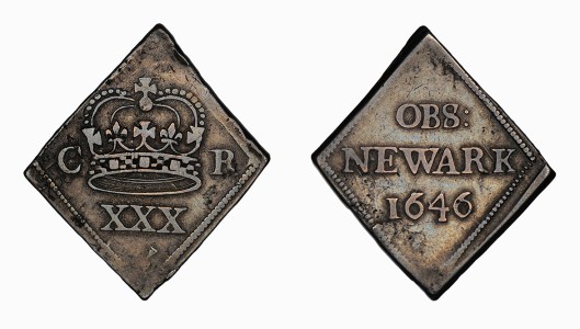
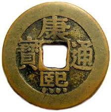
Although it doesn’t look like a modern coin, this is a form which used to be called “half-a-crown”—that is, 30 pennies (that’s what those three xses mean), or two shillings, sixpence.   This coin was struck in the town of Newark-upon-Trent, when it was besieged during the English Civil Wars (1642-1651).

_82601862_newark-1646map.jpg

And that’s where obsideo comes in. The back (the “reverse” in coin language—the front is called the “obverse”) says:

OBS: Newark (with a date, either 1645 or 1646, depending on when the coin was struck)

OBS = Obsessa Newark = “Newark Besieged”

There were a lot of coin-substitutes struck by various besieged towns, but, apparently, those from Newark are the most numerous.]

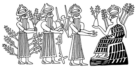
In the medieval western military world, sieges were more common, it seems, than pitched battles. As castles and towns were focal points for the possession and control of land—think of the hundreds of early castles, called “motte and bailey”, which the Normans built all across England in the first years after their conquest–it’s not surprising that they would have been a focus of attack.

motteandbailey.jpg Tapisserie_motte_dinan 704.jpg

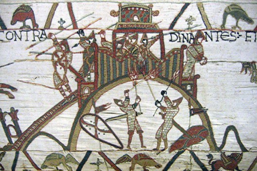
As well, we can imagine that, ultimately, they would have been cheaper, in terms of the most irreplaceable manpower, sparing the highly-trained, hard-to-replace, knights and men-at-arms.

knights.jpg

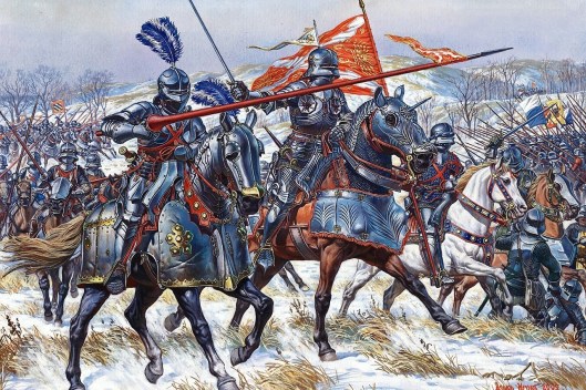
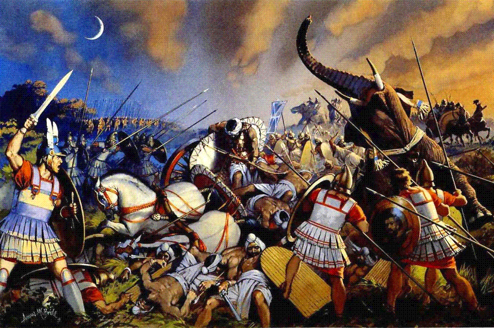
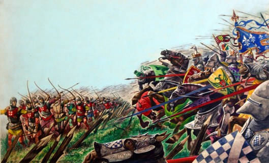
Battles like Crecy (1346), Poitiers (1356), and Agincourt (1415), cost the French dearly as their brave knights threw themselves at their English opponents, whose longbows shot them and their horses down.

agincourt.jpg

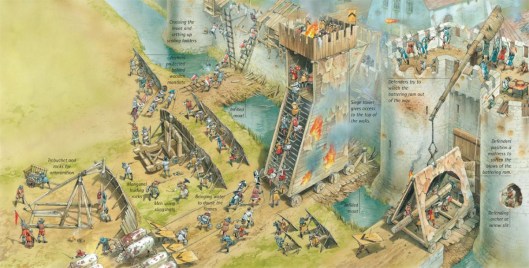
In a siege, although there was the occasional combat, including the exploitation of a break in the enemy’s defenses,

Edward-III-takes-Poix-Castle.jpg

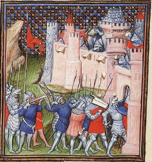
most of a siege would be spent in using machinery of various sorts to aid you in breaking down the walls—and the resistance of the defenders, as well.

castles-and-knights-2-with-labels.jpg

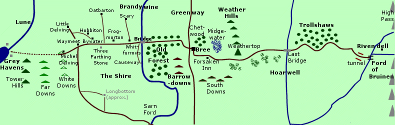
This brings us to the real, historical siege we want to examine: Constantinople, 1453.

Bizansist_touchup.jpg

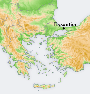
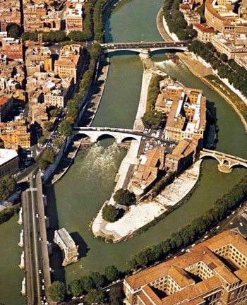
Constantinople had begun life as a Greek colony, called Byzantium, on the European side of the narrow passageway between the Black Sea and the northeastern Mediterranean.

byzempmap.gif

It had been refounded and greatly expanded by the Roman emperor, Constantine I, to be a new capital in the east.

Constantine-I-Face.jpg

Although it was supposed to be called “New Rome”, everyone in the east called it after its refounder, and so it was “Constantinople”, becoming the capital of an eastern empire which we call “Byzantine”. Even with setbacks and a number of unsuccessful attacks over the centuries, it was, for a long time, a very wealthy and powerful city.

1-reconstruccion-de-bizancio.jpg

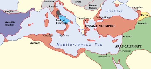
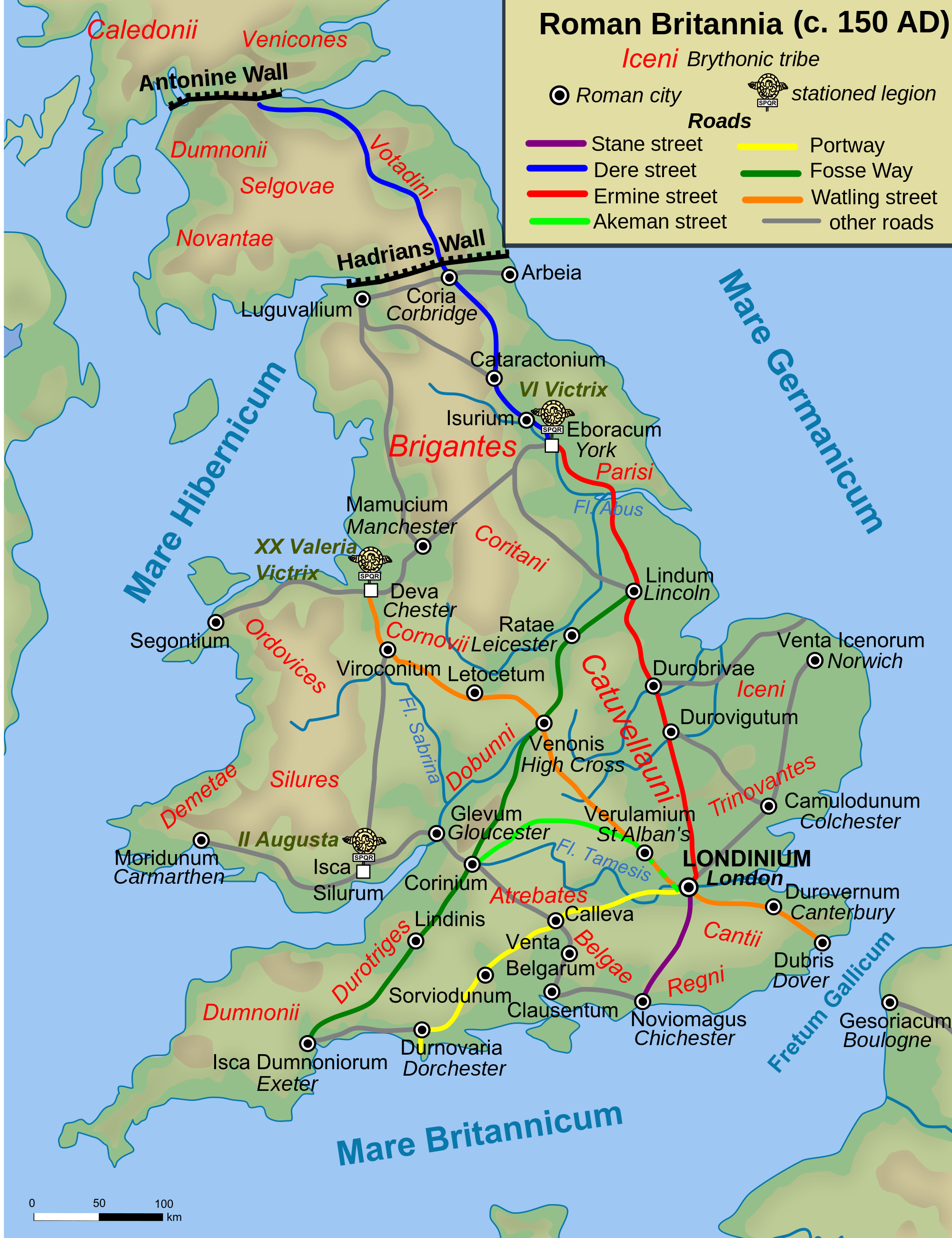
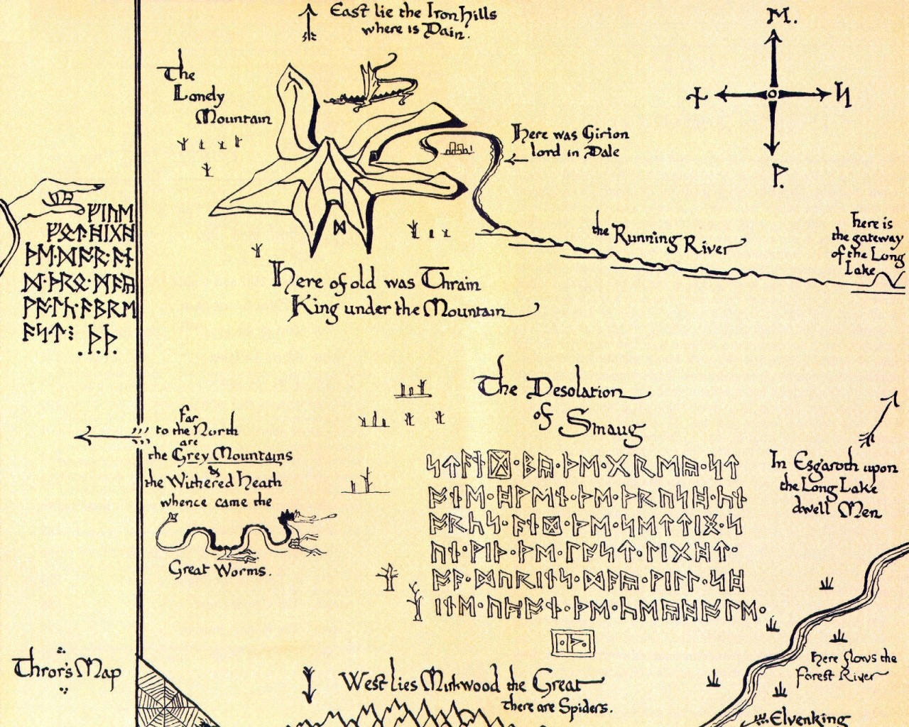
But even the wealthiest and most powerful cities will fade—especially when faced with ambitious enemies. Constantinople had had a number of those, but, finally, in its last years, perhaps its most ambitious and most powerful arose in Asia Minor: that of the Ottoman Turks. As you can see from this map, its beginnings were modest: one Turkic-speaking group among many.

Anatolian_Beyliks_in_1300.png

This was a period of instability, however. The Ottoman leaders quickly took advantage of that instability to grab power and territory, so that, by 1400, they had spread beyond the shrinking Byzantine world, into the Balkans, and, soon, Constantinople was surrounded.

trebizond1400

This surrounding took place in an increasingly-methodical way. In 1393-4, the ruler of the Ottomans, the sultan Bayezid I

bayezit1.jpg


built a small fortress on the Asia Minor side of the Bosphorus, the name for the northern stretch of the passage which led from the Black Sea to the Mediterranean. It was called Anadoluhisari, “the Anatolian fort”.

Anadoluhisari.jpg


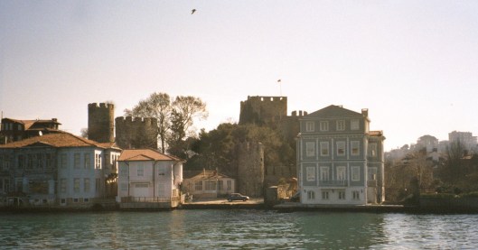
You can see from the map that this was the beginning of setting up a choke point upstream from Constantinople.

mapwithanadoluhisari.gif

In 1451-2, the sultan Mehmet II finished the job with the Rumelihisari just opposite, on the European side (and that’s what its name means, “the Roman—that is, European—fort”).
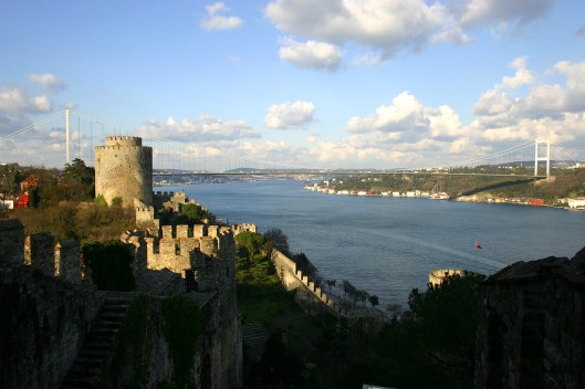
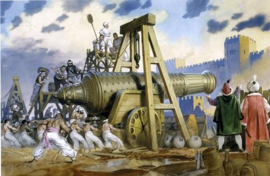
Rumeli_hisari.jpg

Guns were mounted

muslim_rocket_technology_06.jpg

and any help which might have come from the Black Sea was blocked.

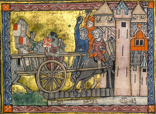
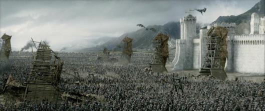
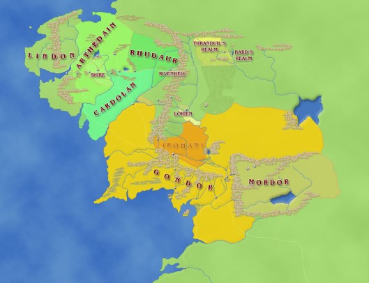
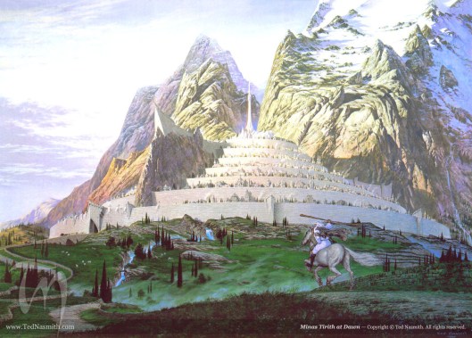
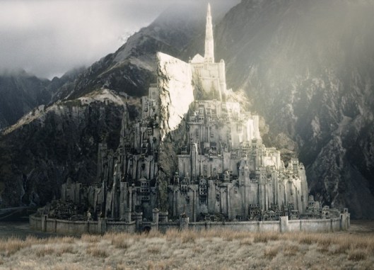
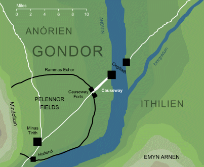
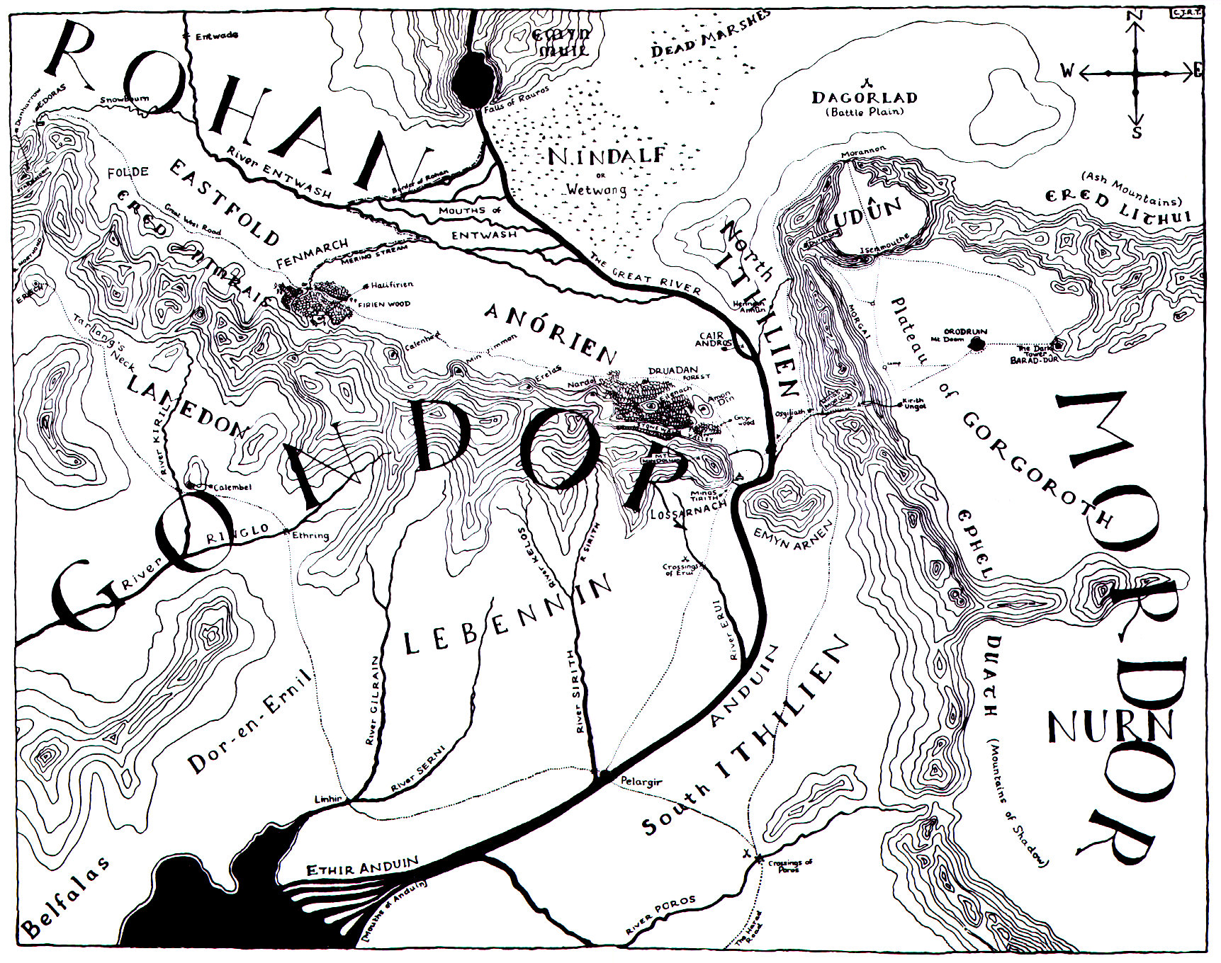
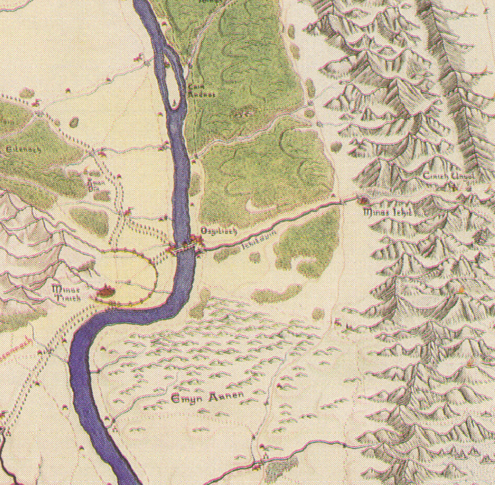
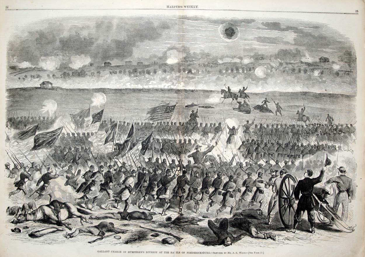
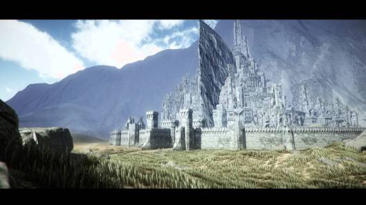
And here we want to take a minute to look at our imaginary city and its danger—because we see some easy parallels here. First, of course, the Ottoman empire was an eastern threat—so was Mordor. Mordor had taken the east bank of the Anduin, just as the Ottomans had taken the Asian side of the Bosphorus. And, in the capture of the European side and the building of Rumelihisari, we might see the taking of Osgiliath and the west bank of the Anduin. Then there is the massive city of Minas Tirith and the attack upon it.

mt.jpg 2381576-zmordorforcesk7.jpg

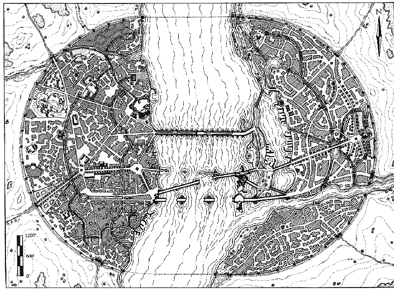
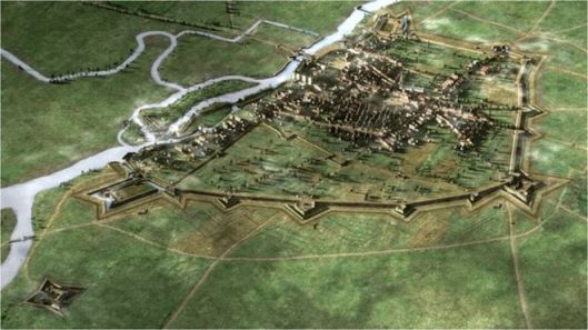
Constantinople was also a massive city.

Byzantine_Constantinople-en.png

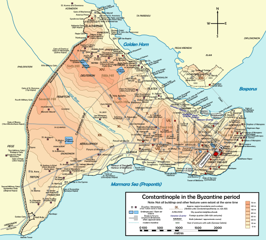
It was, basically, on a triangular piece of land, with two sides protected by water. The original Greek town had had a wall, but it was long gone and almost all of Constantine’s land wall had long disappeared, as well. The latest walls are called the Theodosian, after their originator, the emperor Theodosius II (408-450AD), but the walls included bits of the Constantinian walls and many repairs, over the centuries. The main land defenses included three lines of wall and a moat.

2rh67o0.jpg

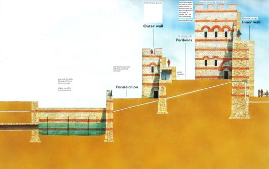
This sounds very impressive until one considers two things: first, is there a garrison big enough to defend what are, in fact, a number of miles of wall? And, second, although the walls have withstood previous attacks, including one made by the Ottomans in 1422AD, how will they stand up to the threat of modern artillery?

At the height of its power and prosperity, it is estimated that Constantinople had had a population of anywhere from 500,000 to 750,000 (although scholars argue over this). At the time of the final siege, the population had fallen to as low as 40,000. Thus, large parts of the city were empty—just like Minas Tirith:

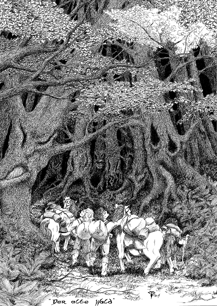
“Pippin gazed in growing wonder at the great stone city…Yet it was in truth falling year by year into decay; and already it lacked half the men that could have dwelt at ease there.” (The Return of the King, Book 5, Chapter 1, “Minas Tirith”)

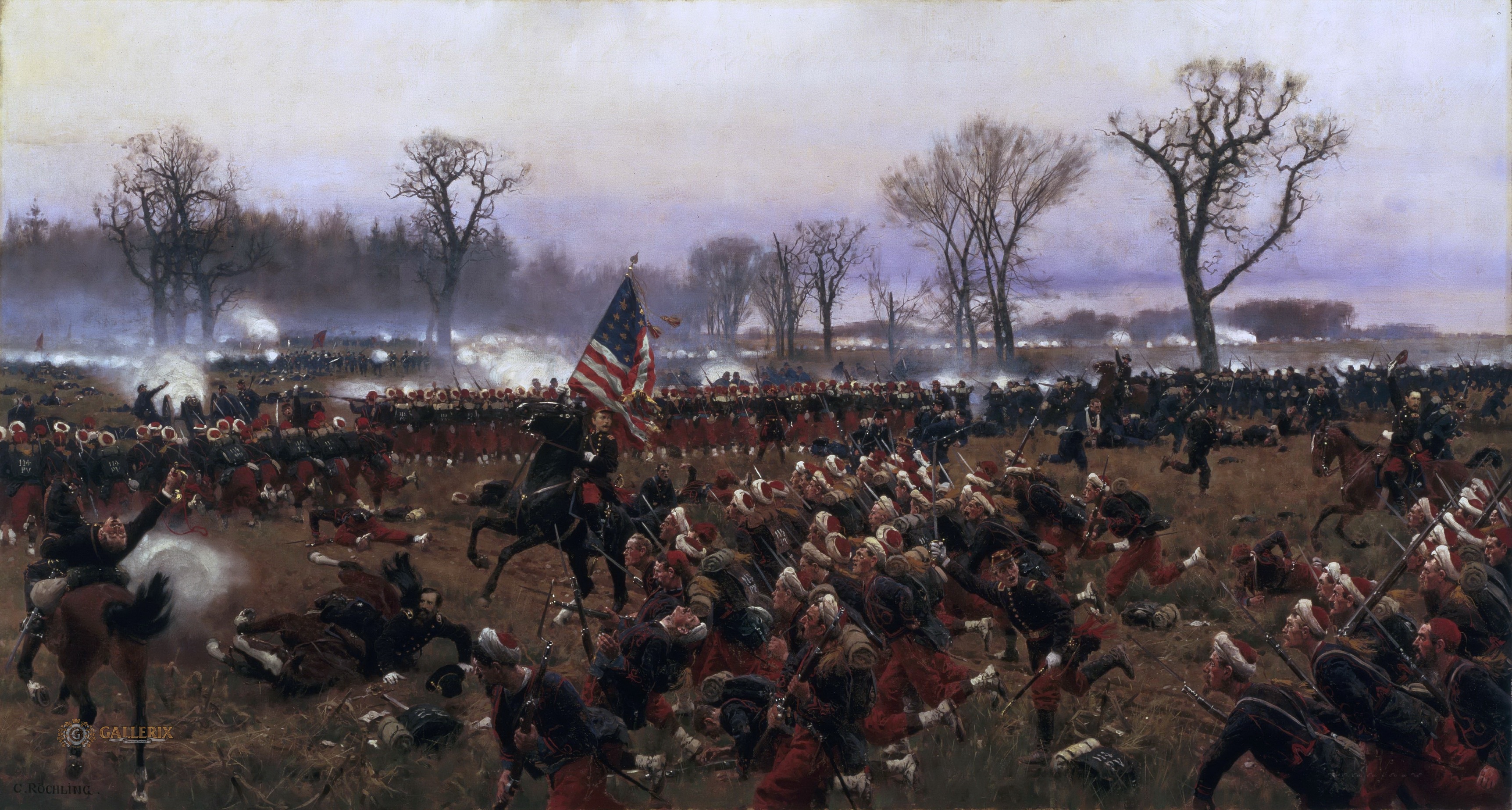
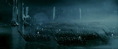
The garrison of Constantinople was perhaps about 9,000, in all, which meant that they were very thinly stretched. We don’t know just how many troops were in Minas Tirith. Some reinforcements had come from South Gondor, as we noted in an earlier posting, but only a few thousand and the defenders were powerfully outnumbered, just as those of Constantinople were, when the forces of Mordor began to arrive. The Ottoman army is thought to have had between 50,000 and 80,000 men, but just how many Orcs and others marched down the causeway from Osgiliath isn’t known–they are just a horde—something which the Jackson film shows very well.

maxresdefault

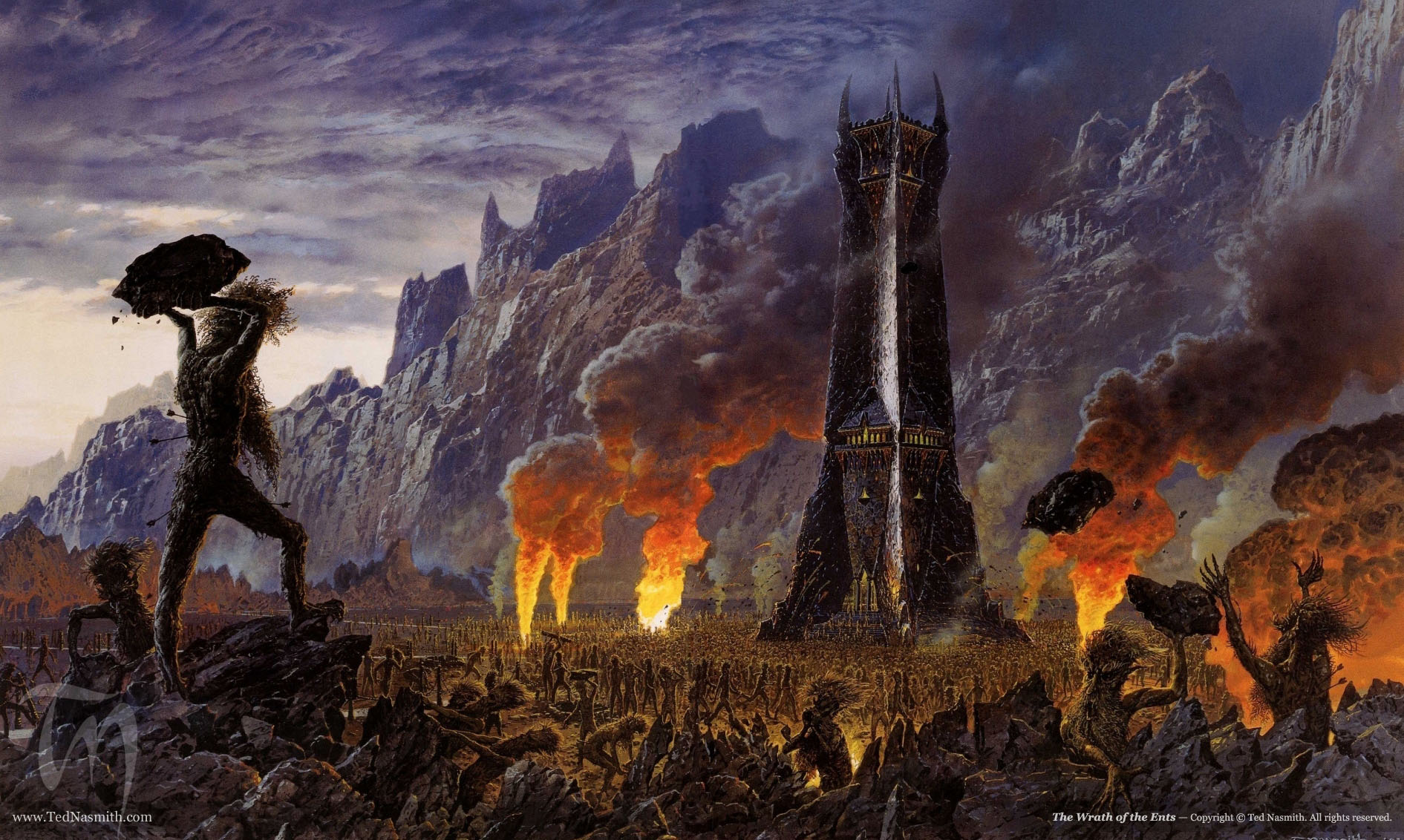
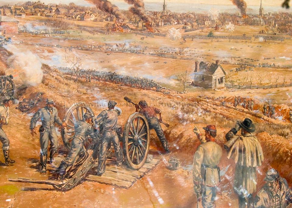
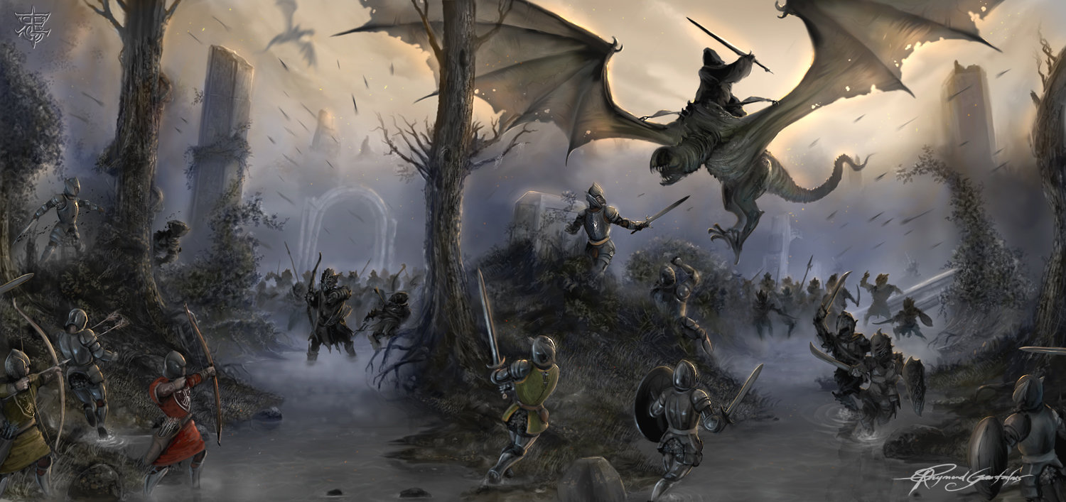
Then the assault begins, the Orcs having giant stone throwers, siege towers, and, finally, a giant, fire-breathing ram, Grond.

Grond_arrives.png

If you’ve been following our postings (and we hope you have!), then you know that we’ve discussed the use of what appears to be gunpowder, both at Helm’s Deep and at the Rammas Echor. The Orcs who attack the walls of Minas Tirith don’t appear to have such a weapon, but, unfortunately for the defenders of Constantinople in 1453, the Turks do, in the form of plentiful modern artillery.

Illustration-of-angus-mcbride-showing-the-ottoman-cannon-basilica-during-the-siege-of-constantinople-in-1453-ad.jpg

Attacks wear down the small garrison and huge, stone-throwing weapons knock down the walls, so that, finally the city falls, on 29 May, 1453.

84087026.jpg

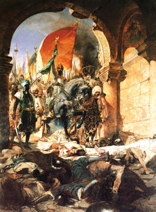
Its conqueror, Mehmet II, rides in—

mehmet2enteringconstantinople.jpg

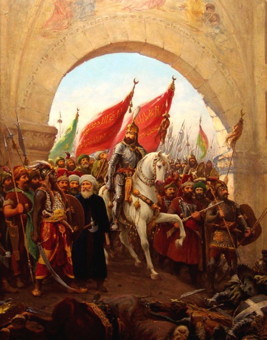
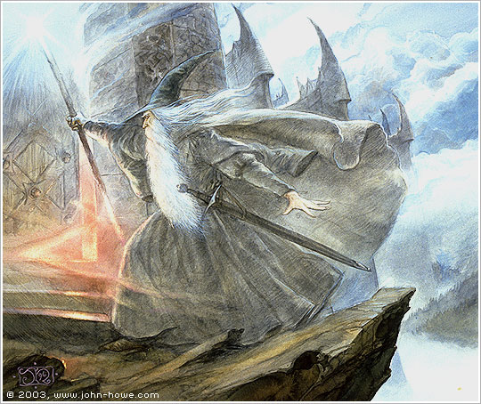
which is something the witch king of Angmar never gets to do, perishing instead, at the hands of Eowyn and Merry.

Eowyn.jpg


And there the parallels end, as does our posting. Did JRRT have the fall of Constantinople somewhere in the back of his mind? What do you think?

Thanks, as always, for reading.

MTCIDC

CD

Like Smoke From a Fire: Sharkey’s End

04 Wednesday Nov 2015

Posted by Ollamh in Fairy Tales and Myths, Imaginary History, J.R.R. Tolkien, Maps, Narrative Methods, Research

≈ Leave a comment

Tags

Adventure, Birmingham, Branywine, Bywater, Coketown, Dickens, Dol Amroth, England, Ents, factory, Fangorn, feudalism, Galadriel, Gandalf, Grima, Hard Times, Hobbiton, Idylls, industrial, Industrial Revolution, Isengard, King Edward School, Medieval, Merry, Midlands, Mordor, Morris, Oxford, Palantir, Pippin, poetry, pre-industrial, Saruman, Sauron, Scouring of the Shire, Sharkey, Southfarthing, Tennyson, The Lord of the Rings, The Shire, Tolkien

Dear Readers,

Welcome, as always.

In a previous posting, we talked about Saruman as a kind of imitation Sauron and Isengard as a mini-Mordor.

sarum1

In this posting, we want to consider the implications of Gandalf’s remark about him in “Many Partings”, from The Return of the King: “I fancy he could do some mischief still in a small mean way.”

The mischief, when we see it, is definitely mean, but not small, even though confined to the limits of the Shire.

The world of The Lord of the Rings is a pre-industrial one. The most advanced technology, on the one hand, is the palantir (actually perhaps a magical, rather than mechanical, device)

palantir

and , on the other hand, a watermill.

j-r-r-_tolkien_-_the_hill_-_hobbiton-across-the-water_colored

Beyond that, it’s a medieval world, but without, it seems, feudalism, although there are, for example, castles and knights in the form of the Prince of Dol Amroth.

We can easily see why JRRT wanted this regression. On the one hand, like so many boys of his age, he had grown up reading Tennyson

John_everett_millais_portrait_of_lord_alfred_tennyson firstedition1859idylls

and William Morris

Morris-Portrait1

morris_tapestry

who had created a world of Victorian medievalism, Tennyson in poetry, Morris in many different art forms.

On the other, Tolkien had grown up in Birmingham, in the English Midlands, where there had been massive development throughout the era of the Industrial Revolution.

Textile Mill Diagram McConnel_&_Company_mills,_about_1820

Here’s Charles Dickens’ description of such a place from Hard Times (1856):

(Excerpt Describing Coketown)

Needless to say, although Tolkien kept a strong affection for King Edward School, where he was educated before Oxford,

KingEdwardsSchoolinBirmingham

he was less enthusiastic about the industrial world which surrounded it and this clearly colors his picture of Saruman. Look, for instance, at Fangorn’s description of him:

“He has a mind of metals and wheels; and he does not care for growing things, except as far as they serve him for the moment.” (The Two Towers, Book 1, Chapter 4, “Treebeard”) (It’s revealing, by the way that this is almost a quotation of something which Saruman later says of Gandalf, “When his tools have done their task he drops them.” The Return of the King, Book 2, Chapter 8, “The Scouring of the Shire”)

Saruman, then, with his metal mind, has turned the once-beautiful Isengardgreg-hildebrandt-isengard-orthanc-saruman-607429-1920x1080

into an arms factory

kruppworks

another Midlands,

isengardasfactory

and has angered the Ents, as well, by the wanton destruction of trees, not just for fuel, it appears, but just out of sheer spitefulness.

The Wrath of the Ents, by Ted Nasmith

As we wrote earlier, all of this has remade Isengard into a mini-Mordor—as Frodo says: “Yes, this is Mordor…just one of its works. Saruman was doing its work all the time, even when he thought he was working for himself.” (The Return of the King, Book 2, Chapter 8, “The Scouring of the Shire”)

So, when Saruman, Grima in tow, leaves his ruined factory, one could almost imagine just what he might have in mind when he says to the hobbits:

“Well, it will serve you right when you come home, if you find things less good in the Southfarthing than you would like.” (The Return of the King, Book 2, Chapter 6, “Many Partings”)

We know from Merry and Pippin’s experience at the gate of Isengard that Saruman has been importing pipe-weed, a main export of the Southfarthing.

merrypippinisengard

But when the hobbits, having forced the gate at the Brandywine, are making their way towards Hobbiton, they begin to have a feeling that much more has been damaged than the South Farthing: “Still there seemed an unusual amount of burning going on, and smoke rose from many points round about. A great cloud of it was going up far away in the direction of the Woody End.” (The Return of the King, Book 2, Chapter 8, “The Scouring of the Shire”)

This smoke bears an ominous resemblance to the Midlands (and, in fact, to all of industrial England):

7ad841d6d5852b586a78fc03df7d64259715bddd.jpg__846x0_q80

There is worse to come, however: Bywater. “Many of the houses that they had known were missing. Some seemed to have been burned down. The pleasant row of old hobbit-holes in the bank on the north side of the Pool were deserted, and their little gardens that used to run down bright to the water’s edge were rank with weeds. Worse, there was a whole line of ugly new houses all along the Pool Side, where the Hobbiton Road ran close to the bank. An avenue of trees had stood there. They were all gone. And looking with dismay up the road towards Bag End they saw a tall chimney of brick in the distance. It was pouring out black smoke into the evening air.” (The Return of the King, Book 2, Chapter 8, “The Scouring of the Shire”)

And here, we move from a single smoking mill to a smoking mill town.

BRADFORD/YORKSHIRE/1873

Saruman’s revenge has been more than small and mean, especially in terms of the industrial world which The Lord of the Rings rejects: the Shire is on its way to becoming another Midlands,

_77710962_3322454

even to the workers’ miserable housing.

preston

And the cutting down of trees (including, as we will find out, the Party Tree) insures the truth of Saruman’s sneering statement to the hobbits:

“…I have done much that you will find it hard to mend or undo in your lives.” (The Return of the King, Book 2, Chapter 8, “The Scouring of the Shire”)

But, as we know, Saruman, even in his moment of triumph, has no more than a moment to enjoy it. He is murdered by Grima and here we see the final irony. As Saruman has turned the medieval, bucolic Shire into a smoky horror, so he himself is turned to smoke:

“To the dismay of those that stood by, about the body of Saruman a grey mist gathered, and rising slowly to a great height like smoke from a fire, as a pale shrouded figure it loomed over the Hill. For a moment it wavered, looking to the West; but out of the West came a cold wind, and it bent away, and with a sigh dissolved into nothing.” (The Return of the King, Book 2, Chapter 8, “The Scouring of the Shire”)

61 - The scouring of the shire

A final thought, however. Might we see Saruman’s gesture towards the West, in which he clearly feels that he has been rejected by that which sent him to Middle Earth, as a mirror Galadriel’s gesture of rejection towards the East, when she refuses the Ring?

“She lifted up her hand and from the ring that she wore there issued a great light that illuminated her alone and left all else dark. She stood before Frodo seeming now tall beyond measurement, and beautiful beyond enduring, terrible and worshipful. Then she let her hand fall, and the light faded, and suddenly she laughed again, and lo! she was shrunken: a slender elf-woman, clad in simple white, whose gentle voice was soft and sad.” (The Fellowship of the Ring, Book 2, Chapter 7, “The Mirror of Galadriel”)

galadriel

Thanks, as always, for reading.

MTCIDC

CD

It Will Have To Be Paid For!

12 Wednesday Aug 2015

Posted by Ollamh in Economics in Middle-earth, J.R.R. Tolkien, Maps

≈ Leave a comment

Tags

Asia Minor, Bilbo, Bronze, Chinese, Coinage, Currency, Deagol, Egyptians, Germanic, Gondor, Greeks, Isengard, Italy, Middle-earth, Moria, Pennies, Rohan, Roman Coins, Roman Roads, Romans, Saruman, Shire, Silver, Smeagol, Sumerians, Theodric, Tolkien, Trade, Treasure

Dear Readers,

Welcome, as always!

We recently wrote about Saruman and his pipeweed trade along the North-South and Great East Roads, and concluded that those roads reminded us of Roman Roads.  Looking at road networks from both Rome and Middle-earth, we see both as just that, networks, lines of communication which travel to and from central points.

roman-empire-roads-map9

middle-earth-map-roads

The roads of Middle-earth don’t appear to be so elaborately constructed and paved, of course, but then, at least for many centuries before The Lord of the Rings, there had been no central authority to maintain the system.

Roman Road

Although the idea of a Roman road—especially one that is incomplete or ruinous–

roman-road-bainbridge-geograph-e1400883247896

gives us a similar image.

But there’s still something missing—Saruman has roads and connections, but how would he have paid for the pipeweed? He could have used a barter system, although that would mean understanding what it would be that he might use—raw material from the mountains? Some sort of manufactured goods made at Isengard? This could certainly be so, if we’re thinking of Middle-earth as a place set in pre-currency times, such as the Sumerians and the Egyptians, who managed their extensive trade just fine without a single coin.

Grain-Goddess-small MonetaryEgyptian

And we could just leave it at that, but then there’s a clue in the first chapter of The Fellowship of the Ring which suggests that the actual commercial system is based upon currency.

“When the old man, helped by Bilbo and some dwarves, had finished unloading, Bilbo gave a few pennies away…” LOTR 25

Bilbo is rumored to have treasure hidden away in his hobbit-hole, with much speculation from all,

“’There’s a tidy bit of money tucked away up there, I hear tell,’ said a stranger… ‘All the top of your hill is full of tunnels packed with chests of gold and silver…’” LOTR 23

And the Shire isn’t the only place where pennies are used—when Sam wants to purchase Bill the pony in Bree,

“Bill Ferny’s price was twelve silver pennies; and that was indeed at least three times the pony’s value in those parts.” LOTR 175

This indicates a standard value based upon that currency, which one assumes was universal (with a tone in the text which implies that everyone might share that opinion), and old enough that it was the accepted modus for buying and selling. As Tolkien himself once wrote:

“I am not incapable or unaware of economic thought; and I think as far as the ‘mortals’ go, Men, Hobbits, and Dwarfs, that the situations are so devised that economic likelihood is there and can be worked out…” LT, L.154 P.196.

Thus, although he was clearly aware of such economic transactions, he didn’t need them for a plot and Merry and Pippin’s food and drink–and smoke–are simply there–with the implication that Saruman’s reach is longer than anyone has assumed.

In fact, there are very few scenes where money is needed at all—the Prancing Pony is the only inn they come across on the road, and the Fellowship otherwise camps out until they are taken in at Lorien, Edoras, and Gondor, and a guest/host relationship becomes a major part of the story. We’ve actually even seen this sort of thing near the very beginning of the story, when Frodo becomes Elf-friend to Gildor, and is awarded provisions (and a hearty breakfast) for their journey. 

We have only a little knowledge of the commercial world of Middle Earth, as you can see, and no description of “pennies”, except that some are silver.  What might they have looked like?  In our earlier essays, we’ve used parallels from the history of our earth, just as JRRT might used road systems which could easily have been influenced by the Roman roads which once connected so much of Britain, to build the roads in Middle-earth. Some of those Roman roads, even in his time, were still visible–some even still used (although usually paved over).

2000px-Roman_Roads_in_Britannia.svgRomanRoadBritain2

Using our parallel method, we turn to Roman coinage.

RomanSilverPenny

We’re dealing with silver coinage in northwest Middle-earth, where Saruman’s imports come from, and if we’re thinking about Rome, we’d be looking at a time where coinage had already existed. We have no idea when coins were first issued in Middle Earth–considering how complexly organized the North and South Kingdoms had been for many centuries, we would imagine that a thousand years before the events of The Lord of the Rings  probably wouldn’t be too soon.  We have a small piece of evidence from some five hundred years before, when Deagol says to Smeagol:

“’I don’t care,’ said Déagol, ‘I have given you a present already, more than I could afford.’” LOTR, 52

In Rome, silver coinage was introduced in 269 BC, courtesy of the Greeks, after the Romans had been using bronze.

RomanBronzeCoin

Coins originated in Asia Minor in the 6th c. BC and quickly caught on, being a convenient and highly portable way of transporting wealth—it was much easier to carry and design to designate between currencies, and the Chinese even began to manufacture coins which could be strung together.

ChineseCoin

In Middle-earth, this would make it easier to trade beyond the borders of a local market, or even the Shire–and would certainly have been accepted at The Prancing Pony.

All of this leads, however, to Questions for Further Study, as textbooks often say.  Currency needs backing—the Roman republic and then the empire backed Roman coins.  What backed those pennies in the Shire and beyond?Imagine that, in Middle-earth, the major legitimate government was Gondor—would these pennies have been originally Gondor-issued? If so, perhaps just what happened to Roman currency in late imperial times might have happened in Middle-earth—as Rome began to fall apart, semi-independent governments began to issue coins on their own, such as Theodric, the Germanic ruler of Northeastern Italy:

Theodorictriplesolidus_zps7dc7f768

Visually, they remind us–and they were certainly intended to–of imperial coins, with their images of Roman emperors.  Theodoric, even with his unusual hairstyle, meant to be seen as a new ruler for an old Rome.  Can we imagine dwarf coins, perhaps issued from the Moria mint?  And, when we remember that Mordor has tried to acquire horses from Rohan, what would Mordorian currency have looked like? And, returning to Saruman for a final time—if he paid for pipeweed in coins, did they bear a white hand?

Thanks, as ever, for reading,

MTCIDC,

CD

Trading with the Enemy

15 Wednesday Jul 2015

Posted by Ollamh in Economics in Middle-earth, J.R.R. Tolkien, Maps

≈ 2 Comments

Tags

Bree, Cross-Roads, Gandalf, Gimli, Great East Road, Greenway, Isengard, Laketown, Legolas, Marxist Critics, Merry and Pippin, Middle-earth, Mirkwood, North-South Road, Peter Jackson, Pipeweed, Roads, Roman Roads, Rome, Saruman, Sauron, South Farthing, Swanfleet, The Lord of the Rings, The Shire, Theoden, Tolkien, Trade, Transport

Dear Readers,

In a recent posting, we opened with the image of Merry and Pippin happily feasting among the ruins of Isengard as Gandalf, Theoden, and company ride up to meet them.

“…suddenly they were aware of two small figures lying…at their ease…there were bottles and bowls and platters laid beside them, as if they had just eaten well, and now rested from their labour. One seemed asleep; the other, with crossed legs and arms behind his head, and little rings of thin blue smoke.” L543

MandPIsengard

We, as the readers, may be just as taken aback as the company; we’re joining the Hobbits again for the first time since Isengard’s demise, and it’s natural to ask: where, in the midst of all of this ruin, did they find this stuff? Gimli doesn’t hesitate to ask for us.

“’Where did you come by the weed, you villains?’” L544

Of course, he’s talking about pipeweed, something common, yet treasured, in the Shire. It is not native to a place like Isengard, so far south, but here we have the Hobbits smoking it and even enjoying a surplus. Legolas is just as impressed,

“’You speak for me, Gimli,’ laughed Legolas, ‘though I would sooner learn how they came by the wine.’” L544

Pippin only teases, answering that

“’Here you find us sitting on a field of victory…and you wonder how we came by a few well earned comforts.” L544

And so we’re left with this mystery of supplies, but we can be sure that, in Tolkien’s mind, there was an answer. He was, after all, diligent about even minute details concerning Middle-earth, and was also the same man who once said that

“I am not incapable or unaware of economic thought; and I think as far as the ‘mortals’ go, Men, Hobbits, and Dwarfs, that the situations are so devised that economic likelihood is there and can be worked out…” LT, L.154 P.196.

In this quotation, Tolkien can almost be echoing, in an ironic way, the argument of Marxist critics that economic systems, even those appearing in literature, hide their true nature. Tolkien seems to be telling us that he was well aware of trade systems, and, we would suggest, this would include a basic foundation: transport. And, using what we are given in the texts, we can see that there were two main methods. One is by water–as in the flourishing wine trade between Mirkwood and Laketown.

hobbit-raft-elves

This pair of places is naturally connected by river and lake. Such is not the case with the South Farthing and Isengard, of course. Instead, water bodies like the Swanfleet lie between them. And yet there is that pipeweed. The Hobbits are smoking it and, in the extended edition of the film version, Peter Jackson even shows us two large barrels of pipeweed labeled “South Farthing”.

This brings us to our second method of transport, by road.

ShireRoads

Like all educated men of his time, Tolkien had been raised on the world of the Greeks and Romans and, among the longest-lasting monuments of the Roman world was the extensive system of roads, some of which are still in existence in our own time and are even (asphalted over) the basis of certain modern English roads. In Middle-earth, there appear to be a number of such ancient roads, such as the Cross-Roads:

CrossRoads

The Great East road:

greateastrd-map

The North-South road:

north-south-road

Other possibilities would include once-active, but now abandoned routes, like the Greenway, running north from Bree and the Stone Road which the Woodwoses know and point out to Theoden.

As you can see, we can easily imagine Tolkien thinking out the economics of Middle Earth through a road network similar to that of the Roman Empire, with its own intricate road systems

RomanRoadNetwork


Along these roads came much of Rome’s wealth and the case would have been the same for Middle-earth, so here’s a clue to Saruman’s pipeweed trade with the Shire. Looking at a map, we see that The Great East Road, which, traveling east from the Shire, would lead to Bree, and to the Cross-Roads, reaching The North-South Road.

fonstad01 fonstad02

Such trade would seem natural, not only to the Romans, but to us. In the wreckage of Isengard, however, for all that Merry and Pippin are so casual about it, there is another implication: Saruman, who wants to be another Sauron, must know much more about the Shire than anyone, even Gandalf has understood, and, thinking of the “Scouring of the Shire”, that could easily bode ill for the future of that place which the Hobbits think so safe and removed…

Thanks, as ever, for reading.

MTCIDC,

CD

Shall We Gather at the River?

08 Wednesday Jul 2015

Posted by Ollamh in J.R.R. Tolkien, Maps, Military History, Narrative Methods

≈ Leave a comment

Tags

Alexander, Anduin, Burnside, Cair Andros, Celeborn, Confederate, D-Day, Denethor, Douro, Faramir, Fredericksburg, French, Gandalf, Hydaspes, Inchon, Indiana Jones, Isola Tiberina, King Poros, Lee, Minas Tirith, Mordor, Napoleonic, Nazgul, Pelennor, Pontoon, Porto, Quebec, Rappahannock, Roechling, Sauron, Soult, The Lord of the Rings, Tolkien, Union, Wellington, West Osgiliath, Zouaves

Dear Readers,

Welcome, as always. In this posting, we thought we’d do a kind of follow-up to our “What Happened to the Rammas Echor” piece by looking at the Mordorian assault on West Osgiliath, which leads up to it. (Yes, we know—bassackwards, right? We can only claim as Indiana Jones does, that “I’m making this up as I go along.”)

We can begin with a map and a description by a participant.

Here’s the Anduin, the major obstacle for Sauron’s forces to cross at a point in easy striking distance of Minas Tirith.

gondor_map

Here’s Denethor’s intelligent assessment of the defensive situation:

“…And the Enemy must pay dearly for the crossing of the River. That he cannot do, in force to assail the City, either north of Cair Andros because of the marshes, or southwards towards Lebennin because of the breadth of the River, that needs many boats. It is at Osgiliath that he will put his weight, as before when Boromir denied him the passage.” LotR 816

EphelDuath_10x10drape2

Although there have been very creative attempts to map or depict Cair Andros, for all of its importance in the defense of Gondor, we aren’t given much detail. Its name means “Ship of Long Foam” , called so because of its shape and its action in breaking up the flow of the Anduin. This brought to our minds the Isola Tiberina on the Tiber in Rome,

18-1

which so reminded the Romans of a ship that—well, this 1770s engraving makes their next step obvious—

Piranesi-16059

Cair Andros was fortified and had a garrison, although Denethor refuses to reinforce it, saying “Cair Andros is manned, and no more can be sent so far.” LOtR 816

We also know that the enemy will capture it during their two-proned general assault (Gandalf says to Denethor: “Fugitives from Cair Andros have reached us. The isle has fallen.” LotR 819)

To the south, somewhere between forty and fifty miles, lies Osgiliath.

Anorien

Identified by Denethor as the other major crossing point, it was once a prosperous city, but now lies in ruins, with its bridges destroyed (Celeborn to Aragorn: “And are not the bridges of Osgiliath broken down and all the landings held now by the Enemy?” LotR 367).

The problem, then, for the Enemy is how to cross a river against opposition, a classic problem for generals since there were generals.

We think, for example, of Alexander at the Hydaspes River in 326BC, defended by King “Poros” (actually Porushattama—Greeks were determined to tame everything—including other cultures’ proper names).

1382499630_Hydaspes

(and we couldn’t resist this second image—Alexander in the center of his pikemen—in what looks like 25-28mm)

VendelMacedonians

As you can see from the map, Alexander crossed upstream, having distracted the king with a demonstration (military for “feint/decoy”).

Battle_hydaspes_crossing

This was through open country, however. In the case of Osgiliath

osgiliath

the Enemy would have to cross the river in the face of opposition within a town. Here, we thought of several possibilities: Wellington’s crossing of the river Douro against French resistance in 1809, for example. Here was not only the river, but its steep banks, as well.

Henry Smith Oporto, With The Bridge Of Boats 1809

(The pontoon bridge was set up after the attack.)

There were no bridges and the French had collected all of the available boats and had either destroyed them or were holding them on the north side of the river. As Porto (the name means what you think it does) was the center of the fortified wine trade (yes , “Pass the port, Wriothsley, will you?”), the major vessel on the river was this—

pb17

Wellington was always a clever and flexible commander and had to be when confronted by the able Marshal Soult across the river. Much of Wellington’s success came from his use of local sources: Portuguese who hated their French occupiers and supplied some of Wellington’s men with a rowboat and crew. On the north side were four wine boats, soon filled with British soldiers—

sec198

and the surprised, but always brave and sturdy, French soldiers were eventually pushed back north, out of the town.

oporto

As you can see, this was really a frontal assault, but, because of their former preparations and their sense of the geography, the French had been lulled into thinking that they were prepared.

A second battle with a river crossing against a defended town which occurred to us was from the US Civil War, Fredericksburg, fought in mid-December, 1862.

Fredericksburg-Overview

Here, as this extremely useful panorama shows, this was actually a two-step battle: first the Union troops had to cross the Rappahannock River, then they had to drive the Confederate Army from their positions on high ground beyond.

fburg_diorama1

The town of Fredericksburg itself was lightly held: mostly close to the river and relatively few in numbers.

barksdales-men

The main Confederate positions were spread a bit thinly for their numbers (not much in the way of reserves, had there been a breakthrough—Lee had had a similar problem at Antietam), but paid close attention to the ground, including taking advantage of a sunken road with a stone wall at its edge as a makeshift trench.

Confederate soldiers rake the field over which Union troops charged six times, from behind the stone walll at the Sunken Road, in  the blood Battle of Fredericksburg, Va., Dec. 1862.  Confederate Sgt. Richard Kirkland became known as the Angel of Marye's Heights when he brought water to wounded Union soldiers. (AP Photo)

To cross the river itself meant a two-stage process: first, to gain the opposite bank and set up a perimeter; second, to build several pontoon bridges to allow for the rapid deployment of troops and artillery.

19th-century armies commonly traveled with pontoons—boats built specifically to be used as the basis for floating bridges—

ACWpontoonsmobile1862

They were dragged along on wagons wherever and whenever armies went—

mud-march-waud-locgov

and, with the addition of planks and anchors and ropes, created complete roadways across bodies of water.

Fredericksburg_pontoon_model

The first stage was difficult,

Amphibious-assault_1376_2

but using pontoons for assault boats

laying-pontoons-fredericksburg

the Union troops managed to secure a foothold on the opposite bank. When bridges went up, stage one had been successful. But, when the Confederates had withdrawn from the town (which they had never intended to occupy in force), there was still that second stage.

dec13fredericksburgcharge

Great courage, but thrown away against resolute Confederate defenders,

1457692_641056089250250_1771492272_n

as you can see in this splendid painting by Carl Roechling, one of our favorite 19th-c. German military-historical painters of the attack of the 114th Pennsylvania (uniformed like French Zouaves, those most admired of French soldiers during this period).

Öèôðîâàÿ ðåïðîäóêöèÿ íàõîäèòñÿ â èíòåðíåò-ìóçåå Gallerix.ru

You can see the kinds of difficulties, then, for the Enemy in their attack on the west bank of the Anduin. How do they succeed? A messenger from Faramir, commanding the defense of West Osgiliath, describes the assault:

“The plan has been well laid. It is now seen that in secret they have long been building floats and barges in great number in East Osgiliath. They swarmed across like beetles.” LotR 817.

Here is the initial attack in Jackson’s film version—

800px-Orcs_crossing_anduin

When these craft land, they open at the bow and, of course, we immediately thought of D-Day and Pacific island battles and the Inchon landing, and Higgins Boats (LCVPs)

Darke_APA-159_-_LCVP_18 tumblr_n6pop14CrH1s57vgxo3_1280

Along with their advanced use of explosives in the attack on the Pelennor to come, these are very sophisticated creatures, especially when one thinks about the landing craft of earlier centuries—the boats designed for the British attack on Quebec in 1759

c-001078

102381

Or the sort of thing you see during the Napoleonic era—

agoid106297-594

These are for amphibious landings. Mostly, when it comes to the era of pontoons, it appears that, when it came to rivers, soldiers simply used them

Voltigeurs_of_a_French_Line_regiment_crossing_the_Danube_before_the_battle_of_Wagram

The “beetles” mentioned by Faramir’s messenger swarm over the men of Gondor, so heavily outnumbered that, as Faramir says, “Today we may make the Enemy pay ten times our loss at the passage and yet rue the exchange. For he can afford to lose a host better than we to lose a company.” LotR 816. And then there is their other weapon, the Chief Nazgul.

battle_of_osgiliath_by_shockbolt

“But it is the Black Captain that defeats us. Few will stand and abide even the rumor of his coming. His own folk quail at him, and they would slay themselves at his bidding.” As Faramir’s messenger adds. LotR 817.

Gandalf goes out to face him

lotr-collectibe_PASSTHED

and we wonder if other commanders—Alexander, Wellington, the Union general Burnside, for example–when faced with the problem of a defended crossing, would wish to have him on their side—or the Black Captain?

As always, thanks for reading.

MTCIDC

CD

Tracking

09 Monday Feb 2015

Posted by Ollamh in Imaginary History, J.R.R. Tolkien, Maps, Narrative Methods, Research

≈ Leave a comment

Tags

Adventure, Book, Exploration, Fantasy, Fiction, History, Maps, Tolkien

Dear Readers,

While working on Across the Doubtful Sea, the Doubtful Sea series, and a forthcoming series that takes place in an alternate medieval Russia, we discovered for ourselves what our friend J.R.R. Tolkien worked on meticulously during the course of his work—the importance of maps in a story, whether they are real, fictional, or a mixture of both, in the case of our work. “If you’re going to have a story,” he said, “you must work a map; otherwise, you’ll never have a map of it afterwards.”

This became apparent when we were working on Across, using previously drawn maps of the theoretical Terra Australis: 

image1 Finaeus_antart

To give us a sense of where our characters and we were (and still are) going. 

When we began talking about the geography of our alternative Russia, we began to ask ourselves, first, how do you make a map in relation to a story? It was a start to look over the shoulder of JRRT, and to see what was done before us. From there, we go on to ask, what is it that made Middle-earth Middle-earth? It’s clear that Tolkien took a considerable amount of time and care to chart out his elaborate fictional world, from Bilbo’s own maps of the Shire and the world beyond.

imgE1 

Some were detailed enough to follow the day-by-day travels of the Fellowship, while others were used to record specific moments in time, both historically and geographically.

In his letters, Tolkien often addressed the subject of his maps. Much of his enthusiasm in creating maps for his worlds had to do with the pleasure of doing so, and the satisfaction of building the physical structure of such an elaborate story. He was, however, sometimes overwhelmed by them—perhaps as if the more landscape he made, the more he had to carry—and said to his publisher that it was a matter of a “lack of skill combined with being harried” (Tolkien, letter 141). He was fortunate to have, in this aspect of his work, collaboration not unlike ours—his son, Christopher, was a talented cartographer, and after discussing the landscapes with his father, would draw the intricate world in accordance with Bilbo and Frodo’s adventures.

middle_earth_map

Tolkien, by creating the maps first, created a landscape which seems to exist not only before the story, but is bigger than the story. When Frodo travels eastwards, for example, there is more of the Shire and beyond than that which he actually travels over. In our case, it was rather like someone laying track while driving a train over it. The tracklayer decides where the train will go, but, looking back, can see a landscape left behind as it moves on. In this way, the story and its landscape are written as they progress, and a narrative railroad is left behind on which readers may ride. And so, unlike Tolkien, by constructing a map this way, we appear to be providing primarily a view from the track itself. If there’s more landscape, we can only know it from the map we’ve constructed afterwards.

oldforest 

With the previously-drawn map, we can see the journey, in contrast, from a bird’s eye view.

shire_map

But this leaves us with a question: is it best to construct a bird’s eye view first, then to lay the track, or to lay track and then to look back?

This brings us to a second question: by either method, how does one make a fictional map credible?

MTCIDC,

CD

PS

For an example of simultaneous train-driving and track-laying, see Wallace and Gromit, The Wrong Trousers.

Newer posts →

The Doubtful Sea Series Facebook Page

The Doubtful Sea Series Facebook Page

  • Ollamh

Categories

  • Artists and Illustrators
  • Economics in Middle-earth
  • Fairy Tales and Myths
  • Films and Music
  • Games
  • Heroes
  • Imaginary History
  • J.R.R. Tolkien
  • Language
  • Literary History
  • Maps
  • Medieval Russia
  • Military History
  • Military History of Middle-earth
  • Narnia
  • Narrative Methods
  • Poetry
  • Research
  • Star Wars
  • Terra Australis
  • The Rohirrim
  • Theatre and Performance
  • Tolkien
  • Uncategorized
  • Villains
  • Writing as Collaborators
Follow doubtfulsea on WordPress.com

Across the Doubtful Sea

Recent Postings

  • Through a glass… January 7, 2026
  • Heffalumps? December 31, 2025
  • We Three Kings December 24, 2025
  • A Moon disfigured December 17, 2025
  • On the Roads Again—Once More December 10, 2025
  • (Not) Crossing Bridges December 3, 2025
  • On the Road(s) Again—Again November 26, 2025
  • On the Road(s) Again November 19, 2025
  • To Bree (Part 2) November 12, 2025

Blog Statistics

  • 104,128 Views

Posting Archive

  • January 2026 (1)
  • December 2025 (5)
  • November 2025 (4)
  • October 2025 (5)
  • September 2025 (4)
  • August 2025 (4)
  • July 2025 (5)
  • June 2025 (4)
  • May 2025 (4)
  • April 2025 (5)
  • March 2025 (4)
  • February 2025 (4)
  • January 2025 (5)
  • December 2024 (4)
  • November 2024 (4)
  • October 2024 (5)
  • September 2024 (4)
  • August 2024 (4)
  • July 2024 (5)
  • June 2024 (4)
  • May 2024 (5)
  • April 2024 (4)
  • March 2024 (4)
  • February 2024 (4)
  • January 2024 (5)
  • December 2023 (4)
  • November 2023 (5)
  • October 2023 (4)
  • September 2023 (4)
  • August 2023 (5)
  • July 2023 (4)
  • June 2023 (4)
  • May 2023 (5)
  • April 2023 (4)
  • March 2023 (5)
  • February 2023 (4)
  • January 2023 (4)
  • December 2022 (4)
  • November 2022 (5)
  • October 2022 (4)
  • September 2022 (4)
  • August 2022 (5)
  • July 2022 (4)
  • June 2022 (5)
  • May 2022 (4)
  • April 2022 (4)
  • March 2022 (5)
  • February 2022 (4)
  • January 2022 (4)
  • December 2021 (5)
  • November 2021 (4)
  • October 2021 (4)
  • September 2021 (5)
  • August 2021 (4)
  • July 2021 (4)
  • June 2021 (5)
  • May 2021 (4)
  • April 2021 (4)
  • March 2021 (5)
  • February 2021 (4)
  • January 2021 (4)
  • December 2020 (5)
  • November 2020 (4)
  • October 2020 (4)
  • September 2020 (5)
  • August 2020 (4)
  • July 2020 (5)
  • June 2020 (4)
  • May 2020 (4)
  • April 2020 (5)
  • March 2020 (4)
  • February 2020 (4)
  • January 2020 (6)
  • December 2019 (4)
  • November 2019 (4)
  • October 2019 (5)
  • September 2019 (4)
  • August 2019 (4)
  • July 2019 (5)
  • June 2019 (4)
  • May 2019 (5)
  • April 2019 (4)
  • March 2019 (4)
  • February 2019 (4)
  • January 2019 (5)
  • December 2018 (4)
  • November 2018 (4)
  • October 2018 (5)
  • September 2018 (4)
  • August 2018 (5)
  • July 2018 (4)
  • June 2018 (4)
  • May 2018 (5)
  • April 2018 (4)
  • March 2018 (4)
  • February 2018 (4)
  • January 2018 (5)
  • December 2017 (4)
  • November 2017 (4)
  • October 2017 (4)
  • September 2017 (4)
  • August 2017 (5)
  • July 2017 (4)
  • June 2017 (4)
  • May 2017 (5)
  • April 2017 (4)
  • March 2017 (5)
  • February 2017 (4)
  • January 2017 (4)
  • December 2016 (4)
  • November 2016 (5)
  • October 2016 (6)
  • September 2016 (5)
  • August 2016 (5)
  • July 2016 (5)
  • June 2016 (5)
  • May 2016 (4)
  • April 2016 (4)
  • March 2016 (5)
  • February 2016 (4)
  • January 2016 (4)
  • December 2015 (5)
  • November 2015 (5)
  • October 2015 (4)
  • September 2015 (5)
  • August 2015 (4)
  • July 2015 (5)
  • June 2015 (5)
  • May 2015 (4)
  • April 2015 (3)
  • March 2015 (4)
  • February 2015 (4)
  • January 2015 (4)
  • December 2014 (5)
  • November 2014 (4)
  • October 2014 (6)
  • September 2014 (1)

Blog at WordPress.com.

  • Subscribe Subscribed
    • doubtfulsea
    • Join 78 other subscribers
    • Already have a WordPress.com account? Log in now.
    • doubtfulsea
    • Subscribe Subscribed
    • Sign up
    • Log in
    • Report this content
    • View site in Reader
    • Manage subscriptions
    • Collapse this bar
 

Loading Comments...