• About

doubtfulsea

~ adventure fantasy

Tag Archives: Roads

On the Roads Again—Once More

10 Wednesday Dec 2025

Posted by Ollamh in Uncategorized

≈ Leave a comment

Tags

Bilbo, Fantasy, Frodo, lotr, Minas Morgul, Mordor, Mt Doom, Orcs, Orodruin, Osgiliath, Roads, Sam, The Lord of the Rings, Tolkien, Udun

As always, dear readers, welcome.

“The Road goes ever on and on
Down from the door where it began.
Now far ahead the Road has gone,
And I must follow, if I can,
Pursuing it with eager feet,
Until it joins some larger way
Where many paths and errands meet.
And whither then? I cannot say.”

as Bilbo sings, on his way away from the Shire to Rivendell.

(JRRT)

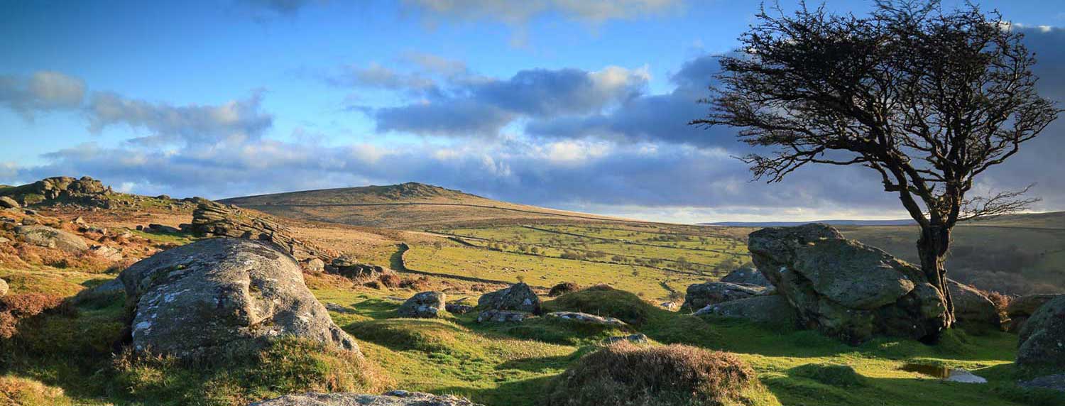
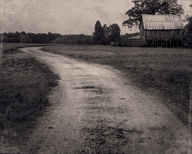
We, however, are currently standing at the broken bridge

at Osgiliath,

(from The Encyclopedia of Arda)

but, through the magic of the internet, we’ll hop over the Anduin and continue our journey along the roads of Middle-earth, this time to the worst possible place (unless you’re an orc)—

(Alan Lee)

Mordor.

To get there, we walk the old road which, in the days before Sauron’s previous invasion attempt, ran from Minas Anor (the “ Tower of the Sun”—now Minas Tirith, “Tower of Guard”),

(Ted Nasmith)

to Minas Ithil (the “Tower of the Moon”)—now Minas Morgul  (the “Tower of Black Sorcery”).

(another Ted Nasmith)

This will lead us eastwards to the crossing of the Ithilien north/south road, where there is a much- abused seated figure—

“The brief glow fell upon a huge sitting figure, still and solemn as the great stone kings of Argonath.  The years had gnawed it, and violent hands had maimed it.  Its head was gone, and in its place was set in mockery a round rough-hewn stone, rudely painted  by savage hands in the likeness of a grinning face with one large red eye in the midst of its forehead.  Upon its knees and mighty chair, and all about the pedestal, were idle scrawls mixed with the foul symbols that the maggot-folk of Mordor used.”  (The Two Towers, Book Four, Chapter 7, “Journey to the Cross-roads”)

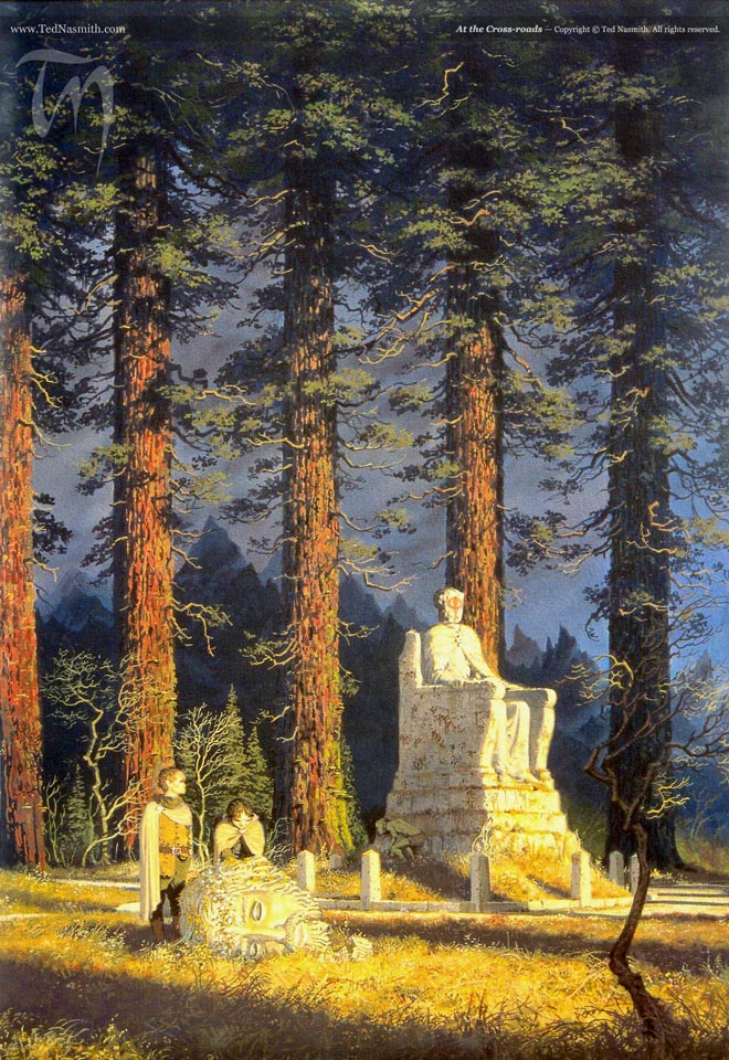
(and one more Ted Nasmith.  Notice—except for the figure’s size, perhaps, which here wouldn’t be called “huge” nor its chair “mighty”—how carefully the artist has paid attention to the text—typical of Nasmith’s always fine work.)

Frodo and Sam pause here, but we’ll keep moving eastwards on the road towards Minas Morgul.

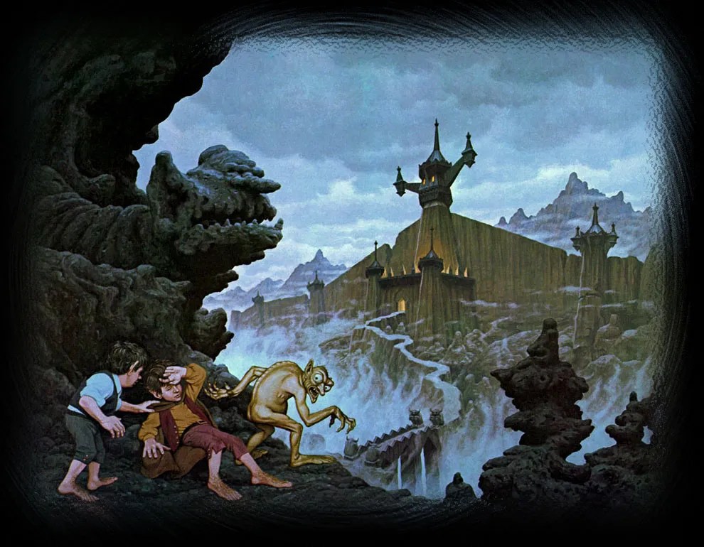
(the Hildebrandts, with a very different view of it and of Gollum)

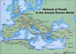
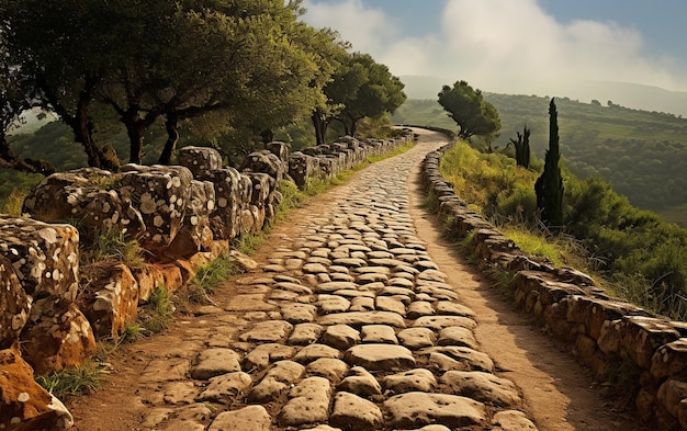
We don’t appear to have a description of this road, but, if you’ve read the previous postings on roads, you’ll know that I would like to imagine that it’s not just a worn dirt track,

but the sort of thing which the Romans built all over their empire,

but now grassgrown and abandoned, like the figure at the crossroads.

Frodo, Sam, and Gollum skirt Minas Morgul, climbing around it, and we’ll join them, although we’ll avoid the tunnel in which Shelob lives,

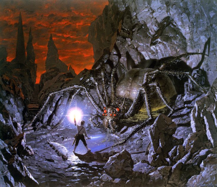
(and one more Ted Nasmith)

to come down into Mordor itself.

(Christopher Tolkien)

This is, to say the least, a very bleak place,

(in reality, this is Mt Haleakala National Park, on the island of Maui)

but it seems heavily populated with camps of orcs and Sauron’s allies.

“As far as their eyes could reach, along the skirts of the Morgai and away southward, there were camps, some of tents, some ordered like small towns.  One of the largest of these was right below them.  Barely a mile out into the plain it clustered like some huge nest of insects, with straight dreary streets of huts and long low drab buildings.”  (The Return of the King, Book Six, Chapter 2, “The Land of Shadow”)

(Alan Lee)

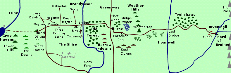
There are clearly roads, at least in the northern area—

(from the Encyclopedia of Arda)

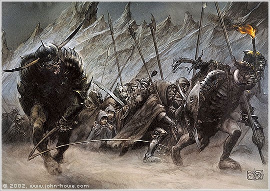
and when Frodo and Sam disguise themselves as orcs,

(Denis Gordeev)

they make their way along a major one, only to be taken for potential deserters and driven into an orc marching column.

(Denis Gordeev)

Before they reach such a road, however,

“…they saw a beaten path that wound its way under the feet of the westward cliffs.  Had they known, they could have reached it quicker, for it was a track that left the main Morgul-road at the western bridge-end and went down by a long stair cut in the rock to the valley’s bottom.” (The Return of the King, Book Six, Chapter 2, “The Land of Shadow”)

We’ll follow them down this path and eventually reach a road:

“…at the point where it swung east towards the Isenmouthe  twenty miles away.  It was not a broad road, and it had no wall or parapet along the edge, and as it ran on the sheer drop from its brink became deeper and deeper.”  (The Return of the King, Book Six, Chapter 2, “The Land of Shadow”)

When Frodo and Sam are picked up and driven along in the column,

(John Howe)

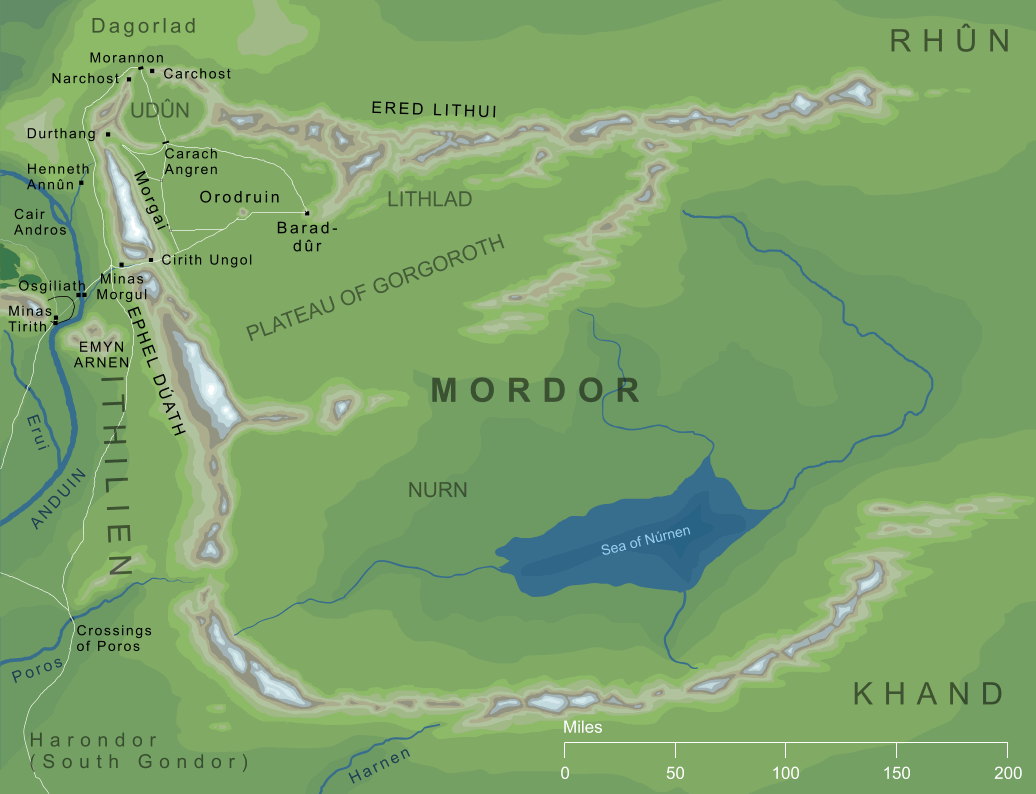
we can now see that the column is headed for Isenmouthe and the entrance to the northernmost part of Mordor, Udun,

(from Karen Wynn Fonstad, The Atlas of Middle-Earth)

but the two manage to escape just before the entrance, dropping

“…over the further edge of the road.  It had a high kerb by which troop-leaders could guide themselves in black night or fog, and it was banked up some feet above the level of the open land.”  (The Return of the King, Book Six, Chapter 2, “The Land of  Shadow”)

(perhaps something like this on the right?)

Frodo and Sam now try cutting across open country, which, although full of places to hide, is hard going—

“As the light grew a little [Sam] saw to his surprise that what from a distance had seemed wide and featureless flats were in fact all broken and tumbled. “  (The Return of the King, Book Six, Chapter 3, “Mount Doom”)

The going, however, is simply too rough for them in their current condition, and they return to the road, as will we, approaching Orodruin (Mt. Doom), where, for the first time since finding a spring on the eastern slope of the Mountains of Shadow, they find water—

“All long ago would have been spent, if they had not dared to follow the orc-road.  For at long intervals on that highway cisterns had been built for the use of troops sent in haste through the waterless regions. 

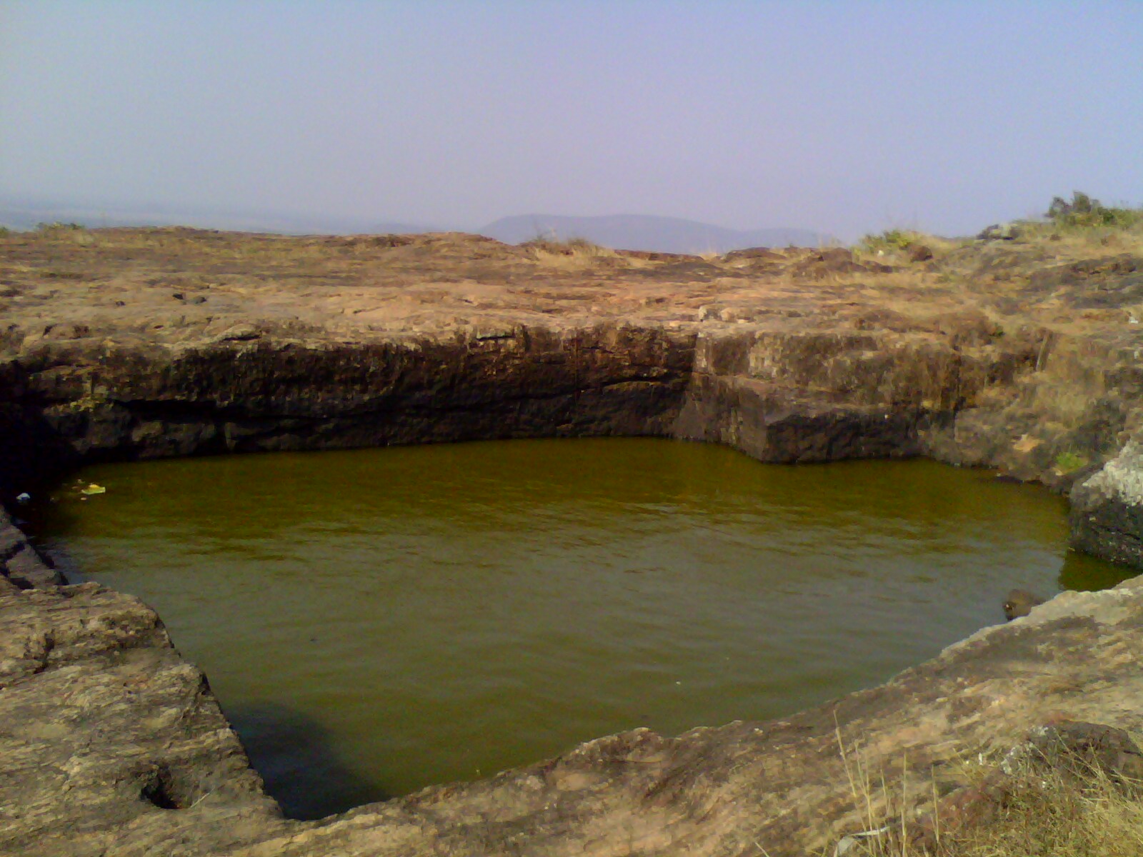
In one Sam found some water left, stale, muddied by the orcs, but still sufficient for their desperate case.”   (The Return of King, Book Six, Chapter 3, “Mount Doom”)

Struggling to the foot of Mt. Doom (Orodruin), Sam discovers a path—our last road in this series of postings—which is actually part of Sauron’s road from the Barad-dur to the volcano.

(from the Encyclopedia of Arda)

“…for amid the rugged humps and shoulders above him he saw plainly a path or road.  It climbed like a rising girdle from the west and wound snakelike about the Mountain, until before it went round out of view it reached the foot of the cone on the eastern side.”  (The Return of King, Book Six, Chapter 3, “Mount Doom”)

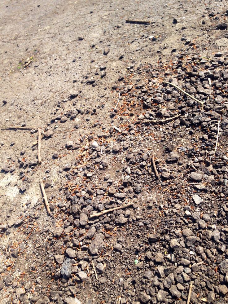
Finally coming to the path, they find

“…that it was broad, paved with broken rubble and beaten ash” The Return of King, Book Six, Chapter 3, “Mount Doom”)

But, before the eagles come to rescue Frodo and Sam, we’ll take our own eagle back to the door where our roads began.

(the Hildebrandts)

As always, thanks for reading.

Stay well,

Remember how perilous it may be to step out your front door,

And remember, as well, that there’s always

MTCIDC

O

PS

For a bit more on the roads of Middle-earth, see:  https://thainsbook.minastirith.cz/roads.html

Shire Portrait (3a)

15 Wednesday Feb 2017

Posted by Ollamh in Economics in Middle-earth, Imaginary History, J.R.R. Tolkien, Literary History, Maps, Narrative Methods

≈ Leave a comment

Tags

Argeleb, Baraduin, Beleriand, Blanco, Bridge of Stonebows, Bronze Age Horse, cable ferry, coins, Dartmoor, Doriath, Dwarves, English South Downs, Fallowhide, Far Downs, Farthings, Fornost Erain, Frodo, Gloucestershire, Government, Great East Road, Green Hill Country, Greenway, Jeremy Brett, Little Delving, Longbottom Leaf, Maps, Marcho, Michel Delving, Middle-earth, Minas Tirith, Misty Mountains, Old Dee Bridge, Oxfordshire, River Baranduin, Roads, Roman Roads, Sherlock Holmes, Sidney Paget, Sir Arthur Conan Doyle, Steven Spielberg, Tharbad, The Hobbit, The Hound of the Baskervilles, The Lord of the Rings, The Shire, Three Farthing Stone, Tobacco, Tolkien, Warwickshire, White Downs, Worcestershire

Welcome, dear readers, to the third installment of our rough portrait of the Shire. We call it a “rough portrait” because, so far, we’ve relied upon only three sources: The Hobbit, The Lord of the Rings, and The Letters of J.R.R. Tolkien. We’ll continue to do so in this installment, but we will add two works of geography, K. W. Fonstad’s The Atlas of Middle-earth and Barbara Strachey’s Journeys of Frodo (although we may take a hint of two from other works).

So far, we’ve discussed the government of the Shire (Shire Portrait 1) and the economy (Shire Portrait 2). In this, we want to move on to the geography of the Shire. We begin with Fonstad’s map.

1mapoftheshire.jpg

Except for Buckland, all of the Shire lies west of the River Baranduin (the “Brandywine”). This river can be broad enough to require a cable ferry

2ferryoncable.jpg

and it is navigable, at least by small boats—after all, it was in such a boat that Frodo’s parents were drowned.

As well, there is the Bridge of Stonebows on the Great East Road. Since it’s wide enough for gates and is reported to have had houses on the far side of it, we might imagine it to look like the Old Dee Bridge, at Chester, in England.

3olddeebridgechester

This bridge dates from Norman times (although there was a bridge there from the days of the Roman occupation—“Chester”, after all, is only a corruption of castra, Latin for “military camp”—founded as Deva Victrix in 79AD), with the present version being more-or-less 14th-century. In the Prologue to The Lord of the Rings, the Bridge of Stonebows is said to have been “built in the days of the power of the North Kingdom”, making us wonder whether the Dwarves, who had cut the Great East Road long before, had only had a ford at that place.

To the west of the river stretches the Shire, most of it to the north and south of the Great East Road, which acts as a kind of spine, there being subsidiary roads leading off it towards the various villages. Originally built by the Dwarves in the First Age, it led from Doriath in Beleriand eastward beyond the Baraduin towards the Misty Mountains. After the destruction of Beleriand, the remaining section ran only from the Grey Havens eastward. When Marcho and Blanco, the Fallowhide brothers, gained permission to colonize the area in TA1601 from Argeleb II, the only payment required was “that they should keep the Great Bridge in repair, and all other bridges and roads, speed the king’s messengers, and acknowledge his lordship”, which would have included the Great East Road.

In a previous posting, we talked about the North-South Road (later, the “Greenway”, which once ran from Fornost Erain, in the north, to Minas Tirith, in the south. Because of its ancient importance and places like the causeway and bridge at Tharbad, we imagined it to be like a Roman road—carefully laid out by engineers and paved but, no longer maintained, gone to seed.

4buildingromanroad.jpg

5romanroad.jpg

6overgrownromanroad.JPG

Because of its great age and one-time importance, we’ve always pictured the Great East Road to be similar, especially when it is clear that the kings of Arnor considered its maintenance to be the equivalent of tribute or taxes from the new Shire. Subsidiary roads which split off from the East Road, however, we might see as the usual rutted country roads.

7ruttedroad.jpg

The Shire, besides being bisected by the Great East Road, is also divided into four parts—hence the name “Farthings”—like the pre-decimal English coin, which was a fourth part of a penny (when a penny obviously was worth a lot more!).

8farthingcoin.jpg

We wonder what these divisions were intended to be used for—perhaps for the election of the Mayor? In our previous posting on the government of the Shire, we quoted JRRT as saying in the Prologue to The Lord of the Rings, “The Shire at this time had hardly any ‘government’”, so, for the moment, that’s our best guess.

(We should note here the “Three Farthing Stone”, which marks more or less where the North, East, and South Farthings meet. It has been suggested that it has been based upon the actual English “Four Shires Stone”—

9fourfarthingstone.jpg

which sits at the place where, pre-1931, four shires—Worcestershire, Warwickshire, Oxfordshire, and Gloucestershire — touched. Not only is there a similarity in the names and what the stone may function as, but the Three Farthing Stone is just to the west of Frogmorton, whereas the Four Shire Stone is just east of Moreton-in-Marsh. And is JRRT having a quiet joke in that, after a boundary adjustment in 1931, the Four Shire Stone should really be called the Three Shire Stone?)

Just south of the Great East Road is the Green Hill Country, which appears to be heavily forested.

11gribskov

This is mirrored by a smaller wood north of the road, Bindbole.

Other than these (and, of course, the Old Forest in Buckland), the land seems to be open. To the north are the North Moors. These are windy uplands, mostly grass, with little in the way of trees.

13adartmore

Dartmoor (which is the image above), in southwest England, seems so bare (although it has the fallen remains of earlier cultures on it), that it can seem a little spooky—the perfect setting for Sir Arthur Conan Doyle’s Sherlock Holmes novel The Hound of the Baskervilles (first published in book form in 1902).

13bbaskervilles.jpg

(We love the original Sidney Paget illustrations in The Strand Magazine, but our favorite film version is the one starring Jeremy Brett as Holmes. For pure fun, by the way, we recommend Steven Spielberg’s Young Sherlock Holmes—not for the purist, we hasten to add.)

13cpaget.jpg

13dartmore.jpg

13dbrett.jpg

13eyoungsherlock.jpg

To the west are two lines of downs, the White and the Far (or Fox) Downs. When we think of downs, we think of the chalky rolling hills southeast of the Thames in England. Here’s what the English South Downs look like

14southdowns.jpg

and it’s easy to imagine that the Shire version would look very similar and the chalk would easily be cut into to make Michel Delving (“Big Dig”) and Little Delving (“Little Dig”). The chalk just below the surface is exposed on the south English coast

15chalkcliffs.jpg

making that name “the White Downs” clear. And we can’t resist adding another chalk artifact. In Oxfordshire (but once Berkshire), on the edge of the Berkshire Downs, is a Late Bronze Age horse, cut into the chalk. We wonder why there isn’t one in Rohan…

16uffingtonhorse.jpg

Last of all, there’s the South Farthing, stretching south of The Green Hill Country. As it is a tobacco-growing area, but in a temperate climate (at least, we understand that the Shire is in a temperate zone—they appear to have—or to have had—snowy winters), we visualize it as looking like the Connecticut Valley, which runs south down from Vermont, through western Massachusetts and through central Connecticut, in the US.

17connecticutrvalley.jpg

In the central part of the valley are tobacco plantations.

18tobaccofields.jpg

These always include drying barns for the tobacco—which would become the Longbottom Leaf Merry and Pippin discover two casks of in Saruman’s pantry.

19tobaccobarn.jpg

The one farthing we haven’t studied directly is the East Farthing, but, as it contains a continuation of the Green Hill Country, abuts the Brandywine, and has the already-mentioned bridge of Stone Bows, and thus has no main features we haven’t mentioned, we’ll conclude here for the moment. In our next, we want to examine Shire architecture, from hobbit holes to mills.

Thanks, as ever, for reading.

MTCIDC

CD

Trading with the Enemy

15 Wednesday Jul 2015

Posted by Ollamh in Economics in Middle-earth, J.R.R. Tolkien, Maps

≈ 2 Comments

Tags

Bree, Cross-Roads, Gandalf, Gimli, Great East Road, Greenway, Isengard, Laketown, Legolas, Marxist Critics, Merry and Pippin, Middle-earth, Mirkwood, North-South Road, Peter Jackson, Pipeweed, Roads, Roman Roads, Rome, Saruman, Sauron, South Farthing, Swanfleet, The Lord of the Rings, The Shire, Theoden, Tolkien, Trade, Transport

Dear Readers,

In a recent posting, we opened with the image of Merry and Pippin happily feasting among the ruins of Isengard as Gandalf, Theoden, and company ride up to meet them.

“…suddenly they were aware of two small figures lying…at their ease…there were bottles and bowls and platters laid beside them, as if they had just eaten well, and now rested from their labour. One seemed asleep; the other, with crossed legs and arms behind his head, and little rings of thin blue smoke.” L543

MandPIsengard

We, as the readers, may be just as taken aback as the company; we’re joining the Hobbits again for the first time since Isengard’s demise, and it’s natural to ask: where, in the midst of all of this ruin, did they find this stuff? Gimli doesn’t hesitate to ask for us.

“’Where did you come by the weed, you villains?’” L544

Of course, he’s talking about pipeweed, something common, yet treasured, in the Shire. It is not native to a place like Isengard, so far south, but here we have the Hobbits smoking it and even enjoying a surplus. Legolas is just as impressed,

“’You speak for me, Gimli,’ laughed Legolas, ‘though I would sooner learn how they came by the wine.’” L544

Pippin only teases, answering that

“’Here you find us sitting on a field of victory…and you wonder how we came by a few well earned comforts.” L544

And so we’re left with this mystery of supplies, but we can be sure that, in Tolkien’s mind, there was an answer. He was, after all, diligent about even minute details concerning Middle-earth, and was also the same man who once said that

“I am not incapable or unaware of economic thought; and I think as far as the ‘mortals’ go, Men, Hobbits, and Dwarfs, that the situations are so devised that economic likelihood is there and can be worked out…” LT, L.154 P.196.

In this quotation, Tolkien can almost be echoing, in an ironic way, the argument of Marxist critics that economic systems, even those appearing in literature, hide their true nature. Tolkien seems to be telling us that he was well aware of trade systems, and, we would suggest, this would include a basic foundation: transport. And, using what we are given in the texts, we can see that there were two main methods. One is by water–as in the flourishing wine trade between Mirkwood and Laketown.

hobbit-raft-elves

This pair of places is naturally connected by river and lake. Such is not the case with the South Farthing and Isengard, of course. Instead, water bodies like the Swanfleet lie between them. And yet there is that pipeweed. The Hobbits are smoking it and, in the extended edition of the film version, Peter Jackson even shows us two large barrels of pipeweed labeled “South Farthing”.

This brings us to our second method of transport, by road.

ShireRoads

Like all educated men of his time, Tolkien had been raised on the world of the Greeks and Romans and, among the longest-lasting monuments of the Roman world was the extensive system of roads, some of which are still in existence in our own time and are even (asphalted over) the basis of certain modern English roads. In Middle-earth, there appear to be a number of such ancient roads, such as the Cross-Roads:

CrossRoads

The Great East road:

greateastrd-map

The North-South road:

north-south-road

Other possibilities would include once-active, but now abandoned routes, like the Greenway, running north from Bree and the Stone Road which the Woodwoses know and point out to Theoden.

As you can see, we can easily imagine Tolkien thinking out the economics of Middle Earth through a road network similar to that of the Roman Empire, with its own intricate road systems

RomanRoadNetwork


Along these roads came much of Rome’s wealth and the case would have been the same for Middle-earth, so here’s a clue to Saruman’s pipeweed trade with the Shire. Looking at a map, we see that The Great East Road, which, traveling east from the Shire, would lead to Bree, and to the Cross-Roads, reaching The North-South Road.

fonstad01 fonstad02

Such trade would seem natural, not only to the Romans, but to us. In the wreckage of Isengard, however, for all that Merry and Pippin are so casual about it, there is another implication: Saruman, who wants to be another Sauron, must know much more about the Shire than anyone, even Gandalf has understood, and, thinking of the “Scouring of the Shire”, that could easily bode ill for the future of that place which the Hobbits think so safe and removed…

Thanks, as ever, for reading.

MTCIDC,

CD

The Doubtful Sea Series Facebook Page

The Doubtful Sea Series Facebook Page

  • Ollamh

Categories

  • Artists and Illustrators
  • Economics in Middle-earth
  • Fairy Tales and Myths
  • Films and Music
  • Games
  • Heroes
  • Imaginary History
  • J.R.R. Tolkien
  • Language
  • Literary History
  • Maps
  • Medieval Russia
  • Military History
  • Military History of Middle-earth
  • Narnia
  • Narrative Methods
  • Poetry
  • Research
  • Star Wars
  • Terra Australis
  • The Rohirrim
  • Theatre and Performance
  • Tolkien
  • Uncategorized
  • Villains
  • Writing as Collaborators
Follow doubtfulsea on WordPress.com

Across the Doubtful Sea

Recent Postings

  • A Moon disfigured December 17, 2025
  • On the Roads Again—Once More December 10, 2025
  • (Not) Crossing Bridges December 3, 2025
  • On the Road(s) Again—Again November 26, 2025
  • On the Road(s) Again November 19, 2025
  • To Bree (Part 2) November 12, 2025
  • To Bree (Part 1) November 5, 2025
  • A Plague o’ Both—No, o’ All Your Houses! October 29, 2025
  • It’s in Writing (2:  I’st a Prologue, or a Poesie for a Ring?) October 22, 2025

Blog Statistics

  • 103,221 Views

Posting Archive

  • December 2025 (3)
  • November 2025 (4)
  • October 2025 (5)
  • September 2025 (4)
  • August 2025 (4)
  • July 2025 (5)
  • June 2025 (4)
  • May 2025 (4)
  • April 2025 (5)
  • March 2025 (4)
  • February 2025 (4)
  • January 2025 (5)
  • December 2024 (4)
  • November 2024 (4)
  • October 2024 (5)
  • September 2024 (4)
  • August 2024 (4)
  • July 2024 (5)
  • June 2024 (4)
  • May 2024 (5)
  • April 2024 (4)
  • March 2024 (4)
  • February 2024 (4)
  • January 2024 (5)
  • December 2023 (4)
  • November 2023 (5)
  • October 2023 (4)
  • September 2023 (4)
  • August 2023 (5)
  • July 2023 (4)
  • June 2023 (4)
  • May 2023 (5)
  • April 2023 (4)
  • March 2023 (5)
  • February 2023 (4)
  • January 2023 (4)
  • December 2022 (4)
  • November 2022 (5)
  • October 2022 (4)
  • September 2022 (4)
  • August 2022 (5)
  • July 2022 (4)
  • June 2022 (5)
  • May 2022 (4)
  • April 2022 (4)
  • March 2022 (5)
  • February 2022 (4)
  • January 2022 (4)
  • December 2021 (5)
  • November 2021 (4)
  • October 2021 (4)
  • September 2021 (5)
  • August 2021 (4)
  • July 2021 (4)
  • June 2021 (5)
  • May 2021 (4)
  • April 2021 (4)
  • March 2021 (5)
  • February 2021 (4)
  • January 2021 (4)
  • December 2020 (5)
  • November 2020 (4)
  • October 2020 (4)
  • September 2020 (5)
  • August 2020 (4)
  • July 2020 (5)
  • June 2020 (4)
  • May 2020 (4)
  • April 2020 (5)
  • March 2020 (4)
  • February 2020 (4)
  • January 2020 (6)
  • December 2019 (4)
  • November 2019 (4)
  • October 2019 (5)
  • September 2019 (4)
  • August 2019 (4)
  • July 2019 (5)
  • June 2019 (4)
  • May 2019 (5)
  • April 2019 (4)
  • March 2019 (4)
  • February 2019 (4)
  • January 2019 (5)
  • December 2018 (4)
  • November 2018 (4)
  • October 2018 (5)
  • September 2018 (4)
  • August 2018 (5)
  • July 2018 (4)
  • June 2018 (4)
  • May 2018 (5)
  • April 2018 (4)
  • March 2018 (4)
  • February 2018 (4)
  • January 2018 (5)
  • December 2017 (4)
  • November 2017 (4)
  • October 2017 (4)
  • September 2017 (4)
  • August 2017 (5)
  • July 2017 (4)
  • June 2017 (4)
  • May 2017 (5)
  • April 2017 (4)
  • March 2017 (5)
  • February 2017 (4)
  • January 2017 (4)
  • December 2016 (4)
  • November 2016 (5)
  • October 2016 (6)
  • September 2016 (5)
  • August 2016 (5)
  • July 2016 (5)
  • June 2016 (5)
  • May 2016 (4)
  • April 2016 (4)
  • March 2016 (5)
  • February 2016 (4)
  • January 2016 (4)
  • December 2015 (5)
  • November 2015 (5)
  • October 2015 (4)
  • September 2015 (5)
  • August 2015 (4)
  • July 2015 (5)
  • June 2015 (5)
  • May 2015 (4)
  • April 2015 (3)
  • March 2015 (4)
  • February 2015 (4)
  • January 2015 (4)
  • December 2014 (5)
  • November 2014 (4)
  • October 2014 (6)
  • September 2014 (1)

Blog at WordPress.com.

  • Subscribe Subscribed
    • doubtfulsea
    • Join 78 other subscribers
    • Already have a WordPress.com account? Log in now.
    • doubtfulsea
    • Subscribe Subscribed
    • Sign up
    • Log in
    • Report this content
    • View site in Reader
    • Manage subscriptions
    • Collapse this bar
 

Loading Comments...