Welcome, as always, dear readers.
One reason why we love teaching—and which we’ve really missed since everything went on-line here in mid-March—is the daily contact with students and the really stimulating questions which they so often ask. There’s been some discussion by correspondence, but it’s just not the same as when things pop up in class and we suddenly have to consider something from a new (and sometimes surprising) angle.
Take, for example, the idea of maps in Tolkien—not the ones you’ll find in your copy of The Lord of the Rings, or in Karen Wynn Fonstad’s The Atlas of Middle-earth

or Barbara Strachey’s equally excellent Journeys of Frodo—

but the ones employed in the text by the characters—or not…
For JRRT, maps were always a subject of great interest and might even form the basis of the narrative itself, as he wrote to Rayner Unwin in 1953:
“…in such a story one cannot make a map for the narrative, but must first make a map and make the narrative agree.” (Letters, 168)
“Even at a little cost,” he wrote to his publishers about those in The Lord of the Rings, “there should be picturesque maps, providing more than a mere index to what is said in the text. I could do maps suitable to the text. It is the attempt to cut them down and omitting all their colour (verbal and otherwise) to reduce them to black and white bareness, on a scale so small that hardly any names can appear, that has stumped me.” (Letters, 171)
At an earlier time in his own life, proper maps had even been a literal matter of life and death. In the Great War,
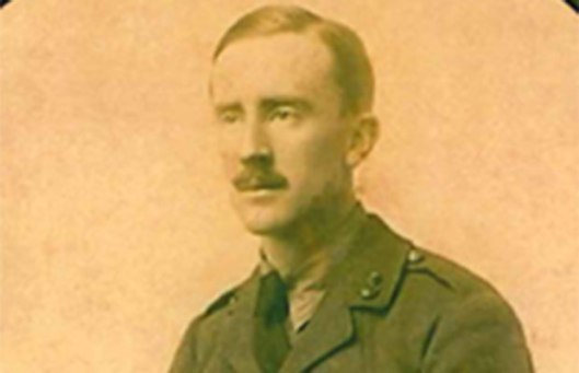
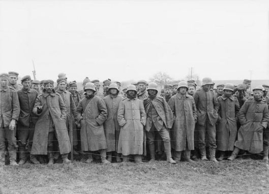
his and his fellow soldiers depended upon good maps, showing not only where they were, but also where the enemy was, and the Army spent a great deal of time collecting information from many sources, including deserters and prisoners,
the bodies of enemy casualties,

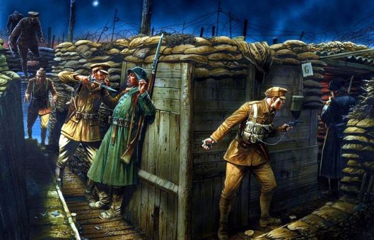
trench raids, to acquire prisoners and possibly documents,
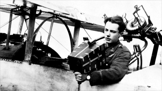
and aerial photography,
to create maps as detailed as this—

A bad map could cause no end of confusion or even get you killed, as ANZAC (Australian/New Zealand) soldiers found to their grief at Gallipoli in 1915, when incomplete intelligence led to a fatal ignorance both of local geography and the location of their Ottoman opponents.


So, one day, before the world went crazy, our class was in the middle of discussing the early chapters of The Hobbit, and one bright student (in a class full of bright students, in fact), asked, “But how would the dwarves know how to get to the Lonely Mountain?”
Another student said, “Well, there’s that map.”
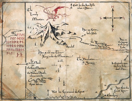
But then a third student, who’d been flipping through the text, raised his hand and said, “But it wasn’t very complete” and read:
“ ‘This was made by Thror, your grandfather, Thorin,’ he said in answer to the dwarves’ excited questions. ‘It is a plan of the Mountain.’
‘I don’t see that this will help us much,’ said Thorin disappointedly after a glance. ‘I remember the Mountain well enough and the lands about it. And I know where Mirkwood is, and the Withered Heath where the great dragons breed.’ “ (The Hobbit, Chapter One, “An Unexpected Party”)
“So,” said the first student, “if that map wasn’t useful, what were they going to use?”
In answer, we said that, because no other map was mentioned, we had always assumed that they used their memories, as Thorin had said that he remembered the Lonely Mountain and Mirkwood, to which the first student replied, “But when was the last time the dwarves saw it? And how far away was it?”
And then class ended and we went off to do a little research.
Using the always-helpful The Atlas of Middle-earth , we found that the trip was about 950 miles, one way, and some browsing in the appendices of The Lord of the Rings provided the necessary time scheme: Smaug arrived at the Mountain in TA2770 and The Hobbit begins in TA2941, so Smaug had occupied the Lonely Mountain for 171 years before the opening of the story.
Of the dwarves, Thorin, born in TA2746, was the oldest (the Jackson films have, for unexplained reasons, made him seem much younger), and therefore was about 24 when Smaug appeared. The next oldest dwarf, Balin, was born in TA2763 (but whom the films make to appear much older than Thorin), and would therefore have been about 7. None of the rest of the company had been born when the Lonely Mountain fell to the dragon. We doubted that Balin, at 7, would have had much memory of the events of the few surviving dwarves’ early exile, which meant that they must be relying upon whatever Thorin could bring back from his own brutal experience at 24, 171 years before. Dwarves clearly have very long memories, we said to ourselves.
And the more we thought about this question of how do people find their way around Middle-earth, the more the only explanation in general appeared to be that: memory, not maps. Just the other day, for example, we were working on a posting on a subject from The Lord of the Rings, and it occurred to us that there were no maps employed at all by any of the characters in any of those three volumes—and the story entails tremendous amounts of travel, from Hobbiton to Bree to Rivendell to Moria to Lorien to Fangorn to Rohan to Minas Tirith, the Paths of the Dead, the Dead Marshes, the Morannon, Cirith Ungol, and Orodruin (which, when we read it back, sounds like a railroad conductor announcing stops on the local line—or end of the line, when it comes to Mordor!)
The Hobbit itself tells us that other maps existed, the author saying of Bilbo that:
“He loved maps, and in his hall there hung a large one of the Country Round with all his favourite walks marked on it in red ink.” (The Hobbit, Chapter One, “An Unexpected Party”)
This was a local map, however, and in that way rather like Thror’s map. It might have guided you to the edge of the Shire, but what then? Certainly, Bilbo didn’t know:
“One morning they forded a river at a wide shallow place full of the noise of stones and foam. The far bank was steep and slippery. When they got to the top of it, leading their ponies, they saw that the great mountains had marched down very near to them. Already they seemed only a day’s easy journey from the feet of the nearest. Dark and drear it looked, though there were only patches of sunlight on its brown sides, and behind its shoulders the tips of snow-peaks gleamed.
‘Is that The Mountain?’ asked Bilbo in a solemn voice…
‘Of course not!’ said Balin. ‘That is only the beginning of the Misty Mountains, and we have got to get through, or over, or under those somehow…” (The Hobbit, Chapter Three, “A Short Rest”)
We might explain this narrowness of mapping by that fact that there doesn’t appear to be a need for maps (which would all have been made and copied by hand, after all). In general, people simply don’t travel much in the Middle-earth of the Third Age, places like Bree—or Rivendell or Lorien, for that matter–being like islands in a nearly-empty landscape:
“In those days no other Men had settled dwellings so far west, or within a hundred leagues of the Shire.” (The Fellowship of the Ring, Book One, Chapter 9, “At the Sign of the Prancing Pony”)
And–
“But the Northern Lands had long been desolate, and the North Road was now seldom used: it was grass-grown and the Bree-folk called it the Greenway.”
Exceptions are rare. There is Gandalf, of course,
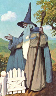
who has crisscrossed the landscape for centuries, having arrived in Middle-earth nearly 2000 years earlier, and whose endless traveling has earned him the Elvish name Mithrandir, “the grey wanderer”.
As well:
“…in the wild lands beyond Bree there were mysterious wanderers. The Bree-folk called them Rangers, and knew nothing of their origin…They roamed at will southwards and eastwards even as far as the Misty Mountains…”
And then there is a third experienced traveler, Gollum,

whose seemingly extensive knowledge of the darker east of Middle-earth both aids and nearly dooms Frodo and Sam.
We are so used to having the world at our (electronic) fingertips

and so lucky to have the painstaking efforts of the Tolkiens, Fonstad, Strachey—and of our friend, Erik, of course, to whose future efforts we look with great anticipation—that it’s good to be reminded that, for all they help us readers, the principal geographical help for the characters is the experience of their own feet and the clearness of their memories—and for which reminding, we, personally, thank our students.
Thanks, as ever, for reading.
Stay well
and
MTCIDC
CD
ps
If you’d like to learn a bit more about time and distance in Tolkien, here’s an interesting LINK:
